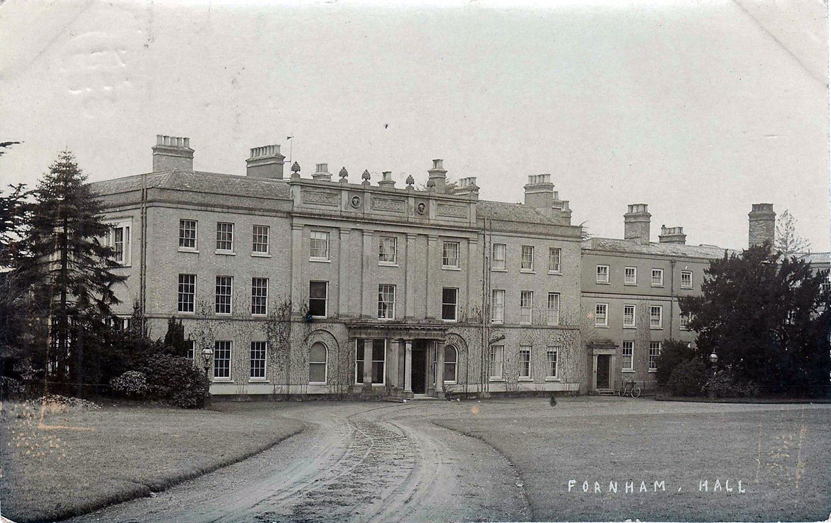
Fornham Hall 1909
Quick links on this page
Sir Thomas Kytson 1540
The Gage Family 1644
Edward Whittaker 1721
The Kent Family 1731
Bernard Howard 1789
Lord Manners 1843
Sir William Gilstrap 1862
George Espec Manners 1896
Military Occupation 1914
Capt MacRae and military again 1939
Sale and destruction 1950
Dream Lodges 2016
|
History of
Fornham Park and Estate
in
Fornham St Genevieve
|
945
|
King Edmund is said to have granted the town of Bury St Edmunds to the the monastery of St Edmund. Not only did King Edmund give the monastery a permanent independent income from the Banleuca, he was also said to have given it the manor of Fornham Parva, its first landed property outside the town precincts.
Fornham Parva was considered by Dr Hart to be the "Little town", of the charter perambulation, and is now called Fornham St Martin. However, this is by no means certain.
As far as can be determined at present, there is no other possible reference to Fornham St Genevieve being placed into the hands of the Abbey of St Edmund. Neither do we know who was Lord of that vill before it passed into the hands of St Edmund's monastery.
|
|
1045
|
The village name of 'Fornham' is discussed in "A dictionary of Suffolk Place Names" by Briggs and Kilpatrick, and confirms earlier proposals that it means "Trout homestead" or "Homestead where trout are caught". They also record that Fornham all Saints has been referred to as 'maior' and as 'magna', to distinguish it from Fornham St Martin and Fornham St Genevieve, which both lay in Thedwestry Hundred, and both lie east of the River. Fornham all Saints lies west of the river, within Thingoe Hundred.
Briggs also found that in a document of 1202, Fornham St Martin was described as 'Parua Forenham', probably 'Parva' or lesser in modern terms.
|
|
1086
|
The record for Fornham St Genevieve in the Domesday Book, folio 362, taken from the Phillimore translation, reads as follows:
"(Phillimore Reference - SUFFOLK landholder 14, entry number 53)
St Edmund's held FORNHAM St Genevieve (Genonefae forha) before 1066 as an outlier;
2 carucates of land. Peter [the steward] has 40 acres of these 2 carucates; he holds
[them] from the Abbot.
2 villagers [and] 2 smallholders have 1 of
these carucates;
the hall to which it belongs is in another Hundred.
Ralph holds from the Abbot 12 acres of these 2 carucates.
Always 8 villagers; 3 smallholders.
Always 2 ploughs in lordship; 3 men's ploughs.
Always 3 slaves. Meadow, 4 acres; always 3 mills. 1 cob, 100 sheep.
6 free men, 1 villager, 5 smallholders;
1 carucate of land.
Always 3
ploughs.
These could grant and sell their lands,
but jurisdiction over the
land, and service, still belonged to St [Edmund's].
Value 10s.
A church with 14 acres of free land as alms.
Value of this outlier, always £4.
It has 9 furlongs in length and 4 in width;
8d in tax."
In 1822 John Gage recorded that this was part of the property of the Treasurer of St Edmund's. Also that here the Prior had a villa, and here was a water corn mill, "known in early deeds by the name of the Abbot's Mill." An ancient guild subsisted in this parish, called the Guild of St Genevieve.
As Fornham All Saints and Fornham St Martin play a part in the Fornham Park estate in future years, their Domesday entries are also reproduced here. To local people the three Fornhams are looked on as an entity, but they were clearly divided administratively by the fact that Fornham All Saints was located within the Hundred of Thingoe, while St Genevieve and St Martin were in the Hundred of Thedwestry.
A further complication is the fact that medieval documents sometimes refer to Fornham Magna and Fornham Parva, ie Great and Little Fornham. It is not obvious to us which Fornham is meant.
Fornham St Martin (Fornha)
SUFFOLK landholder 14, entry number 50
St Edmund's held FORNHAM [St Martin] before 1066 as a manor;
1 carucate of land.
Always 3 villagers; 4 smallholders.
Then 1 plough in lordship, now 2; always 2 men's ploughs.
Then 4 slaves, now 3.
2 cobs; always 4 cattle.
Now 12 pigs;
80 sheep.
10 free men, 6 smallholders; 30 acres of land. Always 1 plough.
These also belong entirely to St [Edmund's] with every customary
due and [belong] to the fold.
In the same [Fornham St Martin] 1 free man with 12 acres of land.
He could grant and sell the land; the full jurisdiction however
and patronage still belonged to St [Edmund's].
16 acres of free land belong to the church of this village in alms.
Value of this manor before 1066, £3; now [£]4.
It has 9 furlongs in length and 7 in width;
6 1/2d in tax.
Fornham All Saints (Fornham)
SUFFOLK landholder 14, entry number 9
St Edmund's held FORNHAM [All Saints] as a manor before 1066;
1 carucate of land.
Always 4 smallholders.
Always 1 plough in lordship; always 1 men's plough.
Always 1 slave.
Meadow, 4 acres;
1 mill.
Always 2 cobs, 14 cattle,
30 pigs, 60 sheep.
3 Freemen with 30 acres of land. Always 1/2 plough.
These [Freeman] are St [Edmund's] with full jurisdiction and
patronage and every customary due. They could not grant or sell
the land without permission.
In the same [Fornham [All Saints]] 2 free men with 1 1/2 carucates of
land.
1 villager; 3 smallholders.
Always 2 ploughs.
They could grant and sell the land, but the full jurisdiction and
patronage still belonged to St [Edmund's].
Value always 40s.
A church, 12 acres of free land.
Value of this manor, except for the free [men], always 40s.
It has 8 furlongs in length and 5 in width;
10d in tax.
|
|
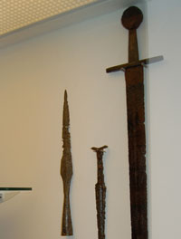
Battle of Fornham
|
|
1173
|
By 1173 Henry II and his wife Eleanor had begun to lead separate lives. She held court in Aquitaine while he now preferred the fair Rosamund de Clifford. The year 1173 would prove to be the biggest crisis of Henry II's reign.
Henry II's son, the young King Henry, was just as ambitious as his father, and eager for more power, wealth and influence, he rose in rebellion, backed by his mother and King Louis of France. There were still many barons, earls and nobles who hated Henry II for his confiscations of their lands and castles. These men could be bought by young Henry with promises of restitution. He gained the support of the 80 year old Hugh Bigod by promising him the hereditary custody of Norwich Castle and returning the substantial castle and Honour of Eye. Bigod also expected the return of his old castle at Walton. The young Henry also persuaded the Earl of Leicester, Robert de Beaumont, to join his cause with similar promises.
Robert de Beaumont, Earl of Leicester, had been raising a combined force of French and Flemish mercenaries. On September 24th, (maybe 29th), they landed at Walton with a force of 1,400 Flemish mercenaries. The fleet was sent back to collect more men, and Walton was attacked.
After attacking Dunwich, Ipswich, Haughley, Eye, Orford, and marauding around Suffolk in general,
the rebel army now returned to Framlingham, where the Bigods were beginning to get cold feet about the amount of destruction in their home county, and particularly about the amount of plunder falling into foreign hands. The Earl of Leicester was persuaded to head for Leicester to recapture his home town, leaving Bigod to deal with matters in Suffolk.
So Leicester's force of Flemings first headed west, through Suffolk, hoping to bypass trouble at Bury St Edmunds, on their progress to Leicester. Beaumont knew that Bury supported the old King, and so he aimed to avoid trouble by skirting north of the town.
Meanwhile Hugh Bohun and Richard de Lacey, the army commanders of Henry II in the north, had agreed a truce with King William of Scotland. They now regrouped and were marching south to meet the threat. Local Suffolk people joined them as they neared Bury, in particular those whose homes and families had been ravaged by the Fleming militias. Ralph de Broc joined them after his crushing defeat at Haughley. William d'Albini had also arrived back in this country from fighting in France accompanied by some of the royal army. The banner of St Edmund was their rallying point, and doubtless the abbey supplied its knights, servants and workmen to help in the fight.
The usual role of untrained peasants around a battlefield at this time was to attack stragglers and butcher the wounded, or hunt down enemy soldiers who got cut off or who had tried to run away.
So, on October 27th (or, in some accounts, the 17th) 1173, the opposing armies met at Fornham St Genevieve on the River Lark, some four miles north west of the centre of Bury. The Flemish army was caught as it tried to cross the marshes down to the River Lark looking for a suitable fording spot. Fighting seems to have taken place from the Babwell hamlet, by today's Tollgate Inn, along the valley to Fornham. The rebels' strongest position was somewhere near Fornham St Martin Church, or Fornham St Genevieve church, depending upon which account you read. The Royal Army was led by Richard de Lucy, and the Flemish mercenaries were cut to pieces. It was said that 10,000 of the enemy were slain. The Earl of Leicester and his wife, the Countess Petronilla, were captured, but Earl Hugh Bigod escaped to Bungay. The Countess was said to have thrown her ring, and other jewels, into the river as a gesture of defiance. The Earl of Leicester and his Countess were later taken to Normandy as prisoners.
Bones and a few lost weapons have been found in the area of the battle, including the Fornham Sword, which is now in Moyse's Hall Museum, on loan from John Macrae, the landowner. This was found when a muddy ditch was being cleaned out near the water mill at Fornham St Martin around 1876. It was loaned to the Moyse's Hall Museum in 1966, and in 2007 moved to West Stow, returning to Moyse's Hall in late 2008.
Hugh Bigod was not safe for long, as a another vast army was raised at Bury and at Ipswich to crush him. When his castle at Bungay was besieged, Bigod had to make peace, only getting a truce in exchange for paying a heavy fine. Bigod was forced to take the 14,000 remaining Flemings, and escape to France.
|
|
1190
|
The Kalendar of Abbot Samson published in 1954 by the Camden Society recorded the Regalian and Hundredal revenues due to the Abbot and also recorded many of the charters granted by the Abbot. Those related to the Fornhams are listed here, generally dated from 1186 to 1190.
'6 Grant to Roger of Walsingham, our clerk, of lands in Great Fornham, (Maiore Fornham) viz. the tenement formerly of Baldwin the priest and the land which he has bought from Aelric son of Berulf.'
'57 Grant to William of the Granary of Salmonford (Salmondesforde) mill (in Fornham) with all the arable land and meadow belonging to it, for an annual rent of 26s. 10d.'
|
|
1200
|
The Kalendar of Abbot Samson published in 1954 by the Camden Society recorded the royal revenues due to the Abbot and also recorded many of the charters granted by the Abbot. Those related to the Fornhams are listed here, and are dated a little later than those above, from 1186 to 1206.
'58 Grant to Henry son of Thurston of the mill of Salmonford (Salemundesforde) (in Fornham All Saints) for 30s a year to the Hall at Fornham; also 8 acres of land formerly belonging to William the priest in Hengrave, (Hemegreth) for 2s. a year to the Hall at Fornham.'
'59 Grant to Ailmer, son of Ailward of Fornham of the mill Ailmeres Melne in Fornham; the rent used to be 26s. but is now to be 30s. to the hall at Fornham; Ailmer is also granted a small meadow at the head of the mill-pond, for seven ploughshares a year to the hall at Fornham.'
|
|
1524
|
The subsidy returns of 1524 listed 17 households in Fornham St Genevieve.
|
|
1537
|
The sales details of 1950 included an historical note by Lilian Redstone and/or Martin Statham, of Bury Record Office.
By this time the Manor of Fornham St Genevieve was held as an outlying Grange of the Abbey of St Edmund, and had been so apparently since before 1066. The Domesday Book had referred to it as a "berewick" of the abbey, translated in Phillimore as "an outlier".
Fornham St Martin was one of the most important manors attached to the office of cellarer of St Edmund.
The Priorie or Priory Manor or messuage was assigned to the office of the Prior of St Edmund. It was associated with the Halderness or Eastgate Barns, (sometimes called Hordernes), which belonged to the Abbey. In 1537 it was let to a farmer, one of whose tasks was to cart fish from the coast to the Abbey at Bury St Edmunds.
|
|
1540
|
Following his Dissolution of the Monasteries King Henry VIII now began to convert the seized properties of the church into cash. The details of each sale were settled by the Court of Augmentations which was responsible for the disposal of former monastic lands for the crown. Nicholas Bacon was Solicitor to the Court of Augmentations from 1537 to 1546, and he had local connections. His father was Robert Bacon, of Drinkstone, Esquire and Sheep-reeve to the Abbey of Bury St. Edmunds.
Sir Thomas Kytson was a wealthy mercer and merchant adventurer, as well as being a friend of the King and one of his executors. Unlike many other rich men who became landed gentry by buying up the newly privatised monastic lands, Kytson had first put his wealth into land in Suffolk when he purchased Hengrave in 1521. He had also acquired the manor of Great Barton, and had built a large and opulent mansion at Hengrave.
In 1540 Sir Thomas Kytson was still extending his Suffolk landholdings, and he bought eight of the previously monastic manors in Suffolk. These were Fornham St Martin, Fornham St Genevieve, and Fornham All Saints, Chevington, Hargrave, Risby, Sextons Manor at Westley, and Monks Hall at Santon Downham. He paid the tremendous sum at the time of £3,710.
As well as the acquiring the manor of Fornham St Genevieve, Kytson also purchased, "the manor or messuage called the Priory in Fornham St Genevieve," parcel of the estate of the dissolved abbey of St Edmund. John Gage wrote in 1822 that, "a few years since, the foundations of some buildings, supposed to have been this priory, were discovered on the north side of the church." (The Lordship of Priory Manor was included in the sale in 1950 as part of Lot 19, the sale of Park Farm, with its 513 acres. Park Farm and its lands is outside, to the east, of what we know today as Fornham Park.)
Sir Thomas Kytson, (1485-1540) died on 11th September, 1540, at Hengrave Hall shortly after making these transactions. He had been a rich wool merchant, trading in Flanders, and had built Hengrave Hall on the proceeds from 1525 to 1538. The house was left to his wife, Margaret, and his only son, also called Thomas, (1540-1603) who was born soon after his death.
|
|
1560
|
Dame Margaret, Kytson's mother, died in December, 1560, and the estate passed to her son, Sir Thomas Kytson II.
In 1560 a schedule of holdings of the late Sir Thomas Kytson, included the following:
"the manor or messuage , lately called the priory, in Fornham St Genevieve, and the closes called Frestnalls and Le Camping Close, a water corn mill, called the abbot's water mill, and all the land called the Slade in Fornham St Genevieve."
In 1560 Thomas Kytson II married, as his second wife, Elizabeth Cornwallis and the couple remained Catholics throughout the Protestant reign of Elizabeth I (between 1558 and 1603) even briefly suffering imprisonment for their faith. Nevertheless, the Queen was to honour the Kytsons by visiting Hengrave in 1578, when she knighted Sir Thomas.
|
|
1603
|
After the death of Sir Thomas Kytson II on January 28th, 1601 the Hengrave Estate passed down the female Kitson line.
At Fornham St Genevieve the visitation listed 57 adult communicants.
|
|
1625
|
The Hengrave estate passed to Mary Kitson, the wife of Thomas Darcy, the 1st Earl Rivers. Their daughter Penelope had married John Gage on 28th June, 1611. He was made baronet in March, 1622.
|
|
1644
|
Upon the death of Mary Kitson, Countess Rivers, the Hengrave Estate passed to the Gage family, who were associated with this estate for many years.
|
|
1674
|
The hearth tax returns for Fornham St Genevieve lists 16 homes in 1674. In 1676 Clopton's census listed 57 adults in the parish.
|
|
1699
|
The Act to make the River Lark navigable also appointed Commissioners to monitor the efficient running of the new project. William Gage was one of those so appointed.
|
|
1721
|
Since 1540 the Manor of Fornham St Genevieve had been a part of the Hengrave estate, as it had been bought by Hengrave's owner, Sir Thomas Kytson. Possibly as part of family inheritances, or to meet expenses, Fornham was eventually hived off from Hengrave. The exact date when it passed to the Gipps family is not yet clear to me.
As early as 1648 (23 Charles I) a Richard Gipps was made one of the five trustees of a deed poll signed by Sir William Hervey and Lady Penelope his wife, vesting in them the manors of Hengrave and other manors in Suffolk - (Gage 1822, page 240). The reason behind this was the fines levied upon the Gages for their Catholic recusancy. Possibly by moving estates into Trust, these estates could avoid the fines. These lands were to be held even after her death, to use them for the benefit of her son Edward Gage and his male issue. This Gipps was probably Sir Richard Gipps, the Suffolk antiquarian of Little Horningsheath Hall (died 1681).
According to John Gage, writing in 1822, the estate of Fornham St Genevieve had passed from the Gage family to the Gipps' family. It was then sold in 1721 by Richard Gipps esq of Badley to Edward Whitaker, made Serjeant at Law to his Majesty in 1726. This Richard Gipps seems to have been a Major in the army, and the only son and heir of Sir Richard Gipps of Horringer.
Whether Gipps was the beneficial owner, or whether he was acting as a trustee, I have not been able to discern.
|
|
1731
|
In 1731 Edward Whitaker sold Fornham St Genevieve to Samuel Kent, a wealthy malt distiller from Southwark in London. Kent became a member of parliament, was surveyor of Chelsea Hospital, and became High Sheriff of Suffolk.
|
|
1761
|
After the death of Samuel Kent the estate descended to his son in law Charles Egleton, a London goldsmith. Egleton had already bought land in nearby Fornham St Martin.
|
|
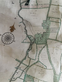
Fornham Hall & village 1769
|
|
1769
|
In 1769, Charles Egleton died and the estate passed to his son, also called Charles Egleton. This Charles adopted the name of Charles Egleton Kent, and was made Baronet in 1782.
The earliest known map of the Fornham Park dates to this period, SRO reference 373/23. This survey was taken by Thomas Warren, who had also produced the well known survey of Bury St Edmunds. The land ownership shown on this map is still apparently fragmented. In addition, many fields have tenants. For example, fields tenanted by Mr Thomas Edgar are denoted by a capital 'E', which together with a Field Book number, related to the rent roll, now lost. Edgar's land also seem to be outlined in yellow.
Large areas of what later became part of Fornham Park were owned by Sir Thomas Gage in 1769. See, for example, Genoveve Close, Slade Close Pasture and Bridge Close, which are named on the map, together with numerals 'I', 'II', and 'III'. Parcels owned by Gage totalled 'XIII' (13) in all.
The area between the Hall and the river was the 'Priory Pasture' of 22 acres. The areas of Glebe land are shown, which would have provided an income to the Vicar or other incumbent of the church. Glebe lands are shaded in a, by now, faded pink wash.
These lands are mostly in the form of strips running up from the river south west to north east. According to Breen (2000) they are almost certainly relics of the medieval landscape of furlongs that would have existed in the open field system that surrounded the village.
Breen also pointed out that the medieval road through the Park is shown passing in front of the Hall, but on its west side. A kiln is shown for brick making.
The serpentine lake which still survives, albeit in modified form, was thought by Breen to provide a head of water for the marked Flow (flour?) mill. However, looking closely at the map, the lake is unshaded, unlike other rivers etc, and it may be possible that the lake itself has been drawn on to this map at a later date. As the flow of the river is from south to north, it is further unlikely to have been a reservoir to serve the mill unless there were considerable changes to the levels achieved by earth moving work. I therefore treat the existence of the lake at this time with caution.
There were buildings around the mill, comprising cottages, gardens and yards, one building was fairly substantial in size. Further dwellings and a shop surrounded the Fornham St Genevieve church and its churchyard.
This map of 1769 shows a pre-emparkment landscape. There is no enclosed section which could be labelled as 'The Park'. The old road system is still in place, and there is a mosaic of land ownership and tenantry.
In the next 15 years these cottages, shops and highways making up the small village of Fornham St Genevieve would be swept away. Road lines would change to encircle an area called 'The Park', and ownership of fields inside the park boundary would be taken into the hands of the owner of Fornham Hall, Sir Charles Egleton Kent. Those fields currently farmed as arable land would be reverted to pasture, to render them more picturesque.
|
|
1772
|
In response to the emparkment of many estates and the closure and diversion of roads by landowners, Parliament brought in a requirement for Road Closure Orders to be made and approved in Parliament before such changes could be instituted.
No such orders exist for Fornham St Genevieve so the roads crossing the park were probably hurriedly closed before this date.
|
|
1780
|
In "Suffolk's Gardens and Parks", 2000, Tom Williamson wrote that "At Fornham St Genevieve ....several houses and cottages were removed some time between 1769 and 1780 when the park was created."
|
|
1782
|
Since his inheritance in 1769, Charles Kent had apparently built or rebuilt Fornham Hall. Gage referred to it as "a pleasant residence".
During 1782 Charles Egleton Kent became Sir Charles Egleton Kent, bart.. He must have already made many alterations to the landscape off his own bat, but he now decided to employ Lancelot, (Capability) Brown to give him advice as to how a baronet's land should appear. Brown sent his own surveyor, a man called John Spyers, to make a survey of the area in March, 1782. Spyers had joined Brown in 1764, and soon undertook most of the draughtsmanship for Brown's survey and presentation plans. (Brown and Williamson, 2016)
|
|
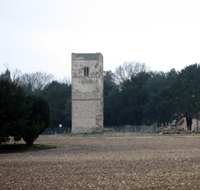 Fornham St Genevieve church ruins 2008
|
|
blank |
While the further emparking of the area was under consideration, the church rather conveniently burnt down on June 24th, 1782. The incident was blamed on a man shooting jackdaws who was careless enough to allow his expelled gun wadding to light some thatch. However, it is hard to imagine anyone shooting inside the new Park without the approval of Sir Charles.
In September, 1782, Capability Brown himself came to Fornham Hall with another of his associates called Samuel Lapidge, to view the site for himself. Samuel Lapidge had first worked with Brown in 1767, and he was named in Brown's will as his successor who would complete any outstanding Brown contracts. As Brown died in 1783 it would have been Lapidge and Spyers who would have completed any work agreed at Fornham.
The plans which were later submitted included alterations to the Hall and the rebuilding of the church, together with Brown's trademark clumps of trees and vista down to a lake. There does not seem to be much evidence that he was actually commissioned to carry out these proposals, except for some plantations of trees in place by 1788.
If we take the 1769 map at face value, the lake already existed by 1782, but I suspect that either Spyers, Lapidge or even Brown himself may well have drawn the lake on to the 1769 map to give Sir Charles Kent a preliminary 'look' at the proposal.
|
|
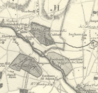
Fornham Estate and neighbours 1783
|
|
1783
|
By the time of Hodskinson's map of Suffolk, in 1783, the Fornham Hall and remains of the burnt out church would be seen to be isolated within a large landscaped park. The old public roads which had crossed the site were similarly extinguished by 1783. The lake appears to be a more substantial feature than in later times. One private drive serves the house, connecting the Culford Road to the road to Fornham St Martin. There is no evidence of a mill on the lake, although it appears to be bridged.
|
|
1784
|
By 1784 the estate was owned by the son of Sir Charles Kent, also called Charles. It seems that he engaged James Wyatt to design a new house.
|
|
1785
|
In about 1785 Sir Charles Kent's new Hall was more or less completed by James Wyatt. The church was not restored, but instead the ruined tower was retained as a garden feature. The garden front of this new house had 13 bays, the outer three bays on each side projecting forwards, with windows in blind arches. The house had three storeys.
|
|
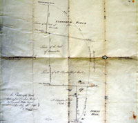
Road proposals 1786
|
|
1787
|
A Road Order was being obtained in 1786, which passed through Parliament on January, 1787, giving powers to close the road along the southern boundary of Fornham Park. Also to close an east-west road which also crossed the Culford Estate of the Earl of Cornwallis. Only parts of this Order were ever carried out.
This map was drawn by Thomas Warren of Bury St Edmunds on July 13th, 1786. It shows that the proposed road would be 20 rods shorter than the existing route.
|
|
1788
|
At this time the Earl Cornwallis was eager to add to his estate at Culford. In a letter of February 1788 he wrote from India to his brother James urging him to buy Sir Charles Kent's estate at Fornham St Genevieve. "For God's sake get it if you can". ..."I would not have an Indian, or indeed any neighbour there on any account." However, James bought Little Saxham instead. It may be that Kent had already agreed to sell to Howard.
|
|
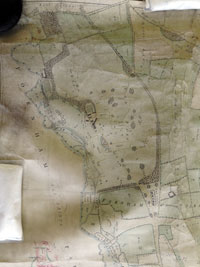
Fornham Park in 1788
|
|
1789
|
The Fornham St Genevieve Estate was sold by Sir Charles Egleton Kent to Bernard Edward Howard in 1789, and there exists a plan of the estate which dates to this time, SRO reference 373/24. In the History of Hengrave, the author, John Gage, writing in 1822, gives the date of 1789 for the estate becoming owned by Howard. As an adjacent landowner, he would be acutely aware of his neighbour's identity. (Howard would become 12th Duke of Norfolk in 1815.)
Other sources continued to attribute ownership to Kent, but might have been confused by the fact that Kent had retained ownership of Fornham St Martin, after selling Fornham St Genevieve.
The map, which is attributed to 1788, shows that the Park was 180-190 acres in size, made up entirely of pasture land, with no arable cultivation. The map was produced by Thomas Bainbridge of No 7 Greys Inn, London. The south and south east boundaries were marked by lines of trees, while the other boundaries were fenced. The lake formerly used by the mill was now labelled as a 'Canal', a usual Brownian term for this as a landscape feature. The river is labelled 'Navigable River'.
Areas of 'Copyhold' land are shown, which Breen suggests are relics of the medieval landscape and are made up of furlong strips running at right angles to the river Lark.
A row of 5 cottages has appeared just ouside the south-eastern edge of the Park, and as the old village within the Park has been swept away by this time, these were very likely built since 1769 to house the displaced villagers. This area is called 'The Green' on the 1788 map. At this time these cottages are clearly outside the Park, but changes to the road alignment in 1819, would bring them within the new Park boundary.
A walled kitchen garden is now located by Ducksluice Farm.
The road from Fornham All Saints had previously crossed the Sheepwash Bridge and turned north eastwards to pass in front of Fornham Hall and thence up to the junction of the West Stow road and the Wordwell or Brandon Road. By 1788 the road crossed Sheepwash bridge and continued in a straight line. A new road now linked Fornham St Martin to the Fornham Hall, and thence to West Stow, running in front of the new cottages on the Green.
|
|
1815
|
In 1815, Bernard Edward Howard, now the 12th Duke of Norfolk also purchased the neighbouring estate of Fornham St Martin from the son of Sir Charles Egleton Kent. This purchase made up roughly two thirds of the parish of Fornham St Martin.
In 1815 there were floods along the River Lark, and some landowners saw their meadows under water. This was blamed on the upgraded canalisation of the River Lark, and so Sir Thomas Cullum sent Mr Bevan to survey the situation. He concluded that in most cases the flooding was no worse than it had been in times past. However, he identified three locations where the river level was normally kept high enough to prevent meadows draining properly into the river. He proposed that for these three spots it would be possible to build tunnels beneath the bed of the river to carry this water away. Ditches would then take the water away to below the next lock or staunch, where it would drain naturally into the river. Such works can still be seen today at Fornham All Saints, Ducksluice and at West Stow. The 1839 tithe map for Fornham All Saints showed a Tunnel Meadow, which reflected the installation of this culvert, which is still working today. The tunnel at Ducksluice appears to be defunct, and as a consequence, the east bank is often flooded today. At West Stow, the Culford Stream is still carried under the river to join it downstream at Fullers Mill.
|
|
1817
|
In 1817 an Act of Parliament placed the Lark navigation under 80 Commissioners. This Act also consolidated into itself all the provisions of the 1699 River Lark Act, and added several new clauses, some of which were to protect the rights of millers along the river. One provision was specifically in favour of the Duke of Norfolk, who owned the Fornham St Genevieve estate. The ancient site of the Fornham St Genevieve Mill, owned by the Duke of Norfolk, was to continue to enjoy its traditional privileges. However, this mill was believed to have been swept away in the late 18th century as part of the emparking of Fornham Park. The Act continued, "if the same ancient mill had been now existing and in use."
|
|
1819
|
A new Road Order was obtained in 1819, which seems to have resulted in the realignment of the road along the southern boundary of the Park.
|
|
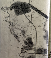
Tithe and Enclosures 1820
|
|
1820
|
The next available map of the area is the Tithe and Enclosure maps of 1820. The copy in the Bury St Edmunds Record Office is unfortunately only a black and white photographic copy, and so some details may have been lost.
The southern road is now labelled as "stopped." The shape of the lake has been altered but a boathouse has been added. (The foundations of the boathouse were still visible in the early 21st century, and a new structure has been added on to these remains by the 'Dream Lodge' leisure group in 2016.)
The five cottages on the Green, in the south-eastern corner of the Park, have now been demolished. A new South Lodge has been built, and the cottage area is now much more integrated into the Park landscape.
The Park is now 193 acres apparently excluding plantations, buildings and gardens. Ancillary buildings included a gamekeeper's lodge, with dog kennels attached, and two ice houses.
|
|
1822
|
In 1822 John Gage published his book entitled,"The History and Antiquities of Hengrave in Suffolk." The dedication was to Bernard Edward, Duke of Norfolk, the owner of the adjacent estate of Fornham St Genevieve. Unfortunately he did not include any maps of the estate or its neighbours. In the introductory chapter he wrote that the parish had a large number of partridges, "the bustard is sometimes, though rarely, seen on the heaths of the neighbourhood. A few quails are occasionally found on the Fornham Hills,..... and in the river the otter is sometimes speared. The fish of the Lark are chiefly pike, perch and eel, and not very abundant."
|
|
Fornham Hall 1824
|
|
1824
|
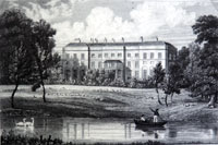
In 1824 H Davy published his "Seats of the Nobility and Gentry." Fornham Hall was illustrated by the attached engraving by J Lambert.
|
|
1826
|
In 1826 a bizarre discovery was apparently made on the Fornham Estate, which was described fourteen years later. In 1840 the historian John Gage Rokewood wrote, in his note to the Camden Society publication of Jocelin of Brakelond's 'Chronicle':
"In felling, in 1826, an ancient pollard ash that stood upon a low mound of earth about 15 feet in diameter, near the church of Fornham St. Genevieve, (the ground being within the Duke of Norfolk's park, but apparently part of the churchyard at some former time,) a heap of skeletons, not less than 40, were discovered, in good preservation, piled in order, tier upon tier, with their faces upwards and their feet pointing to the centre. Several of the skulls exhibited evident marks of violence, as if they had been pierced with arrows, or cleft with a sword".
|
|
1828
|
The 12th Duke of Norfolk had the house re-modelled around 1828 by Robert Abraham, a London architect who had worked for other Catholic families. Another source gives Samuel Acton a hand in these alterations. The main block now has nine bays, with the central five bays projecting forwards. A two storeyed wing had been added with six bays. By the late 19th century this wing had been increased to three storeys.
|
|
Sales map 1843
|
|
1843
|
In 1843 the Duke of Norfolk was appointed as one of the Commissioners of the River Lark.
In July 1843 the Duke of Norfolk sold the Fornham Estate to the Rt Hon John Thomas Manners, (1818-1864), also known as John Thomas Manners-Sutton. White's Directory of 1844, recorded the sale as being 'about 1600 acres'. Also, according to Whites, Manners paid £75,550. It is likely that the Duke also nominated Manners to replace him as a River Lark Commissioner. Manners had become Baron Manners of Foston upon the death of his father in 1842.
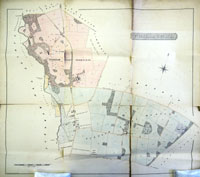
The map produced for the sale is available by clicking on the thumbnail. Sheepwash Bridge is correctly labelled. Also visible is the Burial Ground in use for former employees of the estate. This was needed to replace the churchyard at the the ruined Fornham St Genevieve church. A few grave markers were still visible in 2015. The North and South Lodges are clearly shown at either end of the Park access road.
The areas shaded in pink represent parts of the estate located in Fornham St Genevieve, while the blue shading denotes parts within Fornham St Martin. Pale yellow shading represents parts within Fornham All Saints. Unshaded areas were excluded from the estate and the sale, and are marked up with their ownerships.
John Thomas Orde held the small 200 acre estate around his Fornham House, and the Rector's estate of the Revd. Edward Hogg is also shown.
|
|
1844
|
In 1844 White's Directory of Suffolk recorded that Fornham St Genevieve, "a fertile and picturesque parish", contained, "only 700 acres and 70 inhabitants."
In nearby Fornham St Martin, there were 294 souls and about 1200 acres of land. "Fornham House, a large and handsome mansion, is the seat of John Thomas Ord, Esq., who owns about 200 acres; and the rest of the parish, with the advowson, was sold in 1843, by the Duke of Norfolk, to Lord John Manners, MP." (along with the whole Fornham Park Estate.)
Fornham All Saints was in the Hundred of Thingoe, while the other two Fornhams were in Thedwastry Hundred. Fornham All Saints had a population of 336, and contained about 2,000 acres of land. "Sir Thomas Gage, Bart., is Lord of the Manor but part of the soil belongs to the Rev Sir T G Cullum, Bart. on whose estate...is a commodious wharf, at the termination of the Lark Navigation."
|
|
1846
|
Lord Manners' mother, the Dowager Lady Manners, nee the Hon. Jane Butler, died at Fornham Hall on 2nd November, 1846, aged 67 years. (His father had died in 1842, aged 86 years at their London home of 56 Upper Brook Street, Mayfair.) While retaining the London address, Lodge's "Peerage" of 1845 gave Fornham, near Bury St Edmunds, as the Baron's "Seat".
|
|
1862
|
Lord Manners had owned the Fornham Park estate for less than 20 years.
The entire Fornham Park estate and its property was sold by Lord Manners to Sir William Gilstrap in 1862. Gilstrap held it until his death in 1896. Gilstrap was a Nottinghamshire brewer, who paid £85,000 for it.
|
|
1868
|
In 1868 Sir William Gilstrap bought two-thirds of Fornham All Saints, to add to his local holdings.
As the Gilstrap family now owned the manor of Fornham All Saints, all the three Fornhams came under one ownership until the end of the century. There is no doubt, that over the latter half of the 19th century the Gilstrap family exerted significantly more influence within the area than the Ord family of Fornham St Martin. Gilstrap owned some 4,000 acres and, in 1895, the then Prince of Wales would be a guest at Fornham Hall during the shooting season.
|
|
First OS six inch map
|
|
1882
|
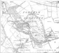
The first OS 6 inch maps covering this area were produced in 1882. The six inch series, (scale1:10,560) had been in production across the country since 1842. Here we see part of the maps for Fornham St Genevieve, covering sheets numbered XXXIIISW and XXXIIISE.
The River Lark north of the Duck Sluice is shown in two looped branches. One loop is labelled 'old canal', and refers to the canalisation carried out before 1715, and still in constant use up to 1846. After the coming of the railway to Bury St Edmunds, the Navigation was allowed to decay, and it may be that the older loop, marked by the parish boundary, was allowed to carry most of the flow at this time, with some drying out of the old canal. (Attempts to revive the Navigation would take place in the 1890s, without much success.)
|
|
Fornham Hall 1882
|
|
blank |
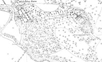
The 25 inch map of the area was also published around this time. A section of the 25 inch map, scale 1:2500, covering the Fornham Hall and its immediate surroundings is also shown here. It reveals several features.
The Hall itself is at the south east of a range of buidings and a kitchen garden. An ornamental garden is show in front of the Hall, with a fountain in its centre.
The house must have been illuminated by gas light at the time. An on-site gasometer is shown, hidden away from the main residence. Coal would have been needed to be brought in to provide this facility.
The cross hatched buildings to the north west of the house are presumably glasshouses to provide exotic fruits and out of season vegetables. The cross hatching was used by the Ordnance Survey to denote a glass roofed structure.
A second walled garden is shown by Ducksluice Farm, with interior divisions by lines of trees. Possibly these were trained fruit trees. A pumping widmill is shown at the foot of this garden, presumably to provide pumped drainage into the river from this low-lying part of the estate.
There is an ice house in the trees of the IceHouse plantation, with an unnamed circular feature to its south east. Possibly this was a second ice house.
|
|
1890
|
Attempts were under way to revive the River Lark as a navigable waterway, largely led by the Marquis of Bristol. In 1890 the subscription was still £6,000 short. In November the Eastern Counties Navigation and Transport Company held their Annual General Meeting at the Guildhall, Bury St Edmunds. Lord Francis Hervey acknowledged that the works of repair and improvement on the river had not yet been completed. Thus there was no money coming in from the Lark. At the AGM, Sir William Gilstrap of Fornham St Genevieve Hall, urged the people of Bury to support the new canal.
|
|
1894
|
By March, 1894, on the River Lark at Fornham All Saints, a new iron bridge had been erected by the West Suffolk County Council. This replaced the old wooden Causeway Bridge which had partly collapsed under the weight of a traction engine in 1890. By at least 1955 the Ordnance Survey maps were calling this Sheepwash Bridge.
On the river itself, barge traffic was as low as one gang of barges a week passing up to Bury St Edmunds. As for the Eastern Counties Navigation and Transport Company, it was in deep financial trouble. On 7th December 1894, a receiver was appointed by the Chancery Division of the High Court. He was Mr Bevan, the local banker who had issued the writ. A few days later the business was handed to a new Receiver, Charles Baker, an accountant. He was to try to run the business until April 1895.
|
|
Fornham Hall Royal Visit
|
|
1895
|
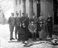
In 1895 the Prince of Wales, later King Edward VII, was a guest of Sir William Gilstrap at Fornham Hall during the shooting season. The visit appeared in the Bury Free Press, proudly stating that the Royal Party bagged 1,077 pheasants on one day in January, 1895. Along with the Prince was his brother, the Duke of York, later King George V. Sir William Gilstrap is the bearded figure sitting in the front row. As well as the pheasants, the newspaper reported other game as 14 partridges, 128 hares, 11 rabbits and 9 "various".
The other guns were the Hon Derek Keppel, Capt Holford, Mr George Manners, Capt Machell and Mr R Moncrieffe. Because shooting rights covered the whole estate, they began at coverts near Walton Burrell's New Hall Farm, at the far end of Fornham St Martin. Lunch was taken back at the Hall, followed by shooting within Fornham Park itself.
As often still happens today, a thick fog came up from the river at 3 pm, putting an end to the day's sport. The royal guests returned to London by train that evening.
House guests included Lady Augustus Hervey and Mrs George Manners, but the ladies did not join the guns. Mrs Manners was the niece of Sir William Gilstrap and acted as hostess. For the reception of the royal visitors at Bury St Edmunds Northgate Station the previous evening, crimson cloth was laid down on the platform, and the party drove to Fornham Hall in two pair-horse carriages.
|
|
1896
|
Sir William Gilstrap died in 1896, and Fornham St Genevieve passed to George Espec John Manners, whose wife was a Gilstrap. In effect it stayed in the family, and Gilstrap's will was to govern its ownership into the 20th century. George Manners would be knighted in 1920, and retain the estate until his death in 1939. However, Sir George had other property, and it appears that he never lived at Fornham Hall, so from 1896 until 1939 the house would be let, except when requisitioned by the army during the First and Second World Wars.
|
|
Fornham Hall OS map 1904
|
|
1904
|
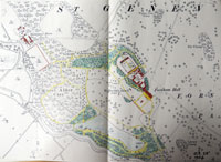
This map shows Fornham Hall and a small part of the Park as depicted on the 1904 revision of the 25 inch Ordnance Survey map.
|
|
Fornham Park being enjoyed c1907
|
|
1907
|
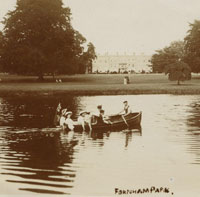
This postcard, or one like it, was postmarked 1907, and shows the ornamental lake in Fornham Park being used for boating. Elegant ladies walk the grounds between the house and the lake. According to Pawsey's 'West Suffolk Illustrated' the tenant of Fornham Hall in 1907 was A Lyle esq..
An ornamental garden is just visible in front of the Hall.
|
|
Fornham Hall gardens
|
|
1908
|
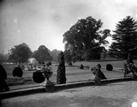
The Spanton-Jarman collection of photographs, held by the Bury Past and Present Society at Bury Record Office includes a number of views of the gardens at Fornham Hall as well as the interior of the Hall and its furnishings. One or two of these views are dated 1908, and it may well be that the whole series dates to this time.
|
|
1909
|
In Spring 1909 Major St John St George Orde sold Fornham House, and left the small estate at Fornham St Martin, which had been the family home since the 18th century. Fornham St Martin Village Hall had been built in 1887 in memory of Sir Harry Orde, and in 1858 the only son of Captain Orde had been lost in the Southwold Lifeboat disaster. The family name remains on Orde Lodge at Fornham St Martin, dated 1870.
|
|
Royal Engineers at the Woolpack
|
|
1914
|
Britain entered the First World War on 4th August 1914, and the regulars and territorials were mobilised.
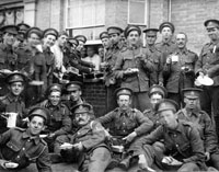
Large temporary encampments were set up around the country to house and train the thousands of mobilised men. In October a contingent of Royal Engineers set up a tented encampment at Fornham St Martin. This occupation extended along the fields behind and around the church and the Woolpack inn. This postcard, one of many such pictures taken by Walton Burrell, shows the Royal Engineers gathering outside the Woolpack as they arrive to set up camp.
Nearby, at Fornham St Genevieve, Fornham Hall and Fornham Park, had been owned by George (later Sir George) Manners since the death of Sir William Gilstrap in 1896. Manners does not seem to have lived at Fornham Hall, as he had property elsewhere, but the house was let at various times. In 1914, the estate was requisitioned by the War office for military occupation. It would seem that it was occupied for a time by the Royal Engineers, according to this later account from "WW2 People's War" by the BBC, 'Memories of a Sapper in the Royal Engineers, 248th Field Company, named Bill Astle':
"That was early 1940 ....... We were then stationed at Fornham Hall, Fornham Park, Bury St.Edmunds ...........
And incidentally we moved from Bedford to Fornham Park and we were the first people that had occupied it as occupiers. A caretaker lived there. We were the first since the First World War when it was the same Unit that moved in, the 248th Field Company from the First World War was also billeted there. "
|
|
Soldiers at Duck Sluice 1915
|
|
1915
|
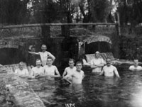
Here we see soldiers bathing at Duck sluice, on the River Lark, at Fornham St Genevieve, Suffolk. The SRO reference is K997/67/12, ( Former reference: 1585) dated 13 August 1915. Duck sluice today is completely derelict and only a few bricks remain to show its location. Its original purpose was to control the water supply to an offshoot of the River Lark, which also no longer exists.
|
|
Punting on the lake
|
|
1916
|
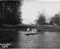
This picture shows five wounded soldiers enjoying a punt on the lake in Fornham Park, Suffolk. It bears the date 1st May 1916, and Fornham Hall is visible in background. They are clearly dressed in their hospital blues, which were thought to maintain discipline, while showing the world that they were wounded in action.
The ornamental garden in front of the House still seems to be visible.
|
|
George Manners
|
|
blank |
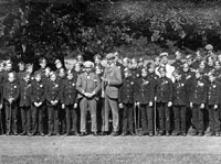
George Manners with messenger boys from London, seen in Fornham Park, in August 1916. Suffolk Record Office Reference K997/101/5. George Manners was the owner of the Fornham Estate at this time, but it is not thought that he lived here very much, having other homes elsewhere. In 1920 he would become Sir George Manners. These boys were presumably on an outing from London, although they are in their messenger uniforms.
|
|
1917
|
The November 8th, 1917, edition of Flight Magazine contained the following announcement:-
"Information has been received that Lieutenant Duncan Macrae, Seaforth Highlanders, attached R.F.C. (Lord of the Manors of Fornham St. Genevieve and Fornham St. Martin, Suffolk, under the will of the late Sir William Gilstrap, Bart.), only son of Colonel and Mrs. MacRae-Gilstrap, of Eilean Donan, Ross-shire, and Ballimore, Argyll, who has been missing for some time, is a prisoner with his observer, Lieutenant Blake, R.F.C., who are both reported by the Turks to be unwounded."
|
|
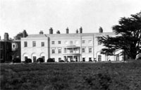
Fornham Hall from the gardens
|
|
1918
|
This view of the Hall is taken from the garden side of the mansion. Often this view includes the lake, but this is taken a little closer to the house.
|
|
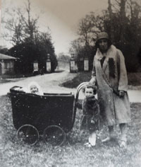
Outside South Lodge gates
|
|
1931
|
This view of Louise Hoggett holding the pram, little girl Irene Hoggett and baby Barbara is dated to 1931. In the background are the gates at South Lodge, Fornham Park. Every Sunday the family would walk around the three Fornhams, and David Ellis's grandfather, William, (Billy), took this picture at a convenient stop. Note the unmade roads. This park exit in 2016 comes out on to the roundabout between Fornham St Genevieve and Fornham St martin.
|
|
1939
|
George Manners became Sir George Manners in 1920, but died in 1939. Under the terms of William Gilstrap's will, a life tenancy was now granted to Captain Duncan Macrae of Dunoon. Macrae probably never took up residence, and the Hall had been more or less empty since at least the 1920s.
In late 1939 the Fornham Park and its Hall were requisitioned by the War Department.
|
|
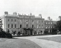 Fornham St Genevieve Hall
|
|
1940
|
The needs of the military were paramount. Fornham St Genevieve Hall and Park had been requisitioned. The following account of Fornham Hall is from "WW2 People's War" by the BBC, Memories of a Sapper in the Royal Engineers, 248th Field Company, named Bill Astle:
"That was early 1940 I should think, about 1940 time, early 1940. We were then stationed at Fornham Hall, Fornham Park, Bury St.Edmunds and that was later demolished. It looked like a sort of, oh, like Woburn Abbey I suppose, and it was later demolished because of it being a landmark. (The empty House was in fact not demolished until 1951.)
And incidentally we moved from Bedford to Fornham Park and we were the first people that had occupied it as occupiers. A caretaker lived there. We were the first since the First World War when it was the same Unit that moved in, the 248th Field Company from the First World War was also billeted there.
And it was a weird place. If you can imagine something like Miss Haversham’s place in Great Expectations - that was the same. Four poster beds, sheets etc. still on the beds and when you tried to pick them up they fell to pieces in your hands. Also, it had a library in there, a very big library and when the door closed in the library you got lost because you couldn’t see the way out, it was part of the book display, it disappeared.
It was on telly a little while ago, a family called Gillstrap used to live there but the Queen stayed there as well. (Sir William Gilstrap had bought Fornham St Genevieve Hall and Park in 1868.)
It still had the furniture in and I felt a pang of regret when they removed all the furniture that was in there and put it in the cellars down below.
But there is another humorous bit to that - in the cellars down below there were a lot of bottles in racks and they still had the stuff in them going back to, probably the 1890s or something like that and they made us smash all the bottles. Because we all had a drink, the snow was on the ground and some of us went to sleep underneath the trucks in the snow, they made us smash all the bottles."
|
|
1941
|
With the advent of an army encampment it was necessary to lay on water and sewerage facilities. As the first units were engineers, this was good training, as well as a necessity. The 1950 sale details describe "a four inch water main laid to the huts and to the mansion. The drainage from the huts is connected to the sewage disposal plant."
|
|
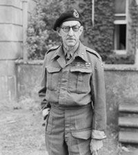
General Percy Hobart
|
|
1943
|
For months there had been extensive trials undertaken to discover ways to land troops on to invasion beaches with the minimum of losses. It was believed that men needed to be in armoured vehicles, and a variety of weird inventions were trialled to assist amphibious landings.
In April 1943 all this work was brought together under Major-General Sir Percy Hobart, and one unit called the 79th Armoured Division. The 79th Armoured had a unique role, and the vehicles that equipped it were so strange that they became known as ‘Hobart’s Funnies’.
Units working on the development of variants of the Churchill Tank were widely spread around the countryside. In West Suffolk one regiment was based at Livermere, with its HQ at Ampton Hall which was already working as a Red Cross hospital. Individual tanks and their crews were also housed more widely, making use of the army maintenance facilities already established in Fornham Park and the Labour Camp at Wordwell.
|
|
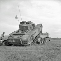
Tanks at Fornham Park
|
|
blank |
At some point 'C' Squadron of the 144th Regiment of the Royal Armoured Corps were located at Fornham Park, remaining until 1944. They were not part of Hobart's Division, but would have facilies for tank maintenance if required.
The lock at a location recorded as "Duck Mill" collapsed in 1943. This name may refer to Ducksluice lock at Fornham All Saints and St Genevieve. Flempton Lock also suffered a collapse. There were no resources available to make good these problems because of war time conditions.
However, the military could command such resources, and D Weston reported that a military dam was constructed at Fornham, to strengthen the anti-tank defences of the Lark Valley Stop Line. This dam was apparently removed in 1962. No doubt this work was carried out using soldiers, possibly REME engineers, based in Fornham Park or nearby.
|
|
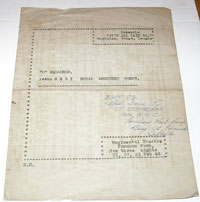
Concert Party Fornham Park
|
|
1944
|
This concert party programme by the 'C' Squadron of the 144th Regiment of the Royal Armoured Corps was for three nights of February 21st to 23rd in February, 1944 at the Regimental Theatre in Fornham Park. A note in the programme states that "It's all Laid on" was their fourth show. Previous shows had been "Bags of Revs" at Minstead, "You've Had It" at Livermere, and "Come and Get it" at Coalburn.
The programme was sent to Corporal K Davis who was one of the show's comperes and appeared himself in a couple of the sketches.
144th Regiment RAC was assigned to the 33rd Tank Brigade for training in the United Kingdom, and remained with this brigade for virtually its entire service. Although trained on Churchill tanks at Fornham and elsewhere, they were assigned Sherman tanks for the invasion of Europe commencing in June 1944 until May 1945.
|
|
1947
|
The war had been over for nearly two years, but there were many issues still being sorted out in its aftermath. On 6 May 1947, Lieut.-Colonel Geoffrey Clifton-Brown MP, stood up in the House of Commons and asked the Secretary of State for War, "why it has become necessary to recondition and re-equip Fornham Park Camp, Bury St. Edmund's, which has stood derelict for 18 months; what will be the cost of this work; and if there is no barrack or permanent camp more suitable for peace-time military occupation."
Mr. Bellenger replied that, " Fornham Park Camp, Bury St. Edmunds is being reconditioned and re-equipped to accommodate a regiment returning from overseas. The camp was evacuated approximately six months ago by Polish Forces when it was certainly not in a derelict condition. The cost of the work being carried out is estimated at £700, and there is no more suitable barrack or permanent camp available at present for the purpose for which it is required. "
Lieut.-Colonel Clifton-Brown had been the MP for Bury St Edmunds since 5th July, 1945. He did not agree with the Secretary of State's answer. "Could the Minister look again at his answer, because no Polish troops had been there until six weeks ago? In fact, Polish troops in a neighbouring camp were given permission to go and take the stuff out of this camp with the result that the camp is empty. Is it the policy of the Government to allow one part of the Service to take it somewhere else so that money has to be spent to take it back again?"
Mr. Bellenger replied, " No, Sir, we do not give that permission to the Polish troops, but, as the hon. and gallant Gentleman will know, sometimes they do not wait for permission. "
Another ex-military MP joined in. Major Legge-Bourke, "Will the right hon. Gentleman bear in mind that general negligence in regard to empty camps only leads to looting and destruction of very valuable equipment?"
Mr. Bellenger replied, "No, Sir, that charge of general negligence is unfounded. The fact is that I have not the large number of troops necessary to guard these empty camps."
|
|
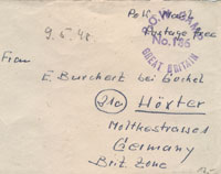
POW letter from Camp 186
|
|
blank |
In the event, it seems that the new purpose of Fornham Park was not to house a returning regiment, but it was used to hold German POWs who were awaiting repatriation to Germany. Berechurch Hall POW Camp in Colchester had been designated as Camp 186 since its opening in September, 1944 to hold prisoners taken in the Invasion of France after D-Day. During 1947, Berechurch Hall Camp was closed, and the designation of Camp 186 was transferred to the newly re-furbished Fornham Park Base Camp. It seems likely that some of the inmates of Berechurch Hall were moved to Fornham Park at this time. One piece of evidence for this is the career of the following German Officer, posted on the internet at Axis History Forum :-
"SS Hauptsturmführer Franz Schwinghammer
Born 7th March 1911 in Innsbruck, Austria, died 11th September 1986 in Innsbruck, Austria.
After the war POW in Naples, London District Cage, Berechurch Hall (Colchester) and Fornham Park (Bury St. Edmunds). POW 209166. Returned to Austria in 1948. "
|
|

POW envelope reverse
|
|
blank |
There also survive a few envelopes preserved by German POW families, which originated from Fornham Park. One was for sale on Ebay in May, 2009, dated December 1947. Another was dated in pencil 9/5/48, addressed to E Burchert Hoxter in Germany. Postmark is POW Camp No. 186 Great Britain. Inked in message is "POW Mail Postage Free".
On the back it gives a sender's address as, "Burchert 186 POW camp Fornham Park nr Bury St Edmunds Suffolk GB"
The envelope is opened but the letter is missing. This item was sold on Ebay in Feb 2009.
In addition, there is the eye-witness report of one Richard Ashton, the son of the newly appointed Camp Commandant to confirm that Fornham Park became Camp 186.
"Father's final posting was just outside Bury St. Edmunds, in the East Anglian county of Suffolk. Fornham Park was a large country house with extensive grounds, and he and mother had their quarters in a portion of the house, the rest of which was occupied with all of the offices associated with a military unit, rather like a colonial era Government House. He had the dubious honour of commanding the last prisoner of war camp in England to close, one that was high security, and which had a large garrison of soldiers to ensure the security.
Now for the conflicting info. I have seen online two different locations for 186 Base Camp.
I can assure you when dad commanded it, it was at Fornham Park, a couple of miles north of Bury St. Edmunds in Suffolk. He retired from there.
As a child I remember during school holidays (while staying there) being sneaked into the soldiers' movie theatre, run by the Army Kinema Corporation, and the film being shown was 'Of Mice and Men', hardly appropriate, but I don't remember any detail of the film. This would undoubtedly have been another Nissen Hut, and thinking back they had two projectors in a make-shift 'bio-box' like a real cinema, and were thus able to do reel changeovers on the run.
It was rumored that Rudolph Hess, one of Adolf Hitler's aides-de-camp, was detained at what was eventually father's camp at Fornham, after his capture in Scotland, and the Allies not entering into the negotiated peace he appeared to have parachuted in to arrange. Hess's whereabouts were never actually divulged, so this is all pure speculation. Father would have known if he were an inmate there, but would never have divulged it.
Interestingly, visiting the U.K. briefly during 1990, I discovered that Fornham Park appeared to be deserted, either still, or again, with no sign of habitation in the house, and the grounds apparently being vacant too. Many wartime military conversions of stately homes resulted in an enormous cost to return them to a usable condition, so perhaps Fornham had never seen civilian use since about 1948 when no.186 Base Camp closed."
|
|
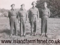
Repatriation escort party at Fornham Park May 1948
|
|
1948
|
Fornham Park had been an army camp during the war, but had been abandoned in 1945. In 1947 it was refurbished as a transit camp, designated Base Camp 186, for the repatriation of Prisoners of War.
This picture, taken from www.islandfarm.fsnet.co.uk web site, shows a group of four soldiers taken at Fornham Park waiting to escort and repatriate some high ranking German prisoners back to Germany. It appears that this picture relates to a Repatriation Party of 76 German Prisoners who left Island Farm Special POW Camp 11 at Bridgend, in Wales on 12th May, 1948. They were reported to be Generals, Admirals and Luftwaffe chiefs in the Welsh newspapers. Island Farm Camp had been a special camp for holding high ranking German Officers since 1944. This particular group of released men apparently passed through Fornham Park as their last transit camp prior to joining the SS Biarritz at Harwich for the journey home.
Fornham Park Camp closed down later in 1948. Its last commandant was Lieutenant-Colonel John Forbes Ashton, of the Border Regiment. He and his wife then retired to a cottage at Beyton.
|
|
Fornham Park & Estate sale 1950
|
|
1950
|
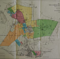
By 1950 it was decided that the estate had to be disposed of, and arrangements were put in hand at the Directions of Captain Duncan MacRae.
The first step was to dispose of the furniture and other domestic contents of the Hall. This included period furniture such as pieces by Sheraton, Hepplewhite and Chippendale, books, pictures, sculptures, carpets, linen, china and glass. Some thousand lots were made up, most dating back to Sir William Gilstrap's time, and these were largely sold off in March 1950.
On October 25th, 1950 the now empty Hall, Fornham Park, and the entire Fornham Park estate was put up for sale. The sales particulars noted that Fornham Hall had, "inevitably suffered some damage during its requisition by the War Department." There were 52 lots, including the Park of 224 acres, seven farms, the Old Rectory, school and school house, the Woolpack Inn in Fornham St Martin, 60 cottages, allotment land, meadows and two entrance lodges. The total estate size was 2,400 acres, and the total rent roll was estimated at £4,000 a year.
The land holdings not only included property in Fornham St Genevieve, Fornham St Martin and Fornham All Saints, but there were also significant holdings in Bury St Edmunds to be sold. The sales details noted that, "The Fornham Park Estate is situated adjacent to and partly within the boundary of the historic County Cathedral and market town of Bury St Edmunds. It has been in the possession of the vendor's family for around 100 years since it was purchased by the late Sir William Gilstrap, Bart., from Lord Manners. In that time the only sales have been those necessitated by the growth of Bury St Edmunds, the provision of a site for the Beet Sugar Factory, and sales to the Local Authority for housing."
The sale was managed by Arthur Rutter, Sons and Co, and took place in the Athenaeum, Bury St Edmunds. The attached map clearly shows that Fornham Park itself was just a small part of the total estate. The Park is coloured pink on the map.
The sale included the three Lordships of the Manors of Fornham St Genevieve, Priory (or Priorie) Manor, and Fornham St Martin. The shooting rights were reserved to the vendor, and excluded from sale.
By 20th October it was announced that the park had been bought in order to realise its timber assets. Later it appeared that this buyer was Mr Hurlock of Brook Hall, Nacton.
(Lot 42 was an arable field of 46 acres, tenanted by the farmer Mr C Stennett. Lot 41 was the 10 acre Tollgate Farm, tenanted by Mr D Boughton. Together these 56 acres of land would be purchased by Bury St Edmunds Borough Council, and become an extension to the Mildenhall Road Council Estate, and be known as the Howard Estate. The first contract for 40 new houses was let in 1952.)
|
|
1951
|
In June 1951 it appeared that the Hall was now in the hands of a syndicate who intended to sell off the ornamental interior fittings and then dispose of the demolition materials.
Fornham Hall was demolished in late 1951. On 17th August the Bury Free Press had a photograph showing the entrance front in the course of demolition. The paper reported that the House had not been privately occupied for thirty years. Only the stable block and a few cottages escaped demolition. A 20,000 foot run of timber was sold from the house, and the doors and windows had already been sold.
|
|
Fornham Park c1955
|
| 1955
|
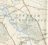
This OS 1:25,000 scale map shows the disposition of features after the War. The Hall is not yet shown as demolished, although a concentration of army huts is visible to the north-east of the Hall. Other huts line the road from South Lodge, with individual huts at the entrances to the Park. Some of these features may have been disposed of by the time this map was published in 1955.
|
|
1959
|
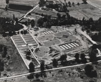
Work began on the Pigeon Lane pumping station and the Fornham Park sewage treatment works to replace the West Stow works. Plans had been drawn up, amended and discussed for sewerage improvements since 1947. In 1959/60 Bury St Edmunds Borough Council spent £37,986 on the start of work at 'The new Sewage Disposal Works.' In 1960/61, a further £173,503 was spent on capital account, and £121,343 in 1961/62. In 1961/62 work on the new outfall sewer to connect the town to Fornham Park cost a further £75,819. Three houses were also built by the sewage works entrance for use by attendants.
|
|
Main Sewer - Abbey Gardens
|
| 1961
|
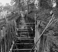
In Bury a major project was taking place to replace the main sewerage system for the town, funded by Bury St Edmunds Borough Council. Trunk sewers up to 4 feet in diameter were installed through the town and out to Fornham Park. As they worked by gravity they tended to follow the bottom of the river valleys of the Linnet and Lark as far as was practical. They went through the Abbey Gardens and along Fornham Road, and the pipes were often set into deep trenches, depending upon the lie of the land.
|
|
Fornham Sewage Treatment Works
|
|
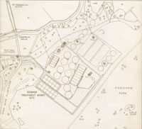
Sewage Works extension
|
| 1971
|
In July, 1971, the Fornham Park sewage treatment works extension was officially inaugurated. In 1962 the Fornham Park works had been opened to replace the old West Stow sewage farm to receive and treat the waste from Bury St Edmunds. Since 1962 the flow of sewage had increased, but the dilution factor given by the river Lark had remained small, particularly in dry weather. The river authority now required a higher standard of purity to be reached in the final outflow liquid in return for licensing a larger final discharge into the river. The sewage works thus had to be extended to meet the higher daily load, and an effluent "polishing" plant was installed to further clean up the outfall into the river. This would be the last sewage works improvement to be financed by the borough council. In 1974 the responsibility for sewage disposal, along with the provision of water supplies, would pass out of the hands of locally elected councillors. You can view the plans and information about the new extension by clicking here: Official opening of Sewage Works extension, 1971
|
|
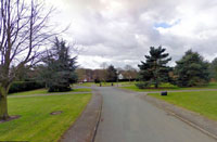
Parklands Green
|
|
1972
|
Another large piece of Fornham Park was taken over when the builder Rooke's acquired land to build 10 executive style homes. These were to be built on plots of between 1.5 acres and 3 acres in size, and set within a landscaped open space. This development was known as Parklands Green, and was located between the extended sewage works and the B1106 from Fornham All Saints to Fornham St Martin roundabout. By 1975 most of these houses would be occupied, although the last ones had to be sold at considerable discounts as the housing market had stalled by 1974/75.
|
|
1974
|
On April 1st, 1974 the ownership of the sewage works and associated sewers, pumping stations and land passed from Bury St Edmunds Borough Council to the Anglian Water Authority (AWA) under the terms of the Water Act of 1973. The West Suffolk Water Board was also abolished, and all its water responsibilities also passed to the AWA.
|
|
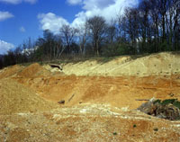
Gravel pit Fornham Park
|
|
1977
|
By 1977 gravel extraction was in full swing within Fornham Park. This picture from the British Geological Survey, shows part of the Allen Newport Quarry in operation at this time. The description on the BGS website reads as follows:-
"Allen Newport Gravel Pit, Fornham Park, Fornham, Bury St. Edmunds. Chalky Boulder Clay overlying glacial sand and gravel. Note the planar base of the boulder clay. The underlying sand and gravel is predominantly horizontally-bedded. It consists mainly of sands within the gravel bands. The chalk seen in the foreground may have been dumped from elsewhere in the pit, but 'in situ' chalk occurs about 50 m. to the south."
|
|
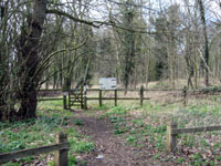
Parkgate Woodland Walk
|
|
1995
|
Around 1995 the owners of the Sewage Works, Anglian Water, developed a small circular woodland walk by the works entrance. It was called the Parkgate Woodland Walk, and ran inside the Parkgate Plantation, along the river and part of the lakeside, and then returning to the Park gate. A boardwalk had to laid along the path adjacent to the works, as it was liable to flood and was always muddy to a greater or lesser extent. Unfortunately, in times of heavy rain, other parts of the path were also impassable. Nevertheless this was a pleasant walk in the shade during summer months. A rookery was part of the attraction, along with occasional sightings of grass snakes.
|
|
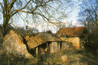
Ducksluice Farm derelict
|
|
1998
|
This picture shows the derelict state of Ducksluice farm by 1998. It must have stood empty for years.
|
|
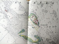
Fornham Hall remains
|
|
2002
|
This map shows Fornham Hall and a small part of the Park as depicted on the 1904 revision of the 25 inch Ordnance Survey map. The coloured up sections show woodland, buildings and roads as they remained in 2002. The area taken up by the Sewage Works is not shown.
On 7th November the Bury Free Press carried this article:
"The battle of Fornham finally drew to a bloody conclusion after a war of words across the council chamber yesterday.
And the victors were Rossfleet Investments, based at Bridgham, Norfolk, which wants to transform arable land and the former site of an historic battle into a new golf course for Bury St Edmunds.
Plans for the Fornham St Genevieve scheme has been in the pipeline for nearly three years.
Rossfleet Investments wants to create a 27-hole golf course on 106 hectares of land at Fornham Park.
At yesterday's development control meeting officers recommended the scheme should be refused on the grounds that there was not an over-riding need for another course and the site is within a special landscape area.
The officers argued the scheme would impact on the historic battlefield site and there was only limited public access to an area of land which is within the Brecks Countryside Project.
The company was already carrying out restoration work on the ruins of the church tower of Fornham St Genevieve and would also ensure improved management of the woodland area.
A footpath between the Park Gate Plantation Walk is also being provided to link in with the Lark Path alongside the river as part of the scheme."
This proposal was never put in place.
|
|
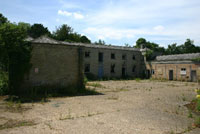
Stable block derelict 2005
|
|
2004
|
The Georgian Group magazine reported in its Autumn edition that gravel extraction had ceased in Fornham Park, and that what remained of Wyatt's buildings had been listed. The Group also influenced the conversion of the stable block etc into appropriately styled dwelling houses.
|
|
2006
|
Planning permission was granted for a 9 hole golf course and 26 holiday lodges. One condition was that the golf course had to be built first.
|
|
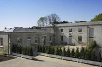
Converted stable block
|
|
2008
|
With skilful restoration and development in 2008/9 the formerly derelict buildings have formed the basis of a small community of exclusive private dwellings.
|
|
Park in 2009
|
|
2009
|
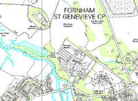
This map which 'Contains Ordnance Survey data © Crown copyright and database right 2013' shows the Fornham Park landscape as at 2009. The largest user is the Anglian Water Sewage Works which serves Bury St Edmunds and adjacent villages. A further large section has been devoted to private housing at Parklands Green, an exclusive development of large homes with large gardens.
Sand and gravel workings, both old and new, are also shown.
At the very foot of the map can be seen the very small burial ground at St John’s Hill Plantation – the site of the Suffolk Hotel and Golf Club – where some of the employees on the estate were buried.
|
|
New Fornham Park landscaping
|
|
2012
|
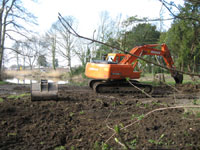
During 2012 there began extensive landscaping within the park. Starting at the lakeside, trees were thinned out and arisings cleared away. Ground cover was largely scraped away at the same time. This was extended around all the park margins, and the once dense habitats were opened up to provide views through the trees.
Over the next few years the park would become a manicured landscape, managed for residential purposes. By 2015 the old flint walls along the Culford boundary would be replaced by a post and rail fence. Views became opened up all along this boundary, through the thinned out tree belt.
|
|
2015
|
The Dream Lodge Group applied for the golf course condition to be lifted as it was no longer considered to be financially viable. The Group renewed its application for the erection of 26 lodges, although its brochure promised 84 lodges would eventually be erected. An objector at the Parish Council meeting pointed out that this request for 26 lodges was therefore a 'Trojan Horse' application as there would need to be many more lodges built to finance the purchase of 250 acres of the site.
|
|
New Fornham Park gates
|
|
2016
|
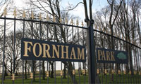
The Dream Lodge Group have this statement on their website in 2016, and announced availability from August, 2016:
"FORNHAM PARK: We have added another truly amazing park to the Dream Lodge Group portfolio set within the extensive and prestigious grounds which was once part of the Duke of Norfolk’s estate. Our development will be home to 27 of our highest grade autograph lodges set within truly magnificent grounds. The park is surrounded by breath taking panoramic views which overlook the natural grounds and beautiful lake. Additional facilities will be added to the park as planning approvals are gained, making this one of the most sought after opportunities in the area that we highly recommend you visit.
The estate consists of parkland and managed woodlands as well as lakes and recently renovated coach house dwellings some listed. The historic Grade II listed church tower that is essential to the development has been restored and the lake has been dredged and the adjacent gatehouse Lodge is being refurbished. Our Lodge park development returns arable land to parkland and puts additional woodland under a management programme. Further facilities will be added to the site as planning approvals are gained, making this one of the most exciting investment opportunities in our portfolio. Fornham Park has a 12 month season.
Suffolk is an ideal place to enjoy walking, cycling or horse riding due to its low lying gentle landscape. Being a farming county there is an abundance of fields growing cereals and sugar beet alongside working farms surrounded by beautiful woodland and the coastal villages are well worth a visit.
Being an area of outstanding natural beauty it offers a wealth of opportunities for exploring and enjoying the great outdoors and it’s an area often visited by bird watchers and nature lovers."
|
|
Quick links on this page
Top of Page 945
Sir Thomas Kytson 1540
The Gage Family 1644
Edward Whittaker 1721
The Kent Family 1731
Bernard Howard 1789
Lord Manners 1843
Sir William Gilstrap 1862
George Espec Manners 1896
Military Occupation 1914
Capt MacRae and military again 1939
Sale and destruction 1950
|
Prepared for this St Edmundsbury website and the Managed Landscapes Project of 'Breaking New Ground'
by David Addy, 14th June, 2016
Books and other resources consulted:
Map of Estate of Charles Kent, SRO 373/23
Lands of B E Howard, SRO 373/24
"The History and Antiquities of Hengrave in Suffolk", by John Gage esq., FSA, 1822
"The History and Antiquities of Suffolk, Thingoe Hundred" by John Gage esq., FRS Dir SA, 1838
Fornham Park Estate Sales Details, 1950 SRO E13/36
UEA report on Fornham Park, labelled c1980, but signed Anthea Taigol 7.1.1993
UEA Fornham Park documentary report, Anthony M Breen, September, 2000
Dorothy Stroud on Capability Brown.
"Lost Country Houses of Suffolk" by W M Roberts, 2010.
"Lancelot Brown and the Capability Men", David Brown and Tom Williamson, 2016
| |


