 |
|
|
Beginning on Monday 15th September, 1968
Bury St Edmunds |
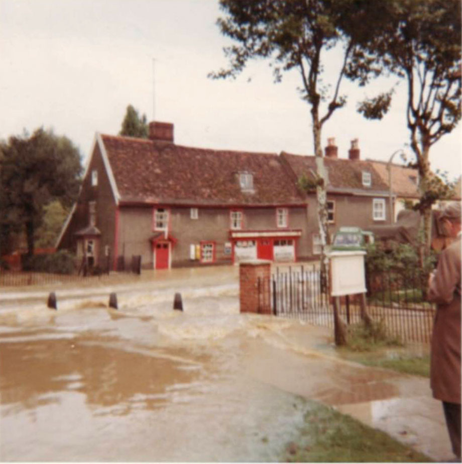
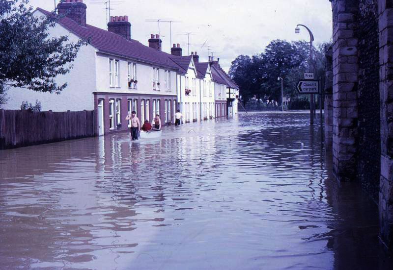
 This view is looking towards town, showing M G Wilson's Post office and Stores at number 19 Eastgate Street. Mr Wilson had the post office from 1947 to 1982. Visible next door is "Sandy" Sanderson, holding a board against the water, who was still living at this address in 2013. Self's Bakery is just visible at the far end of the row. (Grenville Wilson collection). |
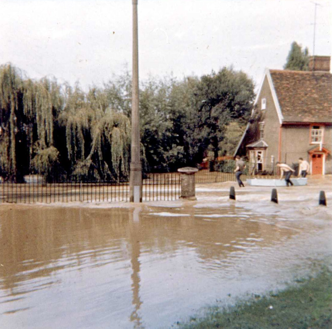
 This view is easily recognisable as the horse trough on the Broadway, Eastgate Street. By the time these pictures were taken, water levels had receded up to a foot. (Grenville Wilson collection). |
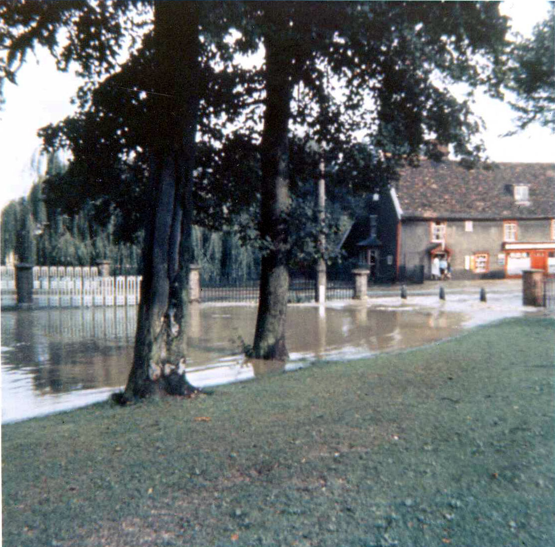
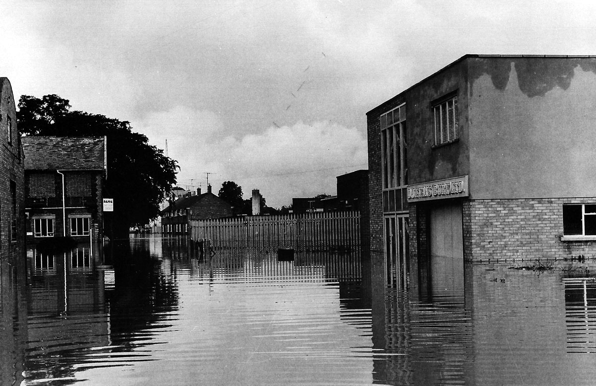
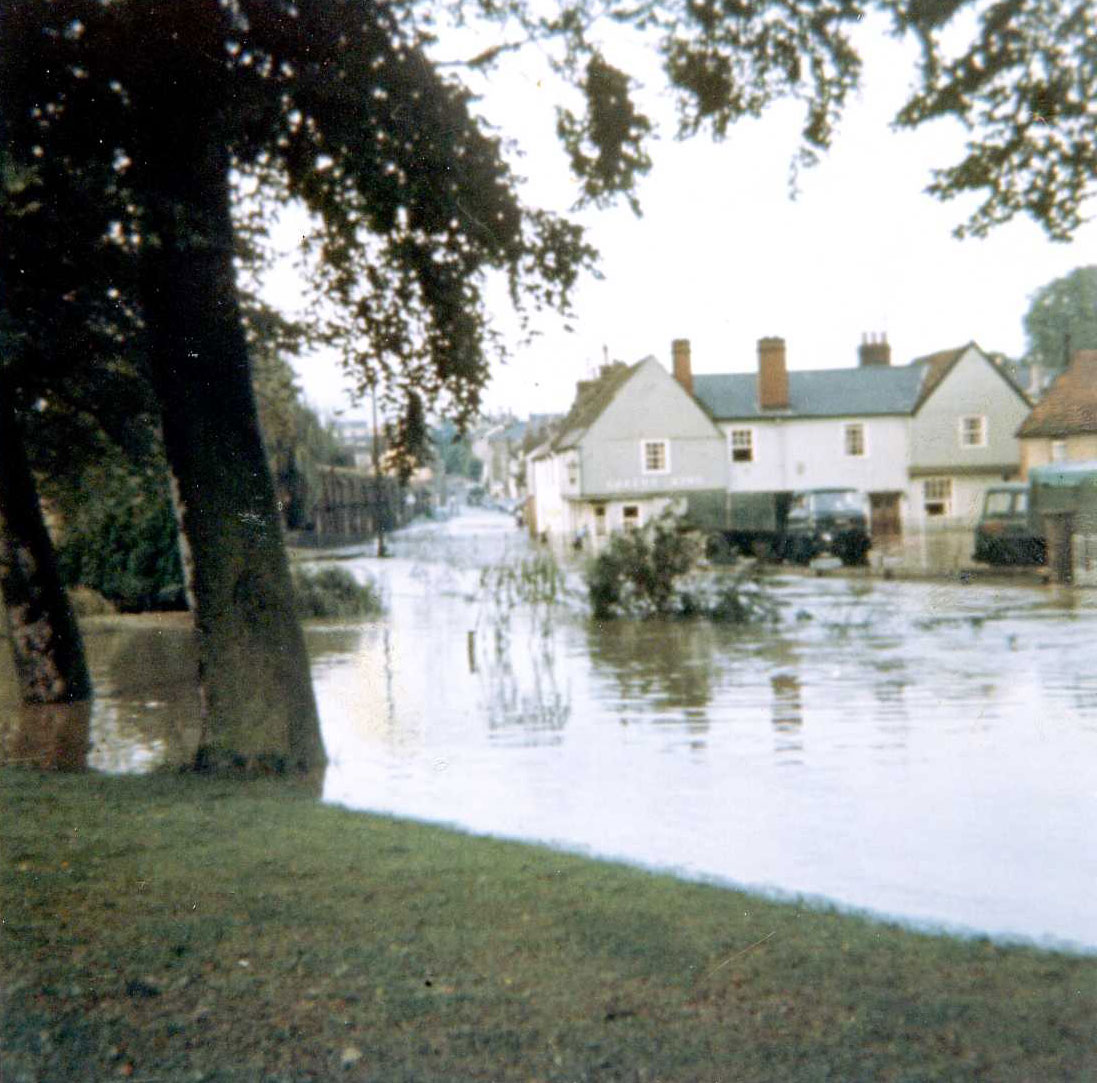 This view shows the Fox and the Broadway, and was taken from the far side of the River Lark, up the driveway to the Grammar School. The river had reached the top of the retaining wall along Eastgate Street, and part of the wall by the Abbots Bridge had collapsed. Grenville Wilson was heading homewards when this wall collapsed and was swept into the Fox's side entrance by the force of water. (Grenville Wilson collection). |
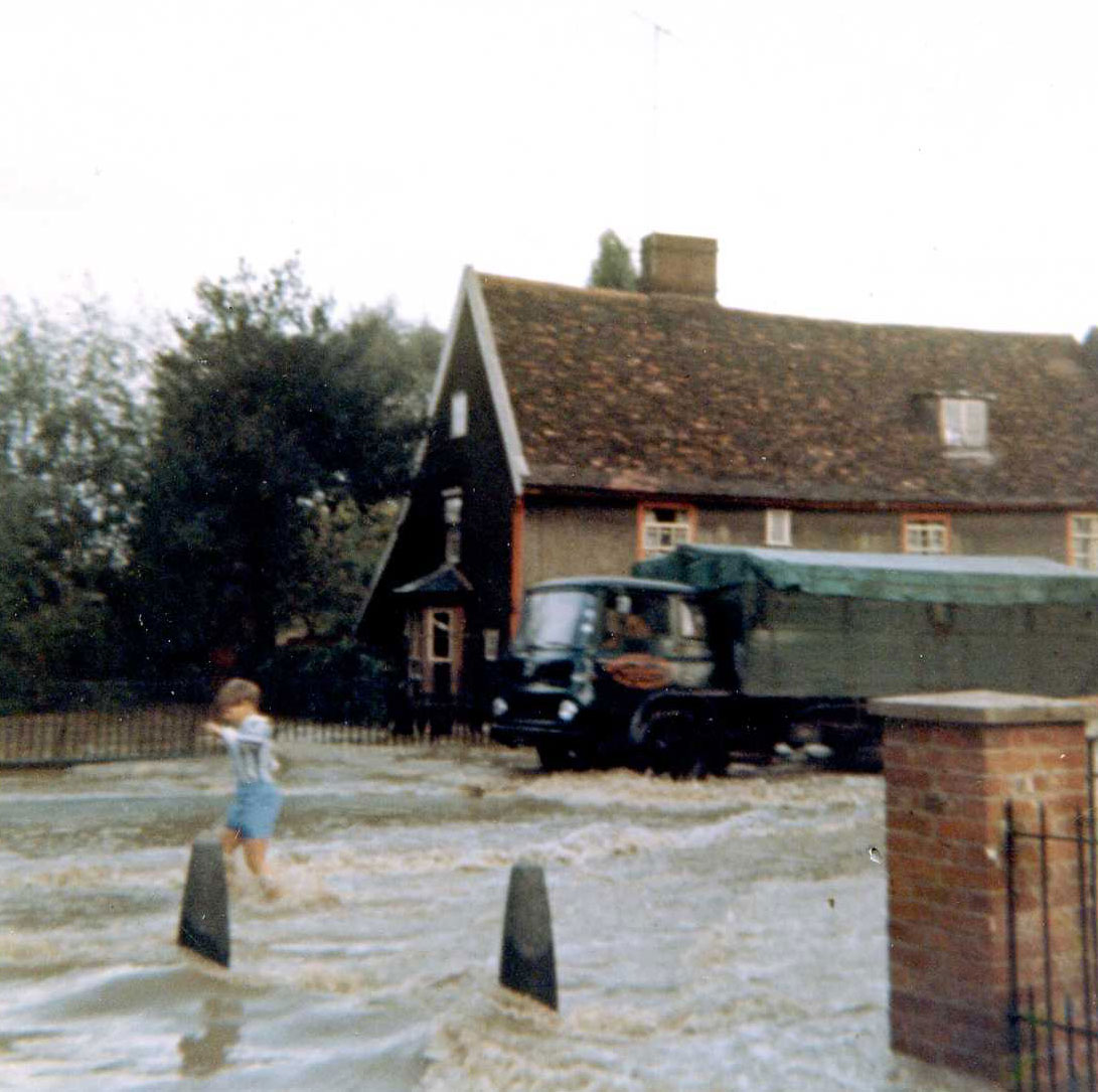 This view, also taken from the school drive, shows a lorry negotiating the floods. At their height it is unlikely that a lorry could have got through. The house in the background belonged to Mr Reg Self, whose bakery and shop was next door. (Grenville Wilson collection). |
 Another view of Mr Self's house, with three men using a flat bottomed boat. (Grenville Wilson collection). |
 In this view the baker's shop of Mr Reg Self is visible next door to his house. It is probably members of the Self family visible in their doorway. (Grenville Wilson collection). |
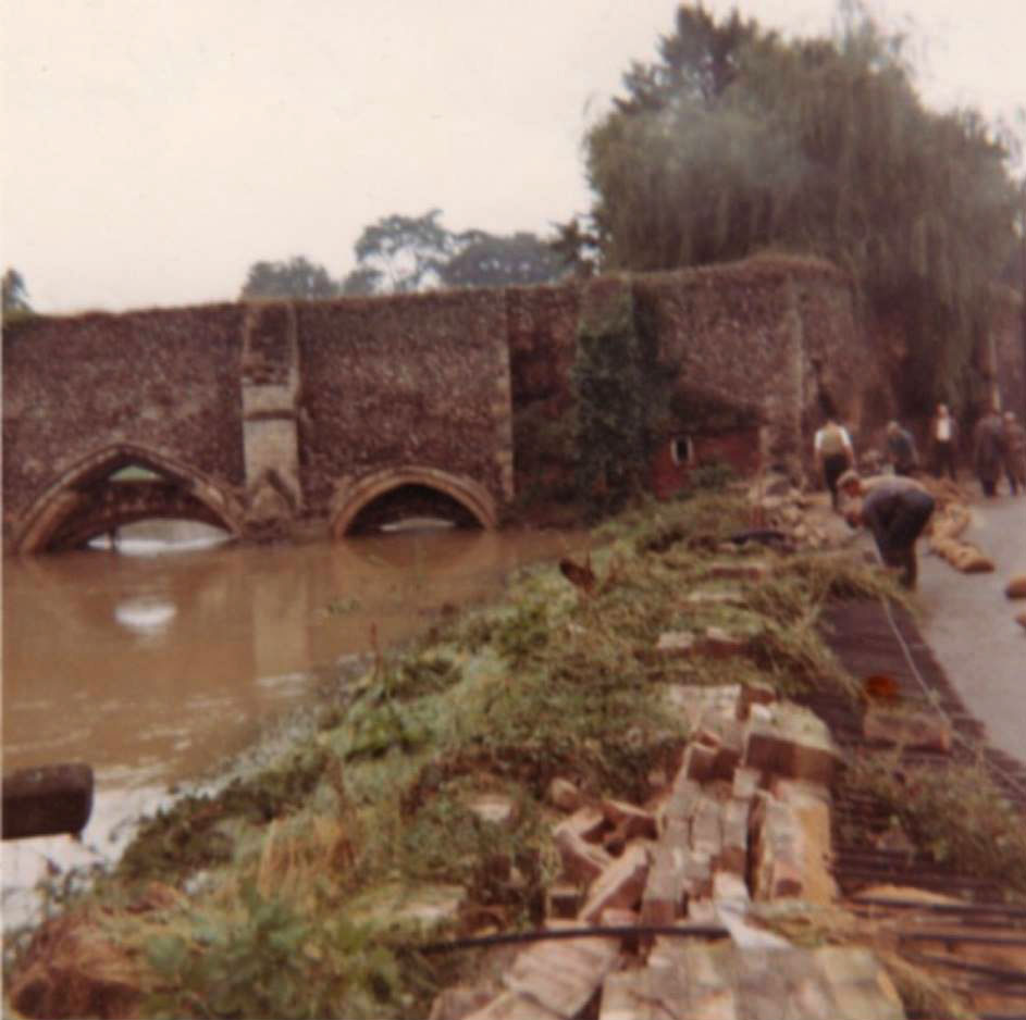 This picture shows the wall along the Broadway which collapsed from the weight of water in the river. (Picture contributed to Facebook group, "We love Bury St Edmunds" by Iris Keeble.) |
 This is another view of the Eastgate Street flooding. (Picture contributed to Facebook group, "We love Bury St Edmunds" by Iris Keeble.) |
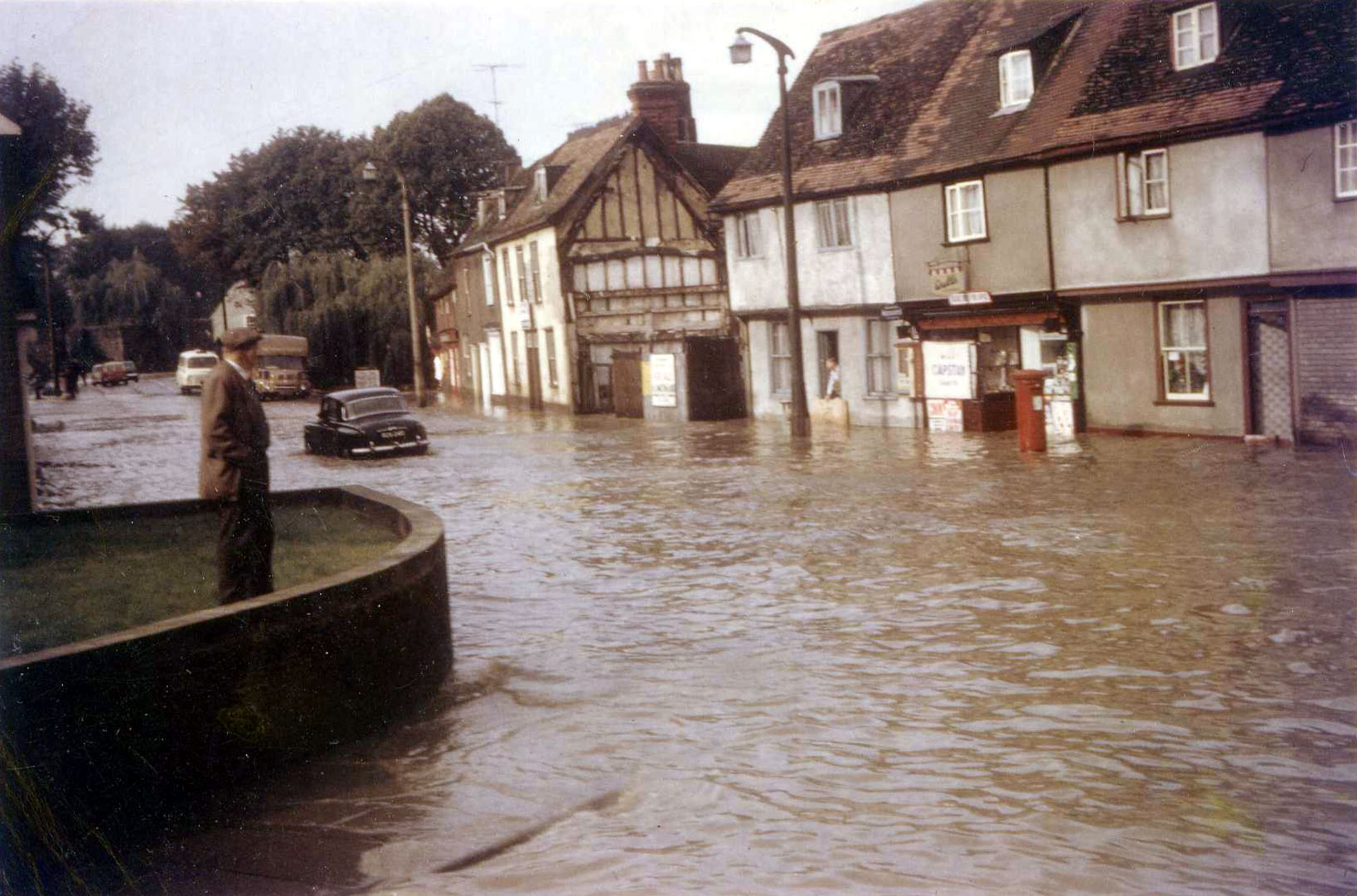
 This picture shows the extent of the flooding up Mustow Street, dated 16th September, 1968. (Picture contributed to Facebook group, "We love Bury St Edmunds" by Iris Keeble.) |
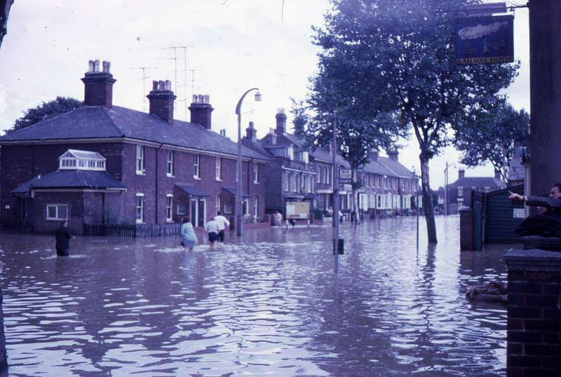 This view shows Northgate Street at the foot of the Station Hill. The Railway Tavern inn sign is visible. By 2016 this is known as the "Railway". (Picture contributed to Facebook group, "We love Bury St Edmunds" by Chris Turnbull.) |
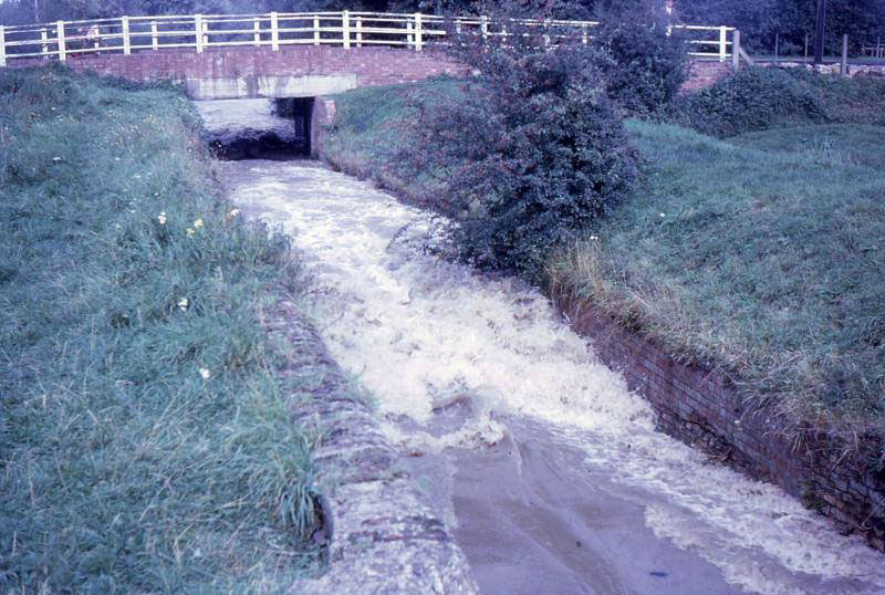 At Fornham All Saints the River Lark was full to the brim. Here we see the lock on Sheepwash Bridge concentrating the floodwater within the old lock walls. (Picture contributed to Facebook group, "We love Bury St Edmunds" by Alison E Ashby) |
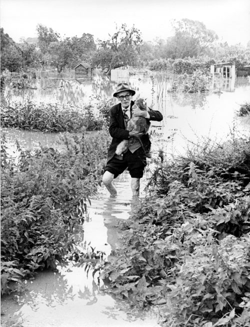
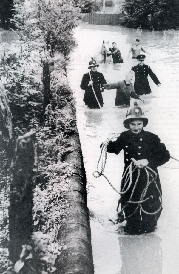 Suffolk firemen rescue horse at Bury. Photograph by Suffolk Fire Service. Published in "A Century of Service" by Suffolk County Council 1989 |
 Floods in St Botolph's Lane, Bury St Edmunds. Published in "A-Z Bury St Edmunds" by Martyn Taylor, 2016 |
Page: 1 2 |
| [ Prev ] [ Next ] |
|
Colour pictures are from the collection of Grenville Wilson. Monochrome Photograph by Suffolk Fire Service. |
| Go to Picture Story homepage | Go to Chronicle 1968 floods | Page created 23rd March 2007. Mr Wilson's pictures added 17th July, 2013. Updated last on 19th September, 2016 | Go to Main Home Page |