
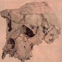
 Sahelanthropus
Quick links on this page
Happisburgh man 850,000 BP
Pakefield man 750,000 BP
Bytham & Boxgrove 500,000 BP
Anglian Ice Age 478,000 BP
Swanscombe/Elveden 400000BP
Hoxne man 360,000 BP
Neanderthals 250,000 BP
Toba eruption 74000 BP
Homo sapiens-Europe 40000BP
End of Neanderthals 30000 BP
Modern Warm period 8300 BC
Britain now an island 6500 BC
New Stone Age 4600 BC
British Copper Age 2700 BC
British Bronze Age 2200 BC
Foot of Page 700 BC
|
From the Beginning of Man
to the Bronze Age
7 million BP to 700 BC
|
7 million years BP
|
First traces of Mankind
In the year 2002, the history of early man was pushed back another two million years when the discovery of a hitherto unknown fossil skull was made in Chad, in central Africa. It represents a new species to science, and has been called Sahelanthropus, but the individual is known as Toumai. This skull, pieced together from many fragments, is between six and seven million years old. The site is over 1,000 miles from the east African sites where most discoveries had been made hitherto. The team that made the finds was from Poitiers University, led by Michel Brunet. African fossil hunters have become extremely skilled at spotting fragments on the surface, and the original find was by Ahounta Djimdoumalbaye, one of the team. It is not yet known whether this new species walked upright.
By this date the dinosaurs had already been extinct for sixty million years.
|
5 million years BP
|
In the Pliocene geological period, at the end of the era called the Tertiary by geologists, an early form of proto-man called Australopithecus anamensis evolved in Africa. Before the year 2002, these were the earliest known fossils of man. This evolutionary branch of upright ape survived until 500,000 years ago, overlapping Homo habilis and then Homo erectus. Australopithecus thus pre-dates the start of the Lower Paleolithic, or Old Stone Age, by 3 million years, but survived into the first million years of that period.
|
|
4,000,000 BP
|
The oldest Australopithecine is known as A.anamensis. At about 4 million years ago it was joined by A.afarensis which lived for about one million years.
|
|
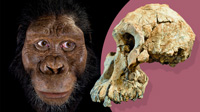
Facial reproduction of skull MRD |
|
3,800,000 BP
|
By this date A.anamensis was once thought to have disappeared from the fossil record.
However, in late August, 2019, newspapers carried the story that the face of the oldest species that unambiguously sits on the human evolutionary tree has been revealed for the first time by the discovery of a 3.8 million-year-old skull in Ethiopia. The skull was assigned the name of MRD.
The Guardian for 28th August reported that, "The fossil belongs to an ancient hominin, Australopithecus anamensis, believed to be the direct ancestor of the famous “Lucy” species, Australopithecus afarensis. It dates back to a time when our ancestors were emerging from the trees to walk on two legs, but still had distinctly ape-like protruding faces, powerful jaws and small brains, and is the oldest-known member of the Australopithecus group.
|
|
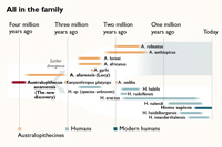
Revised early man timeline |
|
blankxxxxx |
The dating of the skull also reveals that Anamensis and its descendent species, Lucy, coexisted for a period of at least 100,000 years. This discovery challenges the long-held notion of linear evolution, in which one species disappears and is replaced by a new one. Anamensis, which now spans from 4.2 million to 3.8 million years ago, is still thought to be Lucy’s ancestor, but continued to hang around after the Lucy group branched off from the parent lineage. Geological evidence suggests the landscape would have featured extremely steep hills, volcanoes, lava flows and rifts that could easily have isolated populations, allowing them to diverge.
Yohannes Haile-Selassie, of the Cleveland Museum of Natural History and Case Western Reserve University, who led the research, said: “This is a game changer in our understanding of human evolution during the Pliocene.”
Fossil pollen grains and chemical remains of fossil plant and algae taken from the sediment suggest that the individual lived by a river or along the shores of a lake surrounded by trees and shrubland.
The findings are published in the journal Nature."
|
|

Australopithecus afarensis |
|
3,600,000 BP
|
Two sets of fossilised footprints have been found from this date, preserved in fossil volcanic ash at Laetoli in northern Tanzania, discovered by Mary Leakey in 1976. Most importantly, these show a hominid walking on two legs, and since 1978 most opinion assigns these footprints to Australopithecus afarensis. They were under 1.5 metres (5 feet) tall and although they could walk with both hands free, there is no evidence of stone tool use. Their brains were about one-third of modern size at this time, so walking upright seems to have pre-dated the development of intelligence. One theory is that it was developed as a cooling mechanism to minimise the impact of the overhead sun and make contact with cooling breezes.
|
|
3,500,000 BP
|
A.afarensis was joined in Africa by A.Africanus.
|
|
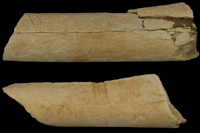
Cutmarks from 3.4 mBP |
|
3,400,000 BP
|
In The Times of 12th August, 2010, it was announced that:
'Two animal bones from about 3.4 million years ago have been found to bear unmistakable cut-marks, which could only have been inflicted by stone tools used to carve off meat and to break them apart for marrow. The next oldest example of tool use is from about 2.5 million years ago.
The find, at a site called Dikika, in Ethiopia, pushes back the date of a critical event in the emergence of modern humans, as systematic tool use is a defining feature of our species and its close relatives, known as hominins.
It also provides the first evidence for tool use by Australopithecus afarensis — the extinct hominin best known from the celebrated fossil Lucy — and suggests that the species was more sophisticated than was once imagined. The research is published in the journal Nature.
Zeresenay Alemseged, of the California Academy of Sciences, who led the study team, said: “This find will definitely force us to revise our textbooks on human evolution, since it pushes the evidence for tool use and meat eating in our family back by nearly a million years."
The tools used to cut the Dikika bones were almost certainly wielded by A. afarensis, as the hominin species is the only one known from the region around 3.4m years ago. An A. afarensis skeleton from a similar date, nicknamed Selam or “Lucy’s daughter”, was unearthed a decade ago less than 300 metres away from the butchered animal bones.
The bones were dated from the volcanic sediments in which they are embedded, which were laid down between 3.24m and 3.42m years ago.
Prior to the Dikika find, the oldest cut-marked bones come from the nearby Bouri site, and were dated to about 2.5 million years ago. The earliest stone tools are known from a similar date from Gona, which is also close by. '
|
|
3,200,000 BP
|
The most complete fossils of Australopithecus afarensis date from this time, and were found in Ethiopia in an area called the Afar Triangle. One individual was 40% complete, now known as Lucy, discovered in 1974. A year later, a family group of 13 individuals was found in the Afar Triangle.
|
|
2,900,000 BP
|
A.afarensis disappears from the fossil record, leaving A.africanus to survive another 400,000 years.
|
|
2,500,000 BP
|
Australopithecus africanus had disappeared by now, but around this time began a greater diversity of hominid species. Classification of these differences has been very difficult because of the very few fossils found, mostly in the Olduvai Gorge in Tanzania since 1951. Homo rudolfensis and Australopithecus aethiopithecus are names assigned to the species arising at this time.
|
|
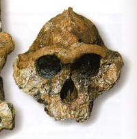
Australopithecus boisei |
|
2,400,000 BP
|
The Lower Paleolithic or Old Stone Age
The Lower Paleolithic or Old Stone Age era began when Homo habilis arose in Africa alongside Australopithecus boisei. The word "lower" in this context implies that strata from this era are found lower in the ground than later periods. Paleo means old, and lithic refers to the use of stone. To the archaeologist the stone tools from this period are characterised as core tools. This means basically that they are roughly made, and include most of the flint nodule or core, as opposed to the flake tools of the middle period and the blade tools of the upper paleolithic. The hand axe is most characteristic.By this time, several hominid species were co-existing, but stone tools were now coming into use. These stones litter the layers from this time in the Olduvai gorge, and are attributed to Homo habilis or "handy man". These tools were used, we think, to widen the dietary possibilities at a time when climate change was reducing the established range of vegetable foodstuffs. Many scientists believe that sudden deteriorations in the climate caused early man-like creatures to turn to meat and to dig for food. Stronger tools became a necessity for survival. This era is dated as lasting until about 200,000 BC, through the time of Homo Erectus and Archaic Homo sapiens, the latter now usually called Homo heidelbergensis.
|
|
2,000,000 BP
|
The climate in Suffolk some 2 million years ago was similar to today. However, the landscape and its inhabitants were very different. While humans were evolving in Africa, large herbivores were roaming the land we call Suffolk today. There were Mastadons and the Southern Elephant, along with giant deer and gazelle. They were hunted by powerful predators, one of which was the Scimitar Cat.
The Mastadon was a relative of the elephant. It lived in forests and had straight tusks and short legs. Teeth of mastodons have been found at Sutton in Suffolk, in the Crag rocks, dated to between 2 and 3 million years old.
|
|
Coastline of 1.8million YBP |
|
1,800,000 BP
|
The Lower, (or Early) Pleistocene of the Quaternary
The geological Quaternary period began with the lower Pleistocene sequence of rock deposits.
The climate in Britain during this early Pleistocene period was sub-tropical. It is believed that it was a relatively stable climate for the next million years. Some parts of Suffolk, Norfolk and Essex were submerged under a shallow sea, as shown on the attached map from the Museum of London. These counties have marine deposits with bones of whales, fish and seals.
Britain was connected to the continent , allowing many species to cross over, including the mastodon, tapirs, red panda, extinct species of horse, and early forms of the mammoth.
The rivers of Britain occupied only relatively small channels, and carried and deposited only fine silts and sands. The course of the River Thames was being laid down at this time. Further north was a river which is now extinct, but which is today known as the beginnings of the Bytham River.
By now the Lower Paleolithic age of man had become well established in Africa and Homo habilis, the first species designated as man, or Homo, was the tool maker in Africa.
Australopithecus still roamed there as well, but by now was represented by A.robustus, as well as A.boisei.
|
|
1,500,000 BP
|
Homo erectus arose in Africa.
By this time, Homo erectus seems to have replaced H.habilis in Africa.
|
|
1,000,000 BP
|
One million year old remains of the Southern Elephant have been found in Suffolk. Teeth have been found in the sands of the Red Crag at Trimley, and in the Norwich Crags at Holton and Southwold.
Homo erectus left Africa to colonise Europe. They might have used wooden boats, starting with rafts made from logs. However, they could also achieve this migration via modern day Israel, without ever needing to cross the Mediterranean Sea or to brave the powerful currents of the Straits of Gibraltar.
The Straits between Gibraltar and Morocco are only a ten mile sea journey and the far side can be seen with the naked eye. Remains of a few stone tools have been demonstrated to be similar on each side of the straits and different from those in Eastern Europe. However, the weight of opinion seems to be that early man did not enter Europe via the Gibraltar route at this time. As long ago as 1871, fossils which we call Java man, were found by Eugene Dubois in Java. These are nowadays attributed to Homo erectus and could be as old as 1.8 million years.
Nearly a million years ago pieces of haematite, (waterless ferric oxide) were carried into habitation sites in South Africa. See Paul G. Bahn, Cambridge Illustrated History of Prehistoric Art (Cambridge University Press, 1998). These were very likely to have been used to produce a form of ochre. Since these early times, Homo erectus was already using pigments such as ochre. It is an iron ore possibly used from earliest times for body paint to disguise the scent in the hunt. Hand axes, scrapers and cleavers were made from flint.
|
|
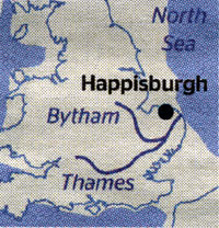
Coastline of 900,000 YBP |
|
850,000 BP
|
Happisburgh, together with many parts of the Norfolk and Suffolk coastline routinely suffer the devastating effects of cliff erosion upon local inhabitants and their property. This erosion has been increasing in the recent past, and cliff falls sometimes lead to discoveries of new fossils. From 1990 to 2010, the sea defences at Happisburgh have been overwhelmed so that 140 metres of dry land have been eroded and lost to the sea.
On July 8th 2010 the Times reported on research published in "Nature" concerning the earliest known evidence of man in Britain. The article in Nature was called, "Early Pleistocene human occupation at the edge of the boreal zone in northwest Europe", and it referred to recent discoveries of early man at Pakefield, and to a new discovery at Happisburgh.
Stone tools unearthed in Happisburgh, on the North Sea coast near Cromer, have shown that early humans reached Britain as much as 150-250,000 years earlier than had previously been thought. More than 70 flint tools and chips have been recovered from the Happisburgh dig and dated, using techniques based on the Earth’s magnetic polarity through the ages, to between 780,000 and 990,000 years old.
|
|
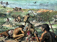
Happisburgh c 850,000 years ago
|
|
blankxxxx |
“Happisburgh Man” lived on the estuary of a large river, which was the ancestral River Thames. This original River Thames was joined by a large tributary, which we now call the Bytham River. These two rivers met up in the vicinity of today's town of Bury St Edmunds, and flowed on towards modern Happisburgh. The coastline was probably about 15 miles downriver, and could be followed across to the continent. The river cut through a dense forest, which was home to large animals including mammoths, elk with horizontal horns, sabre-toothed cats and hyenas much bigger than those found in Africa today. However, early man could negotiate a path along the more open edges of the river valley.
Evidence from pollen shows that the site was inhabited during one of two windows of warmer temperatures during that period, one of them about 850,000 years ago, the other 950,000 years ago. However, their winters were colder, perhaps averaging from -3 degrees Celsius to 0 degrees C, equating to Scandinavia today. The next oldest ancient human site in Britain, at Pakefield, Suffolk, dates to about 700,000 years ago. Not only is the Happisburgh evidence the oldest in Britain, it is also the oldest evidence found anywhere in North West Europe. Older evidence exists in Southern Europe, such as Atapuerca in Spain (1.2 mya), Pirro Nord in Italy, (1.5 mya), and Dmanisi in Georgia, (1.8 mya).
|
|
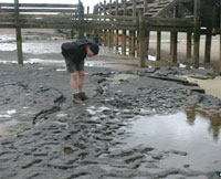
Footprints 850,000 years old
|
|
blankxxxx |
In May, 2013, an even more astounding discovery was made at Happisburgh. This news was released to the press in February, 2014. The Guardian newspaper reported as follows: "The oldest human footprints ever found outside Africa, dated at between 850,000 and 950,000 years old, have been discovered on the beach at Happisburgh, one of the fastest eroding stretches of the British coast. Within a fortnight the sea tides that exposed the prints last May destroyed them, leaving only casts and 3D images made through photogrammetry – by stitching together hundreds of photographs – as evidence that a little group from a long-extinct early human species had passed that way.
They walked through a startlingly different landscape from today's, along the estuary of what may have been the original course of the Thames, through a river valley grazed by mammoths, hippos and rhinoceros. The pattern of the prints suggests at least five individuals heading southward, pausing and pottering about to gather plants or shellfish along the bank. They included several children. The best preserved prints, clearly showing heel, arch and four toes – one may not have left a clear impression – is of a man with a foot equivalent to a modern size 8 shoe, suggesting an individual about 5ft 7ins (1.7 metres ) tall.
'This is an extraordinarily rare discovery,' said Nick Ashton, a scientist at the British Museum where the find was announced. 'The Happisburgh site continues to rewrite our understanding of the early human occupation of Britain and indeed of Europe.'
Although far older footprints have been found in Africa, the prints are more than twice the age of the previous oldest in Europe, from southern Italy and dated to around 345,000 years.
The Norfolk footprints are the first direct evidence of people at the most northerly edge of habitation in Europe, otherwise known only from fossilised animal bones and flint implements from the site nearby. The scientists worked flat out in the few hours between tides, sponging away seawater and brushing off sand, to record the prints. They were dated from the overlying sedimentary layers and glacial deposits, and the fossil remains of extinct animals – identified by Simon Parfitt, of the Natural History Museum, as including mammoth, an extinct type of horse and an early form of vole."
Local people now keep a near daily watch on the beach and phone the scientists if they spot anything interesting.
Though no human remains have been found at Happisburgh or Pakefield, the most likely candidate for the colonists is Homo antecessor or “pioneer man”, a species known from about 800,000 years ago in Spain.
It was not a direct ancestor of Homo sapiens and the descendants of these first Britons eventually died out. Homo antecessor is associated with the simpler technology of flint cores and flakes, and occupation in one place may have been sporadic.
|
|
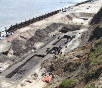
Happisburgh - Dig site 3
|
|
blankxxx |
These discoveries, by a team led by Professor Chris Stringer, of the Natural History Museum, and Nick Ashton, of the British Museum, rewrite the history of how early humans migrated across Europe after leaving Africa. These colonists, however, would have numbered no more than a few hundred, and their encampments would not have lasted long. While summer temperatures were similar to today’s when Happisburgh was settled, they would have been about 3C colder in winter.
The excavations were part of a long term programme called " The Ancient Human Occupation of Britain Project", (AOHB), largely funded by the Leverhulme Foundation, and which had been started in 2001. By 2010, there had been 5 sites examined as part of the Happisburgh investigation. Site 3 was the location of the evidence described above. It is located on the foreshore, and is liable to be covered over at high tides, making excavation particularly difficult.
Professor Chris Stringer now believes that "the occupation of ancient Britain was episodic. People were appearing in Britain for brief periods and disappearing for longer periods of time.
We think there could have been 10 different occupations of Britain by four different human species. We are now part of the tenth human occupation. "
|
|
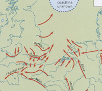
Coastline of 800,000 YBP |
|
800,000 BP
|
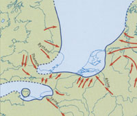
This view of the coastline persisted from about 800,000 years ago until 480,000 years ago. By now the coastline had retreated somewhere in the north of the North Sea. Sea levels fell as the ice cap extended under encroaching colder climatic conditions. Rivers had to extend northwards to drain into the sea. The River Thames also flowed through Suffolk to become a tributary of the Bytham River.
As the Pleistocene period progressed, there were more colder periods. Homo antecessor was probably forced to retreat from Britain. The rivers of northern Europe grew in size and erosive power. Sands and gravels could now be carried over longer distances by the stronger currents.
The Bytham River now became the largest river in Britain's history, occupying a wide river valley, which reached back into the Midlands. To the east the Bytham River may have joined up with the continental rivers such as the Rhine, before flowing north to the sea. This would have provided a valley floor route for animals, and eventually for another incursion by early man, to move over time from within the continent to the interior of Britain.
In southern Britain the drainage turned westwards towards the Atlantic Ocean. The so-called Channel River developed on the dry sea bed of the western Channel. French rivers, such as the Seine, also flowed into the Channel river.
|
|
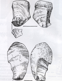
Pakefield flints |
|
750,000 BP
|
The Middle Pleistocene
The geological deposits known as Lower Pleistocene ended and the Middle Pleistocene series began. To archeologists, this is still the Lower Paleolithic time and Homo erectus seemed to have spread throughout the old world. In northern Spain, bones and stone tools have been found dating back 800,000 years at Gran Dolina.
In 2005 evidence was found at Pakefield, near Lowestoft in Suffolk, which, at the time, was the earliest evidence of human activity in northern Europe, dated to about 750,000 years ago. Modern geologists also refer to this period as late Marine Isotope Stage 19 or late MIS 19. This does not, however, mean that man has lived here ever since then. Britain and the British people of today are new arrivals, products of only the last 12,000 years.
Before finding this Pakefield evidence, researchers believed early humans did not cross the land bridge that once connected Britain to the European continent until 200,000 years later than this. The hunters of Pakefield lived in a Mediterranean climate where sabre-tooth cats, elephants and giant deer also roamed freely across the same landscape. Elephants, rhinos and hippos together kept the valley floors open, inadvertently supplying the routeways needed by early man. Summers averaged 18 to 23 degrees celsius, compared to the average 17 degree summer here today.
Archaeologists working along the Pakefield cliffs, near Lowestoft, found 32 fossilised flints in the so-called Cromer forest beds which had been exposed by coastal erosion. In fact the sediments are now known to be laid down in the marshy edge of a large river. Inspection of the flints showed they had been chipped and scraped to form cutting and sawing tools.
|
|
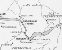
Bytham River c 750,000 BP |
|
blankxxxx |
There were sharp flakes that could have been used for butchering carcasses and notched flints capable of sawing through bone. The tools were probably shaped from pebbles transported to the site by the Bytham river that once ran from Stratford-upon-Avon to the North Sea. Archaeologists also uncovered mammal bones near the flint tools.
Pakefield is just south of Lowestoft, and the identification of these deposits means that the attached diagram of the Bytham River by Bateman and Rose from 1994, can now be modified. The course of the Bytham River on the east coast should now be widened to include Lowestoft and its suburbs. These rivers were long lived, and just like modern rivers, they would have meandered in their valley bottoms, and changed courses over time as they experienced periods of silting up and periodic flooding.
By now the ancient River Thames had shifted its course southwards, so that it no longer joined with the Bytham River near the site of Bury St Edmunds.
The Pakefield findings were reported in the journal "Nature" in December, 2005. Professor Chris Stringer, a palaeontologist at the Natural History Museum in London, said: "Archaeologically speaking, this project has struck stone-age gold and has repercussions not only for us in Britain but also for northern Europe. This opens the window because until recently we wouldn't have believed there could have been humans at this early date. We will now look for further evidence and maybe one day we will be lucky enough to find human bones."
|
|
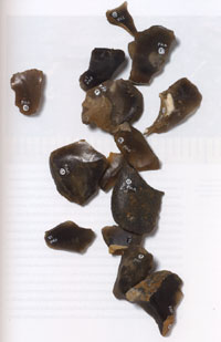
Some Pakefield flints |
|
blankxxxx |
According to the researchers, Pakefield man was most likely a stocky, robustly built species with a smaller brain and bigger teeth than ours. Their tools were fairly sharp and could be used as knives and saws used as butchering tools on animals, Prof Stringer said.
The discovery of the well-preserved fossils owes much to the location of Pakefield. When glaciers began to creep down to Europe at the beginning of the ice age, they flowed gently over the surface of this part of the British landscape, freezing the soil and with it the artefacts.
In much of the rest of northern Britain and Europe, encroaching glaciers were more destructive, tearing up the soil and all but erasing the history locked within it. Now, as coastal erosion takes its toll, bare cliff faces are revealing the preserved fossils.
The Quanternary geology of Britain is therefore well represented in Norfolk and Suffolk and has been extensively studied. Because of this, many of the geological layers are named after East Anglian sites. These names also came to represent the time periods associated with the layers. Thus the warm conditions which resulted in beds of freshwater deposits associated with finds near Cromer have been called The Cromerian Warm Period.
Field geologists gave the following names to the Quaternary stages which they thought they could identify from the types of soil deposits discovered. The oldest stage came first and these broadly cover the time of human occupation: - Cromerian Stage - Mainly warm conditions
- Anglian Stage - Mainly cool conditions, with Norfolk and Suffolk under an ice sheet
- Hoxnian Stage - Mainly warm conditions
- Wolstonian Stage - Cool, ice may not have reached North Norfolk
- Ipswichian Stage - Warm
- Devensian Stage - Cool, ice penetrated into North Norfolk
- Flandrian Stage - Warm - this stage extends to the present day.
By the late 20th century, other methods were examined to investigate the past. Oxygen isotopes have been examined in marine fossils found in cores drilled out of the ocean beds. Similar cores taken from ancient ice layers deep in Antarctica have also been examined for the higher numbers of lighter oxygen isotopes which indicate colder periods. These results have indicated much greater fluctuations in climate than had been visible in the field, showing that even in glacial times, these stages themselves had warmer periods, and the interglacial warmer times also varied considerably. Matching the isotope data with the named stages is not always easy, either. So the dates given below should be treated with caution.
|
|
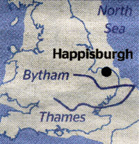
Coastline of 700,000 YBP |
|
700,000 BP
|
The interpretations of the earliest days of man in Britain have themselves evolved over the last few years. The Pakefield evidence was published in 2005, and the Happisburgh evidence in 2010. Views of the coastline and the exact shape of the land bridge to Europe have also evolved as the new evidence is evaluated. This plan of the coastline in 700,000 BP was published in the Times in July, 2010. It shows the Thames and the Bytham Rivers as two separate rivers, although they may have entered the North Sea close together, but at a location far to the east of today's coastline.
The Bytham River is responsible for the deposits of quartz and quartzite pebbles found in pockets in East Anglia such as those at Maidscross Hill, at Lakenheath. Quartz does not occur naturally in East Anglia, and can only have been brought in from the Midlands as water borne pebbles.
Also note that the Wash Basin did not exist at this time. This will be not be formed until the Anglian Glaciation occurs in another 250,000 years time.
|
|
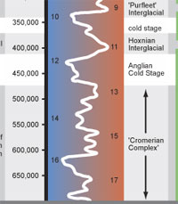
MIS stages and date chart |
|
680,000 BP
|
As well as the Bytham River and the Proto-Thames, another ancient river has been identified which flowed through the area now known as North Norfolk. This is given the name of the Ancaster River. Ancaster river catchment floodplain sediments have been identified at Happisburgh in northeast Norfolk. These sediments, dated to about 680,000 years ago, are within the Marine Isotope Stage 17 or MIS 17 (Lee et al., 2004). The sediments also contain evidence of yet more human activity from this era before the Anglian Glaciation.
The chart shown here comes from the Ancient Human Occupation of Britain Project, (AHOB), funded by the Leverhulme Foundation. The thumbnail shown here is only a small part of this chart which maps the Marine Oxygen Isotope Record, (MIS) against the appropriate dates. By clicking on the thumbnail you will reveal the full chart which extends from 700,000 years BP up to 10,000 YBP. The chart also allocates key dig sites to each stage, and notes where human fossils have been found.
This chart also indicates the speed with which new discoveries are being made by the AOHB project. This chart was up to date when drawn in 2009, but the discovery of even earlier evidence at Happisburgh in 2010 would result in the extension of this chart by a further 100,000 years at least.
Our present time is reckoned as Marine Isotope Stage 1, and all the odd MIS numbers are the warmer periods, while even numbers represent the colder periods, shown in blue on the diagram.
|
|

The West Runton Mammoth |
|
650,000 BP
|
The Cromer Forest Bed formation is exposed at intervals along the coast of Norfolk and Suffolk, from Weybourne to Kessingland. It includes sites such as West Runton and Happisburgh, and outcrops also occur at Pakefield. The forest bed is aged between 700,000 to 500,000 years ago. The bed has been famous for fossil mammal remains for many years and the Cromer Forest Bed continues to be eroded and is rich in fossils. However, nowadays it is generally accepted that rather than being a forest bed, the Cromer series are believed to be a mixture of estuary silt and marine silts. The diagram below shows layers II and III which together make up the British Cromer "forest beds". Layer II is a darker band making up the larger part of the Cromerian series of layers, and is made up of deposits known as the West Runton Freshwater Bed.
|
|
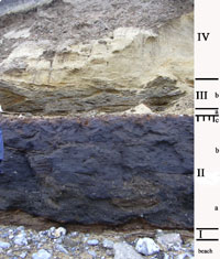
Freshwater bed shown at layer II |
|
blankxxxx |
The “West Runton Freshwater Bed” is a five-foot thick layer of organic-rich mud deposited by a medium sized river about six hundred thousand (600,000) to seven hundred thousand years ago, long before the last ice age. This deposit, just east of West Runton on the North Norfolk coast, is full of all sorts of fossils. These range from thousands of small snail shells, twigs and small mammal bones, through medium sized deer, horse and rhino bones to the huge bones of the elephants, which roamed our country in herds back then. The lower layer, labelled IIa here contains most of the shells. The upper layer IIb contained the elephant. (There is a thin soil layer at the top of the freshwater beds, labelled IIc.) There have been many species of elephant living in England over the last few millions of years. The West Runton Elephant, living here 6-700,000 years ago, is of the species Mammuthus trogontherii.
This was the largest species of elephant that has ever lived, and the largest animal ever to have lived on land except for the very biggest dinosaurs. Standing four metres high at its shoulder, it would have weighed about ten tons – twice the weight of any male African elephant you would find today. It is the largest elephant skeleton ever found and is the oldest elephant skeleton to have been found in the UK.
It was excavated over a three-month period in 1995 by the Norfolk Archaeological Unit. The archaeologists have shown that the climate was identical to what we have now. They knew this from all the pollen studied and other clues such as the presence of amphibians, snails and small mammals that can only live within a narrow range of temperatures. A wide range of animals were identified, many of which were made extinct by later Ice Ages and eventually by the activities of man. Beaver, bear and rhinocerous were among the finds, and the diversity of species was much greater than it is today in this country.
|
|
600,000 BP
|
As the Bytham River existed for hundreds of thousands of years, it is not surprising that its course wandered about as the topography changed with sea level fluctuations and localised mini-tectonic changes in ground levels. At the same time these changes caused the river deposits to be laid down in "terraces" of various heights, as the land changed and the river eroded its bed and banks.
These changes have resulted in Bytham River deposits being discovered today at differing levels, and perhaps half a dozen different terraces have been identified, corresponding to different ages of deposit. The deposits found at Maidscross Hill, in Lakenheath, are assigned to the Second Terrace of the Bytham River, laid down around 600,000 years ago. One or more hand axes were discovered here in the 1860s by Flowers.
Bytham River sites have been assigned to different terrace levels and ages, as follows from Nick Ashton:
- The Seven Hills terrace is thought to be the oldest at 900,000 years ago;
- The Ingham terrace is next at about 800,000 years old;
- The Lackford terrace is aboout 700,000 years ago;
- The Maidscross Hill terrace at Lakenheath is 600,000 years old;
- The Warren Hill terrace is about 500,000 years old.
A period of wider climate fluctuation took place at this time and there were probably "ice-ages" before the Anglian stage identified by field geologists. It is theorised that the Homo erectus evolved into a new form more able to cope with adverse conditions. He grew stronger and his brain grew larger, and after this date, human remains in Europe are assigned the name of Homo heidelbergensis. In the past they were also known as archaic Homo sapiens. It is likely that with Homo heidelbergensis now spread over Africa, Asia and Europe, local populations would have evolved different characteristics. Homo heidelbergensis is associated with flint hand axes and wooden spears, and may possibly have developed the use of fire, building shelters, and wearing clothing of some form. Evidence of his presence in Britain by 500,000 BP has been found.
|
|
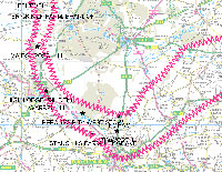
Bytham River in West Suffolk |
|
500,000 BP
|
Five hundred thousand years ago the British landscape was very different from today. Britain was a peninsula of the continent of Europe and Asia. Many of the major rivers we know today either did not exist, or flowed along a different course, as did the River Thames. There were also rivers that have since disappeared.
One major, now extinct, river was 310km in length, which has been named the Bytham River. It drained from the southwest Midlands and the Pennines through Warwickshire and parts of Leicestershire before turning south through the centre of East Anglia and eventually eastwards into what is now the North Sea but was then dry land. Its gravels included red quartzite pebbles and they are visible at Mildenhall and Icklingham. The deposits laid down by the Bytham River are called the Ingham series, after the prototype description derived from layers exposed in the gravel workings at Ingham in Suffolk.
This river, which was already some 250,000 years old at least, is traced along its presumed course through West Suffolk on the attached diagram. The diagram relies upon connecting up known sites of deposits of the Ingham series of sands and gravels. However, it should be noted that most of the gravel extraction along the Lark Valley, including West Stow and Lackford pits, comes from much later glacial and post glacial deposits. The Ingham deposits are, in contrast, much rarer and deeper layers.
The Bytham River was discovered by a geographer, Professor Jim Rose of the University of London, in the 1980s and named after the Lincolnshire village of Castle Bytham where Rose first identified it. The work of reconstructing this lost landscape has been carried out by several geologists and other specialists, with a major contribution being made by the research of Professor Fred Shotton. A large proportion of known human occupation sites, dating from before the Anglian Ice Age, have been shown to lie along the course of this river.
In 1986, a small gravel pit was investigated at Stanchils Farm at Hengrave, and the pre-glacial deposits categorised. The site seemed to illustrate the existence of Hengrave and Ingham sand and gravels which originated in the Midlands, transported here by the Bytham River, and deposited as it reached the area. In 1994, Professor Rose and John Wymer published a "Record of a struck flake and the lithological composition of ‘pre-glacial’ river deposits
at Hengrave, Suffolk" in the Proceedings of the Suffolk Institute of Archaeology and History.
The Bytham River was probably one of the most important routes of colonisation for Britain’s first human inhabitants. Professor Rose considered that its wide sand and gravel banks would have provided an easy route to travel along and the river would have provided water, vegetation and attracted animals making it a useful place for humans to exploit. So far 14 important archaeological sites have been discovered along the route of this lost river. These include High Lodge, West Dereham, Feltwell, Brick Kiln farm at Brandon, Hengrave, Lakenheath and Warren Hill in East Anglia, as well as Waverley Wood near Coventry in Warwickshire. This means that at this early time man knew the area around Bury St Edmunds and Lakenheath, when the landscape was very different to today. It would have been the largest river in Britain at the time although the second largest river, which was to become the River Thames, shows no similar indication of pre-Anglian human occupation.
These first colonisers of Britain, before 500,000 years ago, probably belonged to the ancient human species Homo heidelbergensis, an ancestor of the Neanderthals. The stone tools of this period are classified as Lower Palaeolithic, with the most characteristic tool type being the handaxe. Handaxes associated with this early colonisation of Britain have been found at sites along both the south coast route, such as Boxgrove, and along the Bytham River route, such as High Lodge in Suffolk, and those already mentioned.
|
|
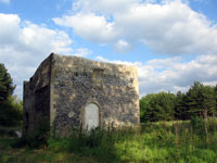
This Warreners Lodge overlooks
the High Lodge dig site |
|
blankxxxx |
High Lodge itself is an important geological site three kilometres east of Mildenhall. For many years it has been regarded as one of the "classic" lower paleolithic site in East Anglia. Deposits indicate that it was in the lower middle part of the
Bytham river catchment (Ashton et al., 1992). High Lodge provides evidence for human occupance of this area dated to about 500,000 years ago, a time now linked to Marine Isotope Stage 13, or MIS 13.
Together with deer and horse bones, a tooth from an extinct species of rhinoceros has also been identified. Scientific analysis of this tooth supports the geological dating of the High Lodge site to a warm period about 500,000 years ago. (N.M. Ashton and others, High Lodge, Excavations; (London, The British Museum Press, 1992). The layers survived the Anglian glaciation as frozen blocks, moved en masse by the ice.
|
|
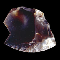
High Lodge flint scraper |
|
blankxxxx |
This scraper from the excavations at High Lodge is made from a flake of flint. A series of small flakes has been removed from one side to create a working edge. The tool's exact purpose is unknown, but it would have been suitable for scraping and cleaning animal hides.
It used to be thought that tools became finer and smaller with time so that the coarser the tool manufacture the older the artifact. This appears to be disproved at High Lodge where the tools from this early site are made from carefully-struck flakes which have been skilfully made into a range of scrapers and points. The scrapers would have been used for scraping skins and the points for projectiles. They are apparently more sophisticated pieces of work than many tools from a much later time. Lacking from the High Lodge finds are handaxes which were always assumed to have been part of the tool-kits of the Lower Palaeolithic hunters.
The scraper was recovered during excavations by the British Museum at High Lodge, Suffolk in the 1960s. It was found in ancient river silts, along with many other tools and manufacturing waste from flint knapping. No stone axes were found, although this is a period from which axes would conventionally be expected. Pollen from the river silts indicates that the climate was only a little cooler than today. Summers may have been 15-16 degrees C, compared to the average of 17 degrees today. Winters were from -4 degrees to 1 degree C. They lived on a marshy floodplain, with local grasslands, but surrounded by coniferous forests.
|
|
Warren Hill, March 2002 |
|
blankxxxx |
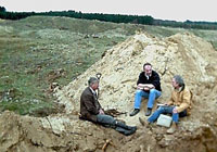
Nearby, another site from this period, usually known as Warren Hill, Mildenhall, has yielded an astonishing total of over 2,000 stone artefacts of all types. Warren Hill, or Three Hills, as it is also known, is just north of the A1101, off ride 306. It was originally the site of three tumuli, which gave it its name, but these have long since been destroyed by gravel extraction and antiquarian treasure hunters. Its designation as an SSSI states that:
"The sequence at Warren Hill is divided into two units; the Warren Hill Sands and Gravels (of variable
thickness) and the Warren Hill sands and silts (over 4.6m thick). Clast lithological analysis is important
in the interpretation of the gravels at this site. Early workers interpreted the deposits as being glacial in
origin, but the absence of characteristic Anglian lithologies such as Rhaxella chert, indicates that the
deposits were not laid down under glacial conditions. The presence of quartzite, quartz and
Carboniferous chert indicates that the deposits may be the product of the river system that deposited the
Ingham sand and gravels to the east. This, coupled with the bedding structures and coarse gravels,
lends support to the idea of a larger river flowing from the Midlands, across the present Fen Basin and
East Anglia into the North Sea. This was the Bytham, or Ingham River."
|
|
Warren Hill, March 2002 |
|
blankxxxx |
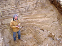
In 2002, Jim Rose reported that:
"Warren Hill, near Mildenhall, Suffolk is known as possibly the most prolific hand-axe site in Europe.
Apart from a small-scale excavation in the early 1990s the site has not been studied with current
research techniques. Using AHOB funds, an excavation was carried out in the spring of 2002 under
the directorship of Jim Rose and John Wymer, aided by Terry Hardaker and Mike Morley. John and
Terry concentrated on the archaeology and Jim and Mike on the sedimentology and
palaeoenvironments.......
The geographical position and elevation of the unit, (a 10 m thick cross bedded sand and gravel), falls
within the spatial and elevational envelope of the Bytham River and is attributed to the second terrace
of the Bytham Sands and Gravels. The second terrace will now be called the Warren Hill Terrace.
This means that the Bytham River flowed through the region of Warren Hill, at a time when this was
the largest river in England, draining much of the midlands and southern Pennines. The site is
immediately downstream of High Lodge and upstream of Bytham sites in the area around Bury St.
Edmunds. This unit contains the archaeology in the form of bifaces and flakes, and both types of
artifact were found in situ during the excavations......
The elevation of the Warren Hill Terrace
suggests that the sedimentary units predate the Anglian Stage (MIS 12) of the British Pleistocene by at
least one temperate stage, in which case it reflects the inclusion of Human artifacts in material of MIS
14 age at the youngest. Thus the human occupation in the area occurred at or before c. 550,000 years
before present."
In 1999 John Wymer also published that Ramparts Field, a former gravel workings between Icklingham and West Stow, contained evidence which linked the site with the Bytham River deposits. This derived from the Geologists' Association Field Meeting in the area on 27 June, 1992. They found that the quartzite and quartz-rich gravels at Warren Hill, Mildenhall, are the same as at Ramparts Field, Icklingham, and make up part of the so-called Ingham Sand and Gravels, a pre-Anglian glaciation fluvial sequence.
|
|
Happisburgh site 1 hand axe |
|
blankxxxx |
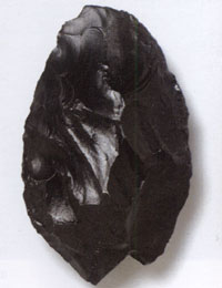
In March, 2000, Mike Chambers found a stone axe embedded in mud on the beach at Happisburgh. Its manufacture seems to be of a very high order, and once again, it casts doubt on the idea that only primitive handaxes would be found at such an early dated site. The mud was part of the Cromerian forest bed layers, and in 2004 the British Museum launched an excavation here for three weeks. Some 8 tons of mud were sieved and revealed butchered bones and 30 flint flakes. This subsequently became known as Happisbugh site 1, and is dated to MIS 13, or about 500,000 to 600,000 years ago.
Summers would have been from 12-15 degrees C, while the winters were from -11 to -3 degrees on average. This was a cold and challenging time in the life of man in Britain. Early man here lived among marshy pools and grassland, surrounded by conifers.
(In 2005, about 1 kilometre from site 1, an even older layer of mud was revealed. This would be called Happisburgh site 3, and is described above, dated to 850 to 950,000 years ago.)
The lower part of the Thames at this time flowed to the north of its current course, over much of South Suffolk laying down some ancient river gravels. Significantly there is as yet no evidence of colonisation along it at this early time.
The Kesgrave series of sands and gravels are thought to have been brought here from Southern England by the Thames on its course northwards at the time. A flint which could possibly show evidence of working by man was found in these early deposits which could be up to 200,000 years earlier than the date attributed here.
In Herefordshire there are traces of another lost river called the Mathon, but again as yet no archaeological evidence of human activity has been found.
At this time it was probably warmer in Britain than it is today. This time is called the Cromerian inter glacial period. There would be two more glaciations of this country before our modern times begin. Early man was in Britain at this time, as we have seen, although he would be driven out again by later ice ages.
|
|
The Boxgrove hammer |
|
blankxxxx |
The other major colonisation route, besides the Bytham River, was along the south coast of Britain and is best represented by the famous site of Boxgrove in West Sussex. Boxgrove is one of the most important archaeological sites in the world, as it is a relic cliff with a marine plain in front of it, undisturbed and well preserved with a wealth of bones, hand axes, cut bones, flint tools and cores and flint scatters. Unlike the riverside sites at High Lodge, Warren Hill, etc in Suffolk, Boxgrove was a grassy coastal strip. Summers were perhaps from 14 degrees C to 20 degrees C with Winters from -4 degrees C to +4 degrees C on average. Inland was mixed woodland, with scrub along the spring lines.
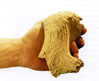
One important find was a hammer for working flints, which had been carved from the antler of a now extinct giant deer. This hammer was used repeatedly, and was carried around with its owner. This type of tool use is beyond the opportunistic use of stone made by Homo erectus in the era before heidelbergensis evolved.
|
|
Boxgrove fossil shinbone |
|
blankxxxx |
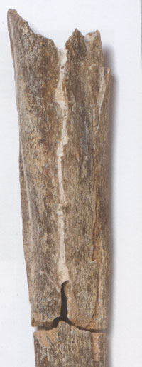
Excavations at Boxgrove had been going on for ten years before the spectacular discovery of a particular fossil bone in December 1993, long outside the traditional summer digging season for archaeologists. This discovery provided the earliest remaining physical evidence of man in the form of human bones in Britain. With excavation funds running out, during the winter of that year it was left to one man and a digger to probe an unexcavated part of the site. In one trench, the digger driver, Roger Pederson, spotted this limb bone, which would become a sensation when it was published in 1994. It is important to realise that before the 1990's there was no evidence known for man in Britain before 400,000 BC.
Human remains of this shin bone and two teeth, subsequently found at Boxgrove in 1995, have been attributed to Homo heidelbergensis. This individual was perhaps almost 6 feet tall and well built, maybe 90 kg in weight, based upon his long bone remains. He died at about 40 years of age. He butchered animals with flint hand-axes. Over 300 well made stone axes were recovered from Boxgrove, and their context was within ancient ground surfaces which are among the best preserved ever discovered.
Boxgrove's land surfaces had been repeatedly covered over by shallow water, and sealed within fine layers of silt. So perfect was the preservation, that it is possible to discern the exact spots where individuals made their own hand axes. Flint scatters were found in front of the impressions of a squatting person where the heavier pieces fell in front of him, while smaller pieces were scattered further away.
Remnants of deer, lion, bear, wild horse and rhino were also identified, with marks showing clear signs of butchery. Another important find at Boxgrove was the scapula of a horse which had apparently been damaged by a wooden spear.
Early man was, therefore, present in our area by this time, but the Ice Ages would probably have either swept away the bulk of any evidence, or muddled up the stratigraphy.
|
|
The Anglian Glaciation |
|
478,000 BP
|
The Anglian Glaciation
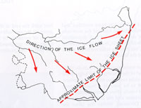
According to the Shotton project of the University of Birmingham, the Anglian Glacial epoch began around 478,000 years ago, and probably lasted to about 424,000 BP. It is usually safe to attribute it to around 450,000 BP, or MIS 12, if you prefer the more recent nomenclature. Some geologists believe that the change from warm to cold periods can take as little as 50 to 100 years. This was the biggest of all the glaciations as far as the UK is concerned, and some authorities have dated it as much later than this, perhaps from 350,000 BP to 200,000 BP.
This glaciation arrived from the north-west and the ice sheet reached the coast south of Lowestoft and aligned itself roughly from there to Ipswich at its edge. The Anglian ice sheet thus covered all of Suffolk except perhaps for the very south east. It also covered the Midlands and reached south of Essex. Suffolk was never again completely covered by ice in later ice ages.
|
|
Coastline of 478,000 YBP |
|
blankxxxx |
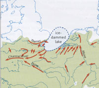
With the ice extending as far south as Finchley in north London, the landscape was completely changed, both temporarily and permanently. Rivers which had flowed into the North Sea were were blocked by a gigantic glacier or ice sheet. An icy lake formed in the low lying lands between the Netherlands and East Anglia. Hitherto this had been dry land.
As the ice carried massive sediments below it, these were both scraped away from some areas and re-deposited in others. The low lying Fens were scraped out in this way. The existing ancient river systems were either obliterated, like the Bytham and Mathon, or fundamentally altered by the Anglian glaciation, the severest glaciation known in British geological history. The River Thames was pushed nearly 100 miles south to somewhere near its modern course.This view of the coastline persisted from about 478,000 years ago until 425,000 years ago. The new lake had to overflow somewhere as the rivers continued to feed it, and a new channel was carved out to the south west, creating the breach in the chalk escarpment now called the Straits of Dover. The River Thames now joined up with the pre-existing Channel River. This was the first time that the British Isles was cut off from the continent, although there would be future periods when sea level falls would produce a dry land crossing again.
|
|
450,000 BP
|
This cold period or glaciation lasted for almost fifty thousand years. The Anglian glaciation was the most severe of a number of fluctuating climatic events that are known collectively as the Pleistocene (Ice Age). The Pleistocene in fact comprises a series of cold stages, known as glacials, and warm stages, known as interglacials, with many more minor climatic variations in between. Since the Anglian glaciation there have been up to eleven glacial and interglacial cycles, according to the Shotton Project.
Modern Geology tends to identify these stages, not by discovering new sites, but from variations preserved in cores of ice, taken from the polar regions. The resulting timeframe is known as the Marine Isotope Series or MIS. Marine Isotope Stage 12, or MIS 12, is the designation for this period of the Ice Age, which conventionally we would date to 450, 000 years ago, or "before present", (BP).
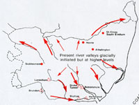
Rivers created by melting glaciers flowed across East Anglia. One such system crossed today's Elveden and Barnham areas, and considerable stratified evidence has survived the jumbling up process often caused by glaciations.
When the ice melted it left behind our boulder clays and the melt water carved out the estuaries of the Waveney, Deben, Gipping and Stour. Typical deposits include the Lowestoft Till found at the lower levels of Elveden Brickyard Pit.
Boxgrove has some evidence of the presence of man on the south coast during a short period of the Anglian Cold Stage.
|
|
Post Anglian Interglacial sites |
|
427,000 BP
|
The Hoxnian Inter-Glacial Period
The Anglian Ice Age had largely receded and the Hoxnian Interglacial, or warmer period began and lasted until about 380,000 BP.
Recovery from glaciation would start with micro-organisms building up in the watery bogs left by melting ice sheets. Insects and worms then appear, followed by dwarf birches. After a few thousand years the fish and small mammals appear, and at Elveden they include roach, rudd, stickleback and pike. At Barnham, a terrapin shell was found and once small mammals like the water voles have moved in, their remains can sometimes be dated by minute evolutionary changes. The Hoxnian layers at Elveden Brickyard Pit are silts and clays up to 6 metres thick over the Lowestoft Till.
Various warm and cool or icy periods followed, with vegetation spreading and contracting at various times as conditions changed. Lake sediments were laid down, in warmer periods, including some found at Sicklesmere.
These periods each covered hundreds or thousands of years.
|
|
Coastline of 425,000 YBP |
|
425,000 BP
|
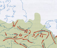
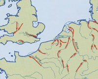
This map illustrates the position from 425 thousand years BP to 130 thousand years BP. The Thames flows into the Channel River, and this valley will be drowned when sea levels eventually rise.
|
|
Swanscombe flint axes |
|
400,000 BP
|
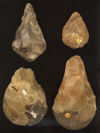
In Britain generally, Paleolithic man is now known to have pre-dated the Anglian Glaciation. By 2010 it had been established that evidence of early man had been found at Happisburgh, dating back to around 850,000 BP. However these early occupations were each curtailed by climatic changes. The famous site at Boxgrove probably dates back 500,000 years, but since then there was a gap of 100,000 years before we find evidence of man once again.
The most important site to provide evidence of man after the Anglian Glaciation is at Swanscombe, in Kent. The River Thames had been diverted southwards by the Anglian ice sheet, and in Kent it was several miles wide, laying down deposits to the south of its present course at Dartford.
Swanscombe was important in the early history of cement. The first cement manufacturing works near Swanscombe were opened at Northfleet, around 1792, making "Roman cement" from cement stone brought from the Isle of Sheppey. James Frost opened a works at Swanscombe in 1825, using chalk from Galley Hill, having patented a new cement called British Cement. Between 1840 and 1930 it was the largest cement plant in Britain, before it finally shut down in 1990. The extensive sand and gravel beds were also dug for road making and construction, and by the 1870s Victorian antiquaries were regularly collecting the fossil animal bones and stone handaxes found by the quarrymen. It has been estimated that as many as 100,000 stone axes have been removed from the various quarries around Swanscombe over this long period of exploitation.
|
|
Swanscombe skull found 1935-55 |
|
blankxxxxx |
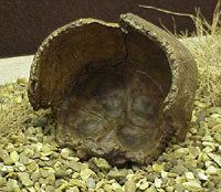
However, it was not until 1935 that Swanscombe became the most famous site in the country when human bone evidence was found. A dentist called Alvin Marston had been collecting fossils in the area since 1933, but on 29th June, 1935, he was digging around in Barnfield Gravel Pit, one of several quarry pits at Swanscombe. He found what he recognised as part of a human skull, called the occipital bone, about 6 feet above the quarry floor. It took 9 months for him to find a left parietal bone on 15th March, 1936. These two skull bones were to be eventually married up with a third skull bone on 29th July, 1955, when J J Wymer and his father and a few volunteers, found a piece within 25 metres of the others. These three pieces of skull bone could be matched up together as part of one human female skull.
The earliest Suffolk evidence, as discovered in the 1990s, appeared to be from Elveden and Barnham, dated at the end of the Anglian Glaciation.
|
|
Time Team at Elveden |
|
blankxxxxx |
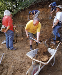
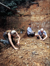
Following excavation in the late 1990's it is clear that one of Britain's major paleolithic sites was at Elveden, very near to the Center Parcs holiday village. Victorian brick makers first dug these pits for clay, and during the construction of the entrance to the new Center Parc development, they were investigated from 1995 to 1999. The television programme "Time Team" ran a three day excavation at both sites from 5th to 7th July, 1999. This Elveden site is about 5 metres more elevated than pits at Barnham, and the activities there were probably along the same river, but a few miles upstream.
Sites showing evidence of human activity dating back as far as this time are extremely rare in Britain. The clay pits of Elveden and Barnham are about 6 kilometres apart, and both contain evidence that man was knapping flints here at the time. There is also evidence that both those sites were on the banks of an ancient river system. One tool from Elveden was a flint "spokeshove" for stripping bark and shaping wooden objects including spears. More than 200 flint flakes were found and these seemed to be two distinct layers of human activity.
|
|
Time Team at Barnham |
|
blankxxxxx |
At East Farm, Barnham, there are similar lower layers to Elveden, but upper layers contain evidence of elephant, rhino, lion, bear, aurochs, deer and wild boar. This claypit has interested archaeologists since its discovery in the late 19th century. It was dug in the 1930s by T T Paston, and John Wymer took a section in 1978. Nick Ashton dug here over the period from 1989 to 1994. They found evidence of gravel bars and the banks along a river's edge. Flake tools and hand axes were evidence for the presence of man, but also identified were 18 species of amphibians and reptiles, more than have been identified at any other British site. These included tree frogs and pond terrapins which require a minimum of 18 degrees C summer temperatures in order to breed. A lion bone was found that was one and a half times the size of a modern lion's bone.
At this time the climate here was therefore several degrees warmer than today's conditions, and although surrounded by oak forests, the river valleys seemed to have open grasslands along them.
Ipswich is best known for its Anglo-Saxon remains, but from 1903 to 1905 many stone tools were found in an excavation at Foxhall Road, Ipswich. Part of the AHOB project was the re-examination of these old finds, together with their archives, and the site was found to be from a pond or lake edge which later became part of a large river system. Chris Stringer has described how unique clusters of distinctive handaxes show that each handaxe maker had a particular style. These remains from Foxhall Road are now thought to date from 400,000 years ago.
|
|
Barnham's neanderthal hearth
|
|
blankxxxxx |
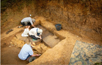
It was revealed in December, 2025 that the earliest evidence for “one of the most important turning points in human history” has been unearthed in an old claypit at Barnham, in Suffolk. The discovery, dating from 400,000 years ago, marks a colossal shift in our understanding of when humans learnt to make fire “on demand”. It is 350,000 years earlier than any other evidence, archaeologists said. Fire was known to early man long before this, but Barnham has evidence of the making and controlling of fire in an "hearth".
“The implications are enormous,” said Rob Davis, curator of the Pathways to Ancient Britain project at the museum, who co-authored the study, published in the journal Nature, and worked at the excavation site in Suffolk.
The first signs of fire here were found in 2014. In 2021 they discovered clay sediment that had been heated. Infrared and magnetic analysis showed that humans had repeatedly used fire in a “hearth”. Finally they identified “two tiny pieces of pyrite”, an iron-rich material perfect for making sparks when struck with flint. Our conclusion is that humans brought that pyrite to the site with the intention of fire-making” as part of a special “fire-making kit”, Nick Ashton said.
Skulls found at Swanscombe near Dartford have been dated to the same period, suggesting that the humans who made fire at Barnham were “early Neanderthals” with brains comparable in size to our own, said Chris Stringer of the Natural History Museum. They lived in Britain at around the time when our own species, Homo sapiens, was just starting to emerge in east Africa.
|
|
Beeches Pit |
|
blankxxxxx |
The Lower Paleolithic period has left further evidence of man in our area at Bury, Icklingham, Kentford, High Lodge, Elveden, Lakenheath, Brandon, Santon Downham and Barnham.
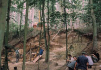
Beeches Pit at West Stow has a long history of being studied geologically and faunally, but its archaeology was studied only in a preliminary
way until excavations were conducted by the University of Liverpool from 1992 to 2000. The sediments of the site were first exposed by a nineteenth century brick pit. Work on removing brickearth had stopped by 1860. This work left a pit approximately 70 by 50 metres across, depressed below the surrounding land scape by up to 5 m, and relatively flat- bottomed.
Dr John Gowlett of Liverpool University has discussed the findings at Beeches Pit with the BBC on 11th August, 1998, and this 28 minute session can be heard on the BBC Sounds website here:
Beeches Pit interview 1998
This investigation found that Beeches Pit contains evidence of the controlled use of fire by early man. Hearth areas were apparent, with burnt artefacts around them. Beeches Pit has excited scientific interest for over a century, and as early as 1891, Thomas Huxley described burnt bones of deer found here. Other antiquarians had recovered flint handaxes from the pit, including specimens taken by Henry Prigg, (sometime known as Henry Trigg), who died in 1892. Some of his specimen flints are now in the Ashmolean Museum.
More recent investigations by the AHOB project has found further fragments of burnt bone. The pit was on a spring line, where water emerged from the underlying chalk, and 78 species of mollusc remains have been found in the fine limestone tufa deposits left by these ancient springs. Hand axes and flint debris confirm the presence of early man here.
The dating is an interglacial period following the Anglian Glaciation and is thought to be within isotope stage 11. The archaeology indicates repeated sporadic visits to a south facing channel bank, with springs serving as a focus for various activities.
|
|
The Clacton Speartip |
|
blankxxxxx |
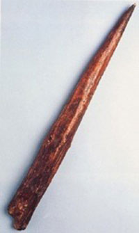
At Clacton in Essex is another of the three "classic" East Anglian sites of the Lower Paleolithic. In 1911, a wooden spear tip was found at Clacton on Sea by Archaeologist, J. Hazzledine Warren, once dated to 450,000 years ago, but now thought to be nearer 400,000 years old. It is made of yew, and is the earliest wooden object yet discovered in this country.
Clacton has also produced bones of an elephant with straight tusks, deer, rhino, pig, horse, beaver and vole.
Many wooden objects from this period have survived in swamps in Schoningen in Germany, discovered around 1996. They were spears, carefully built and designed by men now known as Homo heidelbergensis.
This reminds us that stone is just the only evidence which has usually survived. Most of their tools were probably wooden, and their technology must have been based more on wood, plant and animal material than upon stone.
|
|
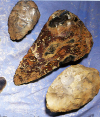
Lower Paleolithic hand axes |
|
380,000 BP
|
The effects of the glacial/interglacial cycles on Britain’s rivers formed the landscape of the river valleys we know today. Fast-flowing rivers transported sands and gravels, which were deposited to a depth of metres in the valley bottoms. These deposits now form a valuable resource extensively exploited, in the Midlands as well as along the Lark Valley, by the construction industry. The deposits also contain valuable evidence of past environments in the form of the fossilised remains of plants and animals as well as evidence of human activity in the form of stone tools. The majority of British handaxes have been found in these sand and gravel deposits.
During the glacial/interglacial cycles the rivers cut down through earlier deposits and laid down fresh deposits of sands and gravels. This process has resulted in the creation of a series of terraces in some river valleys, with the highest terrace being the most ancient and the lowest the most recent. Much geological research and controversy surrounds the interpretation of these terraces and their correlation with specific glacial events.
|
|
364,000 BP
|
The Wolstonian Glaciation begins
It has been suggested recently that the Hoxnian Interglacial or warmer period drew to a close at this time. This would herald in another cool period, known as The Wolstonian Glaciation. The ice sheet stopped somewhere short of North Norfolk but permanently frozen ground conditions would have resulted throughout East Anglia. This period lasted until about 126,000 BP.
The tundra of Norfolk and Suffolk at this time would have gradually lost all the animals that had lived during the Hoxne inter-glacial times. Man would also have had to retreat southwards, and possibly only the woolly rhinoceros and mammoth would be left roaming our area. They would go wherever there was food to be found, varying in their range season by season, and decade by decade, with the climate.
|
|
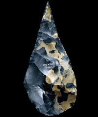
Hand axe from Hoxne |
|
360,000 BP
|
For many years it was thought that the prolific evidence of man found at Hoxne must be related to the main part of the Hoxnian inter-glacial era, when climatic conditions were at their best. So for many years it was dated to around 400,000 years ago. However, when the AHOB re-examined the evidence it was concluded that the many hand axes and artefacts found here came from the upper layers, in a time when the climate was entering a cooler phase. Therefore Hoxne man has been tentatively re-dated to around 360,000 YBP, a phase when the climate was entering a new cooler time. Although still allocated to the inter-glacial MIS 11 phase, the presence of three types of Lemmings shows that cooler times were now prevailing, and the tree pollens were from pine and birch forests.
As early as 1797, Hoxne near Eye in East Suffolk became a site known for remains of large animal fossil bones and flint tools of this period. The remains were dug up by workmen in a clay pit for brick making. Much of the spoil was used to fill holes in local roads until John Frere, a local squire from Westhorpe in Suffolk with antiquarian interests, recognised some of the fragments. The site gives its name to the Hoxnian Interglacial period. It was here that the great antiquity of man and his flint tools was first recognised in the 1790's by John Frere, although he had no way of putting even an approximate date on their origins. Frere's work was largely overlooked until the time of Darwin, when ideas of evolution led to a re-examination of his work.
John Frere announced his finds to the Society of Antiquaries in London in 1800. The axe shown here may have been one of his original finds, now belonging to the Society, and on loan to the British Museum. Frere collected many remarkable hand axes and flint scrapers from workmen digging for clay.
Since Frere's time there have been many more finds from Hoxne. The site seems to have been next to water, and a wide range of stone tools have been identified. Animal remains include horse, red deer, bison, elephant, Macaque monkey, birds and fish. Horse bones indicate that horses were eaten for food, and not used for riding at this time. Almost certainly wood played a big part in their lives, but any remains have rotted away, and so the dominant use of wood can be easily overlooked.
These pits have been excavated by archaeologists since the 19th century. In the 1890s Clement Reid dug here. John Wymer investigated the site in the 1970s, and contributed to the massive work entitled "The Lower Paleolithic Site at Hoxne, England", in 1993, by R Singer, B G Gladfelter, and J J Wymer. This team, led by the University of Chicago, dug from 1971 t0 1978. Like most early sites, the local habitat was shown to be of open grassland on the edge of a river.
|
|
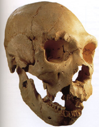
Atapuerca skull |
|
300,000 BP
|
Britain was still on the edge of the Wolstonian glaciation at this time, making it a windswept tundra. Evidence of man in Britain now falls off dramatically, and we know very little about what presence, if any, still remained here until evidence re-emerges at Lynford about 60,000 years ago. Only further south, more distant from the Ice sheet, could conditions on the continent still support man.
Very important remains from this date were found in 1997 at The Pit of Bones in the Atapuerca cavern, near Burgos in northern Spain. They comprise evidence from the remains of 32 individuals who somehow arrived together deep underground. They display facial characteristics indicating change from the classic Homo heidelbergensis shapes. From this evidence it would seem that signs of Homo neanderthalis were now evolving in Europe. There is some evidence that fire was used and controlled at this time.
If European Homo heidelbergensis was evolving into neanderthal man, as suggested in Robin MacKie's book, 'Apeman', then in Africa, heidelbergensis would evolve into Homo sapiens over the next 200,000 years.
|
|
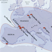
Neanderthal sites |
|
250,000 BP
|
The Middle Paleolithic Period
The transition to the Middle Paleolithic Period began at this time. From this Early Middle Paleolithic time, the Middle Paleolithic lasted until about 38,000 BC.
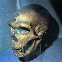
A new species of hominid first appeared around this time in Europe despite or, possibly, because of, the fiercely cold conditions of the Wolstonian ice-age. They had evolved large noses to warm their inhaled breath, rounded bodies to retain heat and powerful physiques. Most amazingly, their brains were slightly larger than those of modern man. Scientists refer to them as Homo neanderthalis. Neanderthal man gets his name from the Neander Valley near Dusseldorf in German, where his remains were first identified in 1856. Homo neanderthalis means Neander valley man. A further complete skeleton was found in a cave at La Chapelle-aux-Saints in Southern France and published in 1911. This skeleton became known as the Old Man of La Chapelle.
In the warmer eastern Europe and western Asia, Neanderthal man was less stocky and more lightly built. Unlike earlier hominids, Neanderthal man buried his dead in graves, often in caves or crevasses.
Stone tools were now characteristically more refined than the old 'core' tools, and more use is made of flake tools, incorporating more thought and deliberation. This technology has been called "Levallois", and rather than make one flint into a handaxe, Levallois technology implies a more resouceful use of the flint. Several flake tools are made from one piece of flint by carefully pre-visualising the strokes needed to produce this result. Some cores were added to wooden hafts, using a form of glue, and a wider range of tools are now made.
Over the next 200,000 years Neanderthal man would evolve a complex society, expand his range, develop his new tools and produce art-objects with no known practical purpose other than to convey symbolic meaning. The total extent of Neanderthal man's existence as a species could have been as much as 360,000 years in total, a timespan ten times longer than the current existence of Homo sapiens. His ingenuity, strength and environmental intelligence is not to be underestimated.
|
|
Neanderthal skull La Chapelle |
|
200,000 BP
|
In Europe, the Middle East and Asia, this time is characterised by Neanderthal man who dominated these continents throughout this period. Neanderthal has sometimes been portrayed as something less than modern man, but his culture was refined and developed over more than a hundred thousand years down to 40,000 BP. Traces remained of him as late as 30,000 BP.
In the area now called Suffolk, the climate was warmer than it is today. Mammoths roamed the land, along with herds of bison and horses. The Straight Tusked Elephant was also in Suffolk at this time. Along with the remains of the animals are the flint tools left by the Neanderthal inhabitants of Suffolk .
The Straight Tusked Elephant was the typical forest living elephant in the warmer periods of the late Ice Age. Remains of this elephant have been found at Brundon, Hoxne and Stutton.
In Africa, south of the growing Sahara desert, Homo sapiens first appeared and would apparently be restricted to that Continent for another 100,000 years.
|
|
180,000 BP
|
Early Man is now absent from Britain
By around 180,000 years ago any evidence of man in Britain is absent. From now until about 60,000 BP no sites have been discovered here with any flint working or any animal bones with evidence of butchery on them.
|
|
Stalagmite structures in Bruniquel cave |
|
176,000 BP
|
Although now absent from Britain, Neanderthal man was surviving in southern Europe, and good evidence of his existence is found in the complex of caves in southern France.
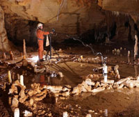
In the Bruniquel cave in southwest France the oldest known human made structures have been identified and published in 'Nature' in June, 2016. The cave itself was not discovered until 1990. Stalagmites had been broken off and arranged in patterns of circles and half moons, possibly to contain fire-sites. The picture shown here is credited to Etienne FABRE - SSAC, on the website of www.livescience.com.
The summary from 'Nature' included the following:
"The regular geometry of the stalagmite circles, the arrangement of broken stalagmites and several traces of fire demonstrate the anthropogenic origin of these constructions. Uranium-series dating of stalagmite regrowths on the structures and on burnt bone, combined with the dating of stalagmite tips in the structures, give a reliable and replicated age of 176.5 thousand years (±2.1 thousand years), making these edifices among the oldest known well-dated constructions made by humans. Their presence at 336 metres from the entrance of the cave indicates that humans from this period had already mastered the underground environment, which can be considered a major step in human modernity."
Scientists discovered about 400 stalagmites and stalagmite sections that were collected and stacked into nearly circular formations. Previous carbon-14 dating used in 1995 on burnt bone found here had been unable to place a date older than the maximum possible of 47,600 years old using that technique on organic matter. The new Uranium-series dating could be used on the stalagmites themselves.
|
|
Coastline of 130,000 YBP |
|
130,000 BP
|
This diagram shows the time from 130 thousand YBP to 115 thousand YBP. The English Channel has been formed because the defunct Channel River valley was now low enough to be flooded by rising sea levels.
One of the most important finds of early fossils of Homo sapiens was made by Richard Leakey in 1967 in the Omo-Kibish region of Ethiopia. In 1967, before this discovery, it was believed that Homo sapiens was only 60,000 years old and had evolved from Homo neanderthalis. Leakey showed that the species of modern man was at least 130,000 years old, and came out of Africa. Homo sapiens had not yet reached Britain, although earlier forms of man have now been shown to have visited East Anglia before the Ice Ages.
|
|
126,000 BP
|
The Ipswichian Interglacial Period
The Ipswichian warmer period began and remains of hippo and pond tortoise have been found dated to this period. After the Hoxnian interglacial there followed a complex series of glacial/interglacial events during which, in some warm periods, Britain may well have become an island. During the exceptionally warm interglacial known as the Ipswichian, dated by the Shotton Project to 130,000 – 110,000 BP, when hippopotami roamed Trafalgar Square, there is no evidence of human occupation. The rapidity with which the English Channel flooded may explain the inability of the Neanderthals to colonise Britain at this time. Indeed, current research suggests a gap in occupation that may have lasted from 180,000 to 60,000 years ago.
|
|
125,000 BP
|
At Saham Toney in Norfolk, numbers of animal bones and mammoth teeth, dated to about 125,000 years ago, have been found. However, there was a marked absence of any human presence at this time.
|
|
120,000 BP
|
Meanwhile, in Africa, Homo Sapiens was evolving. Further evidence of early Homo sapiens dated to this time has been found on the Klasies River in South Africa. Stone implements found in their caves were surprisingly advanced for this date. Geological deposits of the Upper Pleistocene series start at this date as the Middle Pleistocene ended.
|
|
100,000 BP
|
Around this time we think that Homo sapiens was expanding out of Africa into the Middle East. Remains of both Homo sapiens and Homo neanderthalis have been found in the caves of Skhul and Qafzeh in Israel. Both species seem quite similar in their hunting and gathering practices at this time, but we do not know if they occupied the same places at the same times, or if they interacted in any way.
|
|
90,000 BP
|
At Border Cave in South Africa Homo sapiens remains have been dated to this time.
From the same time period, remains have been discovered in Katanda in Zaire including superbly carved 90,000 year old bone harpoons and knives. Work of this quality had previously been unknown earlier than 40,000 years ago from Cro-Magnon man in Europe. Homo sapiens and his Cro-Magnon descendants can therefore be traced back into an African genesis.
|
|
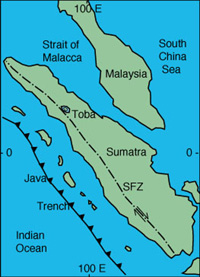
Toba on Sumatra |
|
74,000 BP
|
There is some evidence of a catastrophic volcanic event some 74,000 years ago. Geological layers have been thought to show that volcanic ash covered much of the earth. This ash would have circled the earth in the upper atmosphere, drastically reducing the penetration of sunlight, and causing permanent winter for many years. This was an ELE or Extinction Level Event which is likely to have had a massive impact on the human, as well as animal and plant populations. The eruption has been attributed to Toba, which has left a massive caldera in the heart of Sumatra in Indonesia. Now known as Lake Toba, this caldera is 18 miles wide and 60 miles long. This eruption is thought to have been the biggest in the last 2 million years.
This volcano lies on the Sumatra Fracture Zone, (see SFC on map), and is in the same region as the origin of the tsunami of Boxing Day, 2004.
Professor Ambrose of The University of Illinois has estimated that Toba caused a 3 to 3.5 degree celsius reduction in the earth's temperature lasting for several years.
Human populations may have shrunk to around 50,000 individuals, a suggestion somewhat supported by genetic analysis of human populations today. This analysis is made more difficult by the start of the Devensian Glacial Period soon afterwards, which would have also made life extremely difficult for man, beast and plantlife.
|
|
70,000 BP
|
The Devensian Glacial Period
The Devensian cooler period began around this time. If the theory of the Toba eruption is correct, mankind would have been recovering from a massive fall in populations, only to be beset again by adverse conditions. In the advance of the ice sheet down from the north, the ice may again have reached the North Norfolk coast. The ice probably advanced and retreated sporadically, but did not seem to reach its peak until around the period from 24,000 BP to 15,000 BP.
|
|
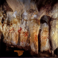
La Pasiega cave art |
|
65,000 BP
|
Caves and cave paintings in Cantabria, northern Spain, have been known since 1911, and scientists had previously thought they were made by Homo sapiens and covered a timespan from 35,000 years ago up to 10,000 years ago for the most recent.
In 2018 the latest techniques were applied to some of the earliest markings and it was discovered that the world’s oldest known cave paintings were made by Neanderthals, not modern humans, suggesting our extinct cousins were far from being the uncultured primitives of legend. A high-tech analysis of cave art at three Spanish sites, published in "Science" on 22nd February, 2018, dates some paintings to at least 64,800 years ago, or 20,000 years before modern humans arrived in Europe from Africa.
That makes the cave art much older than previously thought and provides the strongest evidence yet that Neanderthals had the cognitive capacity to understand symbolic representation, a central pillar of human culture. The early cave art at La Pasiega, Maltravieso and Ardales includes lines, dots, discs and hand stencils.
Scientists used a precise dating system based on the radioactive decay of uranium isotopes into thorium to assess the age of the paintings. This involved scraping a few milligrams of calcium carbonate deposit from the paintings for analysis.
“What we’ve got here is a smoking gun that really overturns the notion that Neanderthals were knuckle-dragging cavemen,” said Alistair Pike, professor of archaeological sciences at the University of Southampton, who co-led the study.
Joao Zilhao of the University of Barcelona said the new findings meant the search for the origins of human cognition needed to go back to the common ancestor of both Neanderthals and modern humans more than 500,000 years ago.
|
|
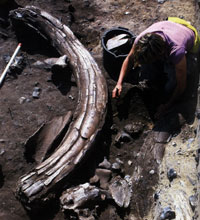
Mammoth at Lynford |
|
60,000 BP
|
Man returns to Britain
Around 60,000 years ago the first evidence of the re-colonisation of Britain by Neanderthals occurs, according to the Shotton Project, along with the appearance of such other colonists as the woolly rhino. This time also coincides with the start of the cool period known as MIS 3, which would last until 25,000 years before the present day. Neanderthal man seems to have evolved to cope with these cooler conditions at the time, and although he had been present on the continent of Europe and the Middle East, the waters of the English Channel seems to have kept him out of England until about 60,000 years ago. The first signs of man's return to this country for about 100,000 years were only recently found at Lynford, near Mundford, in Norfolk.
It seems likely that by this time early man could cross Doggerland, (a name given to the now submerged area in the North Sea) by following the river valleys and the reindeer herds. An early version of the River Wissey would have taken them to Lynford, where they found outcrops of good blue flint in the chalk.
The stone tools of this period are classified as Middle Palaeolithic, and the re-colonisation of Britain is particularly associated with a flat-based, sub-triangular type of handaxe (often described as ‘bout coupé). Several such handaxes have been uncovered during 2002 at Lynford Quarry's Pit C in Norfolk, along with the bones of mammoths. The Lynford Gravel Pits have revealed that the hand axes found were probably used in the butchery of mammoth parts.
|
|
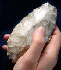
First axe found at Lynford |
|
blankxxxxx |
Lynford seems to have been a source of high quality flint for the making of stone tools. Its chemical composition is akin to that found at Grimes Graves, which is perhaps not surprising as the two locations are only about a mile apart. Roadstone has been extracted from pits at Lynford since the 1950s, and it is the spoil from these diggings at Pit A that yielded the first known flint axe found here in the 1970s by a quarry worker. This axe was given to the landlord of the Mundford Crown inn, and was largely unknown to science. The first archaeologist to find a handaxe here seems to have been Phil Harding, in 1982.
After the excavations of 2002, about 2,000 kilograms of samples were processed of pollen, plants, molluscs, insects and vertebrates. Remains of nine mammoths were found, as well as evidence of woolly rhino, reindeer, horse, bison, fox, wolf, hyean and brown bear. Some 500 man made artefacts were found, which included 40 small handaxes, made in black or dark blue flint.
The environment here at the time of Lynford Man was the boggy edge of a river, and conditions would have required highly evolved coping strategies as winter average temperatures were as low as minus 10 degrees C, and the summer averages were only about 12 or 13 degrees C.
In the Midlands, evidence of Neanderthal occupation in this period is largely absent, but a spectacular find of a partial skeleton of a woolly rhino, along with the remains of four further woolly rhino, mammoths, reindeer, horse, bison and wolf has recently come to light at Whitemoor Haye Quarry in Staffordshire. These remains, found together with a rich assemblage of plants and insects, will enable a detailed reconstruction of the Ice Age environment in the Trent/Tame valley at this time.
In Israel, a lot of evidence survives from this period. Neanderthal man was being pushed southwards into that area by the Devensian Ice Age. Homo sapiens was migrating out of Africa northwards. Homo sapiens did not restrict himself to a known range as much as Neanderthal, and may have been able to exploit a wider number of possible terrains. If Homo sapiens encountered Neanderthal man around this period in the eastern Mediterranean, they would have found a highly developed culture based on 200,000 years of history.
Some Neanderthal graves included objects such as a deer's jawbone or flowers and certainly this was the case in Israeli and Iraqui discoveries dated to 60,000 years ago. Other evidence reveals that they cared for injured or sick relatives or companions. Their stone tools were more complex than earlier hominids and they built fires in their shelters. Stone blades, stone flakes with sawtooth edges and a side scraper were all new tools invented and developed by Neanderthals. They also made pendants to wear on strings. At this time the culture of Homo sapiens was still not that different from Neanderthal.
|
|
45,000 BP
|
From 45,000 years ago until about 12,000 years ago, the European climate became very unstable. This is shown by records from the Greenland icecap and from cores taken from European lake beds. Although this whole period is contained within the cooler time known as MIS 3, Chris Stringer suggests that the unstable years were linked to fluctuations in the current known as either the North Atlantic Drift, the Gulf Stream, or sometimes as the North Atlantic Conveyor.
|
|
43,000 BP
|
The oldest known iron mine in the world is located at Lion Cavern in Swaziland. The type of haematite found there is also called specularite, and it was not being dug out for iron working, but for its colour. The heavy ore can be ground down to produce a red ochre which was used for body painting in various ways. The unique property of this specularite was that it included a metallic speckling which ensured its continuous use for many years.
|
|
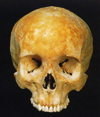
Homo sapiens skull |
|
40,000 BP
|
The Upper Paleolithic Period
The Hoxnian Man seems to have died out around this time. This disappearance of Neanderthal man seems to have happened throughout their range over a period of the next 10,000 years.
In Europe, the period from about 40,000 to 30,000 years ago saw the replacement of Neanderthals by our own species, fully modern humans (Homo sapiens). The arrival of these modern humans is associated with more sophisticated stone tool types, dominated by the use of flint blades, and the first substantial use of bone and antler for tool manufacture. At the same time, the first art appears, both carved on bone and antler, and – on the continent – incised and painted on cave walls. These changes mark the transition to the Upper Palaeolithic.
The first Homo sapiens to appear in Europe have been called Cro-Magnon man, named after the Cro-Magnon cave above the town of Les Eyzies in France. Remains were first discovered there in 1868. Homo sapiens had arrived in Europe from Africa where they had first appeared about 160,000 years earlier. For the next 10,000 years Homo sapiens would come to dominate Europe and Neanderthals would disappear from the fossil record.
From 40,000 BP onwards there was an explosion in the cultural development of Homo sapiens. The use of fireplaces became widespread and were very necessary to a species evolved in Africa and only recently left there. He had spread across the world, as far as Australia and suddenly his art became something new, his implements began to develop and he began building homes. He developed societies and began to trade over wide areas.
To the field archaeologist the time is known as the Early Upper Paleolithic period. This really refers to Europe, as it is associated with the arrival of Homo sapiens from Africa. Flint tools from this time are called 'blade' tools, as they look like attempts to fashion a blade, and even the scrapers are thinner and more carefully produced for a range of tasks. We have little evidence of man in Suffolk at this time, apart from possible hunting parties crossing the land-bridge from Europe. The climate was much like modern Siberia in Suffolk at this time, and so not likely to encourage permanent occupation if better conditions could be found further south.
|
|
35,000 BP
|
Castelmerle Valley in the Dordogne was the commercial heart of the region. There was a bead making factory using woolly mammoth ivory from Czechoslavakia and soapstone from even further east. The beads were woven into the clothing and there were specialised "factories" making one part of the process. It is believed that the standard 6 mm beads were produced by women. Similar beads have been found as far away as Russia.
|
|
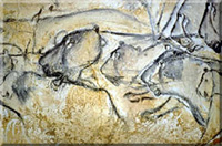
Chauvet lions |
|
32,000 BP
|
In 1994 the Grotte Chauvet cave paintings were discovered in a cavern in the Ardeche gorge in southeastern France. Over 300 animals were depicted with great originality and flair. Not only was this to prove to be one of the best and most highly developed examples of ancient cave painting, but also it was the oldest ever found, being dated between 31,000 and 33,000 years old. Previously Cro-Magnon art was reckoned to begin about 25,000 years ago in a fairly primitive style and improve to the most recent creations of 11,000 BP. These 1994 finds show that human creativity and ability at this time was equal to ours, despite the 30,000 year time difference.
|
|
30,000 BP
|
The last remaining evidence of Neanderthal man is in southern Spain dated at about 30,000 years ago. They may have survived in other isolated parts of eastern Europe as well, but in the main they had been replaced by Homo sapiens. This seems to coincide with the advancing height of the Devensian ice age, the last of the great ice ages. The foothills of the Pyrenees were a great centre for ice-age hunter gatherers in southern France at this time.
|
|
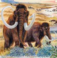
Woolly Mammoths |
|
blankxx |
In Suffolk at this time the climate was cold, with a landscape similar to that of the arctic regions today. Suffolk was now inhabited by the Woolly Mammoth, his coat necessary in the prevailing cold conditions. Also present were the Woolly Rhinocerous, bison and Reindeer. Wolves and Hyaenas preyed on the herds, as did the homo sapiens, our own ancestors, who would have been here as opportunity arose, following the herds.
The Woolly Mammoth had a fatty hump as well as his thick coat. It had had small ears against the cold, compared to our modern elephants. Long curved tusks are thought to have been used to sweep snow off the ground to expose plant food. Remains of these giants are commonly found in in the gravel extractions of the Gipping, Stour, Lark and Waveney Valleys.
In Britain, there is evidence of early Upper Palaeolithic occupation, in both cave and open-air sites, from before 30,000 years ago, including at King Arthur’s Cave in Herefordshire.
|
|
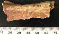
Ochre staining at Paviland |
|
27,000 BP
|
Human remains from around this time are best represented by the famous burial known as the ‘Red Lady’ from Paviland Cave on the Gower.
Goat's Hole cave, Paviland, on the Gower Peninsula in South Wales, is well known as the site of one of the best-known prehistoric burials in Britain. This was the misnamed 'Red Lady of Paviland' which was discovered in 1823. William Buckland, Professor of Geology at Oxford University and a correspondent of the Talbot family of Penrice, arrived on 18 January 1823 and spent a week at Goat's Hole during which his famous discovery took place. At the time it was interpreted as no older than Roman because of religious convictions surrounding the date of Noah and the Flood.
The 'Red Lady' would today be interpreted as a ceremonial interment of a high status man of the Gravettian period of the Palaeolithic (c 28-21,000 BP), such as are now known across Europe from Paviland to Moscow and south to Portugal. The bones were deeply stained with red ochre, and the grave goods, ivory rod and bracelet fragments, and perforated periwinkle shells, were also stained. In addition, small limestone blocks seem to have been placed at the head and feet and the skull of a mammoth found nearby was probably part of the grave furniture.
In 1989, a date of 26,350 ± 550 BP was produced by the Oxford Radiocarbon Accelerator on bone powder from the original sample. Because contamination of ancient samples normally results in ages that are too young, it was reasonable to assume that the 'Red Lady' died around 26,000 years ago in radiocarbon years. Unfortunately calendar years are possibly several thousand years older than radiocarbon years at this date.
There were many other items found at this site which range from about 40,000 BP to about 13,000 BP showing that the site had significance over a very long period.
Wikipaedia states that although now on the coast, at the time of the burial the cave would have been located approximately 70 miles inland, overlooking a plain. The ice sheet of the most recent glacial period, in the British Isles called the Devensian Glaciation, would have been advancing towards the site, and the weather would have been more like that of present day Siberia, with maximum temperatures of perhaps 10°C in summer, -20° in winter, and a tundra vegetation. Bone protein analysis indicates that the "lady" lived on a diet that consisted of between 15 percent and 20 percent fish, which, together with the distance from the sea, suggests that the people may have been semi-nomadic, or that the tribe transported the body from a coastal region for burial. Other food probably included mammoth, the woolly rhinoceros and reindeer.
|
|
26,000 BP
|
The Devensian Ice Age was building up to a peak, but would not reach further south than the North Norfolk coast. By once again locking up fresh water into the ice sheet, sea levels fell dramatically.
On the continent, Dolne Vestonice ice age settlement was a wide flood plain valley with woolly mammoths roaming the area. This area has been called the New York of the Upper Palolithic period. An extremely early ceramics industry existed here. Amazingly, evidence of textile production has been found from impressions in fossilised dried mud. Here in Eastern Europe, fine cloths were woven, and ropes and nets produced from plant fibres. Their hair was braided and they made woven hats and woven cloth. The venus figurines also show braided hair and clothing.
|
|
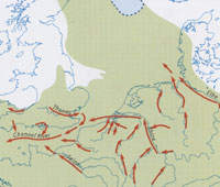
Coastline of 25,000 YBP |
|
25,000 BP
|
This view of the coastline persisted from about 25,000 years ago until 13,000 years ago.
|
|
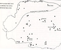
Extent of Devensian Icesheet |
|
24,000 BP
|
From 24,000 BP until 18,000 BP, the Devensian Ice Age was at its peak. This final glaciation reached into North Norfolk. Sea level was about 60 metres below present levels, and there was a dry land bridge of arctic tundra conditions between Suffolk and the Low Countries and Denmark.
|
|
20,000 BP
|
Homo sapiens were now the only species of hominid left on Earth, physically the same as ourselves. Much of the North Sea was land. In the last few years this "lost" land has been named Doggerland, a name derived from the Dogger Bank which is a modern sandbank in the North Sea well known to fishermen.
|
|
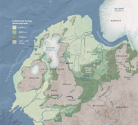
Doggerland at its height |
|
18,000 BP
|
The Last Glaciation was still at its height. Today we refer to it as the Devensian Stage. This glaciation did not reach further south than the North Norfolk coast, but it locked up so much water that sea level fell by up to 60 metres.
This led to the exposure of lands between Britain and the continent to such an extent that the whole of Britain was now a part of North Western Europe, as shown on this speculative visualisation from the National Geographic website. This graphic differs from that of the Museum of London regarding the course of the River Elbe. Here it is shown as flowing to the east of Jutland, not to the west as at present.
This major cold event, which peaked around 18,000 years ago, once again saw the abandonment of the British Isles. This cold event saw the last major advance of the ice sheets of the Devensian glaciation, which came as far south as Birmingham and covered much of Herefordshire. Britain was probably not re-colonised by humans until around 13,000 years ago.
|
|
Lasceaux Cave painting |
|
17,000 BP
|
The ice had disappeared around this time from Southern Britain, but the North was still under the ice sheet. Britain was probably a treeless Tundra, but was still joined to the continent. As the wild herds roamed here in summer, the hunting parties of men would have followed, even if they regarded home as further south in France. Archaeologists have referred to the south of France at this time as the Glacial Refuge. The Lasceaux Cave in the Dordogne region of France contains a large number of wall paintings, including many bulls and horses. These are dated to about 17,500 years ago.
|
|
The Hall of Bulls |
|
blankxx |
One cavern is called The Hall of the Bulls, and was discovered by children in 1940. One particular picture of a falling horse engraved on a curved rock surface is thought to show considerable artistic awareness. The skill and imagination shown caused many experts to doubt that they could be really this old as they used techniques such as perspective, lost again until the Middle Ages. Picasso said, "We have invented nothing" after he visited these caves.
Peche Merle Cave contains complex horse paintings covered with black and red dots. Some animals were first drawn 10,000 years before they were finally over drawn by later artists. Painting to these people has been thought to be like prayer and the act of painting has been seen as similar to religious practices.
|
|
16,000 BP
|
Following the frozen conditions of the Devensian Ice Age, which peaked around 21,000 years ago, by 16,000 years ago the climate of western Europe suddenly improved. Rich herds of game could once again migrate into Britain, and inevitably the predators, including bands of men, followed them. The first signs of returning man from this period have been found in the Cheddar Gorge, and have been known about, if not accurately dated, since the 19th century.
|
|
Gough's Cave today |
|
14,700 BP
|
Gough's Cave is located in Cheddar Gorge on the Mendip Hills, in Cheddar, in the county of Somerset. The cave is 90 metres (295 ft) deep and is 2.135 kilometres or 1.33 miles long. Most of this system is flooded, but the first 820 metres (2,690 ft) of the cave are open to the public as a show cave, and this stretch contains most of the more spectacular geological formations. It has been the stalagmites and stalactites which have attracted visitors to the caves in the Cheddar Gorge since the early 19th century. Between 1892 and 1898 Richard Cox Gough, who lived in Lion House in Cheddar, excavated and opened to the public further areas of the cave, looking for ever more impressive caverns and formations. Much of this sediment was discarded, but bones, teeth, flint knives and bone instruments were reportedly recovered.
|
|
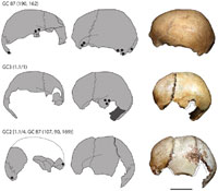
Gough's cave skullcaps |
|
blankxx |
Much of this evidence is now lost, but the Ancient Human Occupation of Britain project, (AHOB), has re-examined what could be found. in 2010 human bones from the cave were examined, which ultra-filtration carbon dating dated to around the end of the ice age 14,700 years ago. A second technique, using the Alicona 3D microscope, showed that the flesh had been removed from the bones using the same tools and techniques used on animal bones. According to Professor Chris Stringer of the Natural History Museum this supports theories about cannibalism amongst the people living or visiting the cave at that time. In February 2011, the same team published an analysis of human skulls of the same date found at the cave around 1987, which they believe were deliberately fashioned into ritual drinking cups.
Other animal remains from this period were dominated by horse bones of all ages. These had butchery marks, and occurred in some profusion, showing that these were a major food source for the people at this time. Other food items were red deer and giant ox, as well as small game such as birds and arctic hare. Worked bone and reindeer antler show that the bones were also used as a resource for tools or for decoration. There is also evidence that dogs were present with the people.
Other remains from Gough's Cave show that occupation re-occurred here at least up to the Bronze Age.
Sea level at this time was 75 metres lower than today and the area which is now the North Sea, was then made up of rich plains and hills joining Britain to the Continent. This lost landscape has been dubbed Doggerland, and explains why trawlers frequently land the bones of extinct mammoths, woolly rhino and reindeer, along with their fish catches.
|
|
Carved antler spear thrower |
|
14,000 BP
|
The Mas d'Azil tunnel in the Pyrenees at Ariege in France is one of the most important ice-age sites in the world. Huge numbers of artefacts have been found there, including an antler spear thrower, ornamented by a carved ibex. This was an important innovation to improve the range and power of spears for the hunt. It also illustrates a high level of skill and artistic interpretation of the subject. It could have been made by modern man today. At this time it is believed that groups of about 20 to 25 people worked together, but came together in the Pyrenees foothills for trade, barter, celebration, and possibly for religious purposes.
|
|
Engraved horse at Cresswell |
|
13,000 BP
|
By now man had permanently re-colonised the warmer lands of Britain, after a gap of up to 5,000 years. In the Midlands, artefacts from this late Upper Palaeolithic period have been found in caves in Herefordshire and Derbyshire.
The first cave paintings in the UK were not discovered until 2003 in Nottinghamshire, at Cresswell Crags. Images of deer, bison, bear and birds have been identified dating back 13,000 years. In many pictures of these engravings, the outlines are obscured by wear and later graffiti, and so some retouching is usually needed to render the objects visible. This is the case with the horse shown here.
Caves such as Church Hole had been excavated for remains as long ago as the 1870's, and the caves where the finds were made were well known already. It took experts on cave art from Spain to examine the walls and spot the engravings, using directional lighting, and their knowledge of what to look for.
|
|
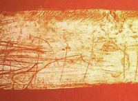
Cresswell engraved bone |
|
blankxx |
A bone artefact from Robin Hoods Cave was recovered in the 19th century and the engraved horse is typical of the art in the caves.
About 90 engravings have now been identified, and these caves are now the most northerly representations of ice age cave art so far discovered.
In 2007 a carving of a mammoth, estimated to be 13,000 years old, was found in Gough's Cave in the Cheddar Gorge, in Somerset. Following the Cresswell cave art discoveries, researchers began a programme of examining the walls of similar caves in Britain, and thus the Cheddar mammoth drawing was discovered.
Pergouset Cave in France is very restricted in access and could not hold large numbers of people but contains superb drawings in four "rooms", some with fantasy animals that do not represent real animals.
|
|
12,500 BP
|
A Thousand Year Freeze
Soon after the time of the Cresswell peoples the climate crashed into a severe cold period, and this probably again saw the abandonment of Britain by man. Over a period as short as ten years, the mean annual temperature dropped by about 15 degrees C, according to measurements taken of the Greenland ice cores. It is believed that this was an effect of the Gulf Stream failing, or even reversing in its flow. As well as the effects elsewhere, it seems that Scotland and the Lake District acquired new ice caps, and this cold period seems to have ended as abruptly as it began, after a thousand year freeze.
|
|
11,500 BP
|
Our modern Holocene Epoch begins
Northern Europe rapidly thawed out when the Gulf Stream resumed its "normal" flow, bringing warmer waters across the Atlantic to North Western European coastlines. Over the next 2,000 years the ice sheets in Europe would melt away. This new post glacial era is known as the Holocene. In terms of the Marine Oxygen Isotope record, it is called MIS 1.
In lower lying areas, like today's Fens, the land available for settlement gradually began to shrink as sea levels rose.
|
|
11,400 BP
|
The Mesolithic period, or Middle Stone Age
The Late Glacial Period began and the Mesolithic period is the name given to human remains from after this date up to the time farming began. Nowadays, the Mesolithic period is dated to a 6,000 year period, from 10,000 BC until about 4,000 BC.
According to British Archaeology issue September, 2007, "In the 1940s the British mesolithic (then thought to have lasted 3,000 years) barely registered in prehistoric narratives." However, the period known as the Mesolithic, in which early man was characterised as living within a "hunter-gatherer society", has become much better known because of recent important archaeological excavations, particularly at Star Carr, about two miles south-west of Scarborough in Yorkshire.
A piece of engraved bone was made in central France with 1,000 engraved marks for time recording and predicting the phases of the moon. This piece is 4 inches long and could apparently be used to calculate everything that Stonehenge was thought to do.
|
|
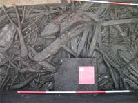
11,000 year old wood |
|
11,000 BP
|
Star Carr is world renowned in Archaeology. It dates to around 9000 BC and was occupied by hunter-gatherers. It is especially important because of the high degree of organic preservation and when it was first uncovered, finds such as barbed points, stag frontlets (head-dresses) and beads emerged. These sorts of discoveries are extremely rare. In addition, the preservation of wood and plant remains allowed archaeologists to reconstruct the environment at that time. The wood even has the bark still on it despite the fact that it grew 11,000 years ago. What is more, in recent excavations wooden platforms and trackways have been uncovered which demonstrate the earliest evidence of carpentry.
The site belongs to the early Mesolithic and was occupied from around 8770 BC until about 8460 BC, possibly with a period of abandonment between 8680 BC and 8580 BC. It was discovered in 1947 during the clearing of a field drain by John Moore, an archaeologist from Scarborough. It was then excavated from 1949-1951 by Professor Grahame Clark of the University of Cambridge under the auspices of the Prehistoric Society.
Clark found what he called a brushwood platform which appeared on the edge of the former Lake Flixton. The platform would have been laid down to consolidate the boggy water's edge. Recent excavations have revealed that people would have lived on the dry land upslope of the lake and at the lake edge various activities would have been carried out.
It was then excavated again in 1985 and 1989 by the Vale of Pickering Research Trust.
In 2004 excavations commenced once more, directed by Drs Nicky Milner (University of York), Chantal Conneller and Barry Taylor (University of Manchester).
|
|
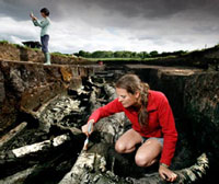
Excavating at Star Carr |
| 10,500 BP
|
In August 2010, the team excavating at Star Carr announced that they had discovered the oldest known house in Britain, dated to 10,500 years before the present, or 8,500 BC. The Star Carr house was comparable to an Iron Age roundhouse, about 3.5 metres (11 ft) wide and made of wood. It is believed to have been used for between 200-500 years after its construction.
Carbon dating and analysis of hundreds of scattered flint tools revealed that the building stood in 8,500BC, when Britain was still joined to continental Europe. At the time it was thought the country was home to restless, nomadic hunter-gatherers. But the scale of development at the Star Carr site near Scarborough, combined with other recent finds at Howick in Northumberland and East Barns in Scotland, now suggest a much more domestic, settled picture.
The Guardian newspaper reported as follows:
"'This changes our ideas of the lives of the first settlers to move back into Britain after the end of the last ice age," said Dr Chantal Conneller of Manchester University, whose archaeologists helped discover the house with a team from York University.
"We used to think they moved around a lot and left little evidence. Now we know they built large structures and were very attached to particular places in the landscape."
The previous holder of the title of Britain's oldest house was a similar wooden structure at Howick built 500 years later.'"
The archaeologists believe the house was repaired and added to several times during its occupation which lasted, uninterrupted, for between 200 and 500 years. Its owners also enjoyed bonfires, used to clear land to encourage wild cattle, deer and elks to forage for fresh shoots, and they kept dogs.
|
|
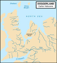
Possible extent of Doggerland |
|
10,300 BP
|
The Flandrian warm period
This date is generally reckoned to herald the start of the warmer Flandrian period, which we remain in today. Today's post glacial warm period began quite rapidly at this time and the treeless British landscape was gradually replaced by trees colonising from the south east. The first forests were of birch, an arctic tree, pollinated by wind when it was still too cold for insects in Britain.
Since 2007 the proposal that there was much more than just a 'landbridge' connecting Britain to the continent has become widely accepted. The term "Doggerland" was first proposed for this now lost area of land by Bryony Coles in the 1990s, drawing upon evidence from dredged up artefacts and remains found throughout the 20th century. Her speculative maps of the area as a lost landmass awaited confirmation by further research.
The publication of the book "Mapping Doggerland" by Gaffney et al, in 2007, has shown that it is possible to map the lost landscape below the North Sea by interpreting 3D seismic data of the sea floor collected by the oil and gas industry. Maps such as the attached view showing the landmass as it might have been around 8000 BC have now become more acceptable to the scientific community.
The detailed mapping from Gaffney at the University of Birmingham showed the remains of rivers, lakes and other landscape features. The whole idea of Doggerland now became much more real and solid, and dredged items could now be placed into some real landscape context for the first time.
This mapping exercise revealed a vast lowland area which was available to the hunter gatherer communities of the Mesolithic for exploitation. However, over the next two thousand years this area would gradually reduce in size as sea level rose with the melting of the ice sheets.
It now seems likely that the great mass of evidence of human occupation in the Mesolithic period today lies under the North Sea. Thus what we see on mainland Britain today of this period is relatively scarce because Doggerland was a much more attractive area for exploitation than the more hilly terrain of Britain.
|
|
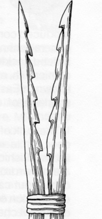
Fish or eel spear |
|
blankxx |
Early Mesolithic (hunter-fisher peoples) sites believed to date from this period have been identified at Home Heath at Lackford and Wangford, near Thetford. From this time to the present the human occupation of Britain has been continuous. Their flint technology now seems to include microliths, which are small worked flakes which are believed to have been set in wooden or bone shafts to make a composite blade, or tool.
Bone was also used as a resource, and barbed bone points have been discovered surviving from this time. One example was dredged from the North Sea 25 miles NE of Cromer, dating from this time when the area was still marshy land. Another example is from Feltwell. The diagram shows how these may have been used in pairs as fish or eel spears.
It is thought that the average July temperature rose from 8 degrees centigrade to 17 degrees within a short span of years. The earlier arctic animals were gradually replaced by the animals familiar to us today in East Anglia, together with other species which are now extinct. These included the elk, the tarpan, (a type of wild horse), the lynx, beaver, wolf, bear, wild boar, and the massive wild cattle known as aurochs. Of these animals, the wolf, beaver, and wild boar survived in East Anglia up to Anglo-Saxon times.
In 1998 the skull of an aurochs was dredged from the River Lark at West Row, dating from around this time. This was a very large specimen with a 90 cm span across the horns. Peat deposits were thought to have preserved it, together with cut marks attributed to butchery by the local inhabitants before eating it. It stood over 2 metres tall, and thus was larger than modern cattle. The aurochs died out during the Bronze Age. In this early mesolithic period, Britain was still joined to Europe by a land bridge, probably at modern day Denmark. The North Sea coastline was somewhere north of the Dogger Bank, so continental flora and fauna could migrate freely into Britain.
|
|
10,000 BP
|
In Britain, Pine trees began to replace the arctic birch, followed by hazel, elm, oak and alder.
The Nicaux Cave in the French Pyrenees is another significant ice-age location. The great cave complexes of the Pyrenees were not used as homes or as art galleries. They contain vast numbers of cave paintings but often they are virtually inaccessible. They were probably painted for religious purposes for ceremonies and mystical practices, but were detailed and precise.
A site called Asiklihoyuk in central Anatolia in Turkey shows that mud built homes were being made at this early date in this region. Most remarkably, this small settlement had beads made of copper, not only cold-worked but also subject to heat treatment. This evidence pre-dates the usually accepted date for the copper age by about 5,000 years.
|
|
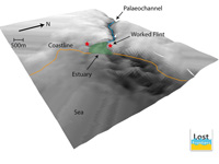
Landscape of part of Doggerland |
|
9,700 BP
|
In June, 2019, Scientists investigating a drowned Stone Age landscape at the bottom of the North Sea discovered two potential prehistoric settlement sites on the banks of a long-vanished ancient river. It is shown here in a 3D rendering of data collected by remote sensing from aboard ship.
It is the first time that an archaeological expedition has ever found such evidence far offshore under the huge body of water. This report is based upon information in the Independent newspaper.
In the past, prehistoric artefacts have on occasions been trawled up by fishermen and found by oil exploration teams – but the seabed contexts they came from were never archaeologically assessed.
The first discovered two stone artefacts – recovered in two seabed sediment samples (each of just over a cubic foot) from target seabed sites (25 miles north of Blakeney, Norfolk) – did not look visually impressive. But they are, for the very first time, enabling archaeologists to home in on what is likely to be Stone Age settlement sites that were swallowed up by the sea in around 6000 BC.
The potential settlements themselves – on opposite sides of an ancient river estuary – are even older – probably dating from between 8200 and 7700 BC.
The archaeologists - from the universities of Bradford and Ghent – have also discovered evidence explaining precisely why the Stone Age humans were so attracted to these two particular locations. The pollen and other environmental evidence being recovered from around the two sites show that the Mesolithic hunter-gatherers, who were active there, had easy access to more than half a dozen different landscape zones, each with different resources to exploit.
Marshland with rich reed beds provided opportunities to hunt large waterfowl, collect eggs and gather reeds for making baskets and fish traps. Inter-tidal mud flats and gravel beaches each provided access to different species of nutritious shellfish – and plentiful grey and common seals would have provided a seasonally rich source of very high-protein meat and fat.
Salt-marsh grassland would have attracted deer, elk and giant wild cattle (aurochs), which in turn would have provided a crucial supply of year-round meat to local humans.
Slightly higher and dryer land, overlooking the river estuary, was covered with hazel trees – yielding not only nuts, but also wood which was ideal for arrow manufacturing.
And a walk upstream along the river would have given the inhabitants access to large numbers of freshwater fish.
The gently undulating chalk topography that formed the hinterland to both potential settlements would have had springs and small streams for drinking water.
Last, but certainly not least, was a crucial geological resource on the western side of the estuary. For there, a layer of flint-bearing chalk lay at the old ground surface, providing fresh flint for the population to make their tools from.
The two artefacts which the archaeologists have discovered offer a clue as to what the Stone Age locals were doing there. It strongly suggests that the site was being used as a tool-manufacturing base.
The Stone Age landscape, submerged when the North Sea was formed, and now 32 metres deep, is one of the largest such drowned landscapes on Earth.
The North Sea expedition was led by Belgian geophysicist, Dr Tine Missiaen of Ghent University and the Flanders Marine Institute, in collaboration with Bradford University’s “Europe’s Lost Frontiers” drowned landscapes project, led by archaeologist, Professor Vincent Gaffney.
Key to the success of the expedition was the participation of the Belgian Navy which allowed its research vessel “RV Belgica” to be used by the archaeologists and geologists.
The expedition was funded by the European Research Council under the European Union’s Horizon 2020 research and innovation programme.
|
|
9,500 BP
|
The climate was now becoming warmer and moister than it is today.
The deep valley between England and France still allowed free movement to and from the continent, but was probably experiencing brackish conditions in some lower lying areas as sea levels were rising.
In this Middle Stone Age, or Mesolithic period, it is estimated that the whole population of Britain was no more than 10,000 people, all living in small family based bands, following a hunter gatherer existence along with the wolves and bears.
|
|
9,150 BP
|
The Ancient Human Occupation of Britain project has re-examined many finds from the past, using the most modern research tools.
In 1903 the remains of a human male, since named Cheddar Man, were found a short distance inside Gough's Cave, in the Cheddar Gorge in Somerset. He is Britain’s oldest complete human skeleton, having now been dated to approximately 7150 BC. There is a suggestion that the man died a violent death, perhaps related to cannibalism, although this has not been proven.
|
|
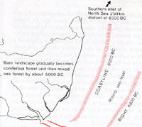
Post glacial Suffolk |
|
9,000 BP
|
By 9,000 years ago the climate was warming up to herald a 4,000 year long period known as the Holocene Optimum. Between 9,000 and 5,000 years ago the climate was warmer and wetter than it is today. The forests grew nearer to the poles than they are today. Much of the Sahara Desert was green and lush, and hippos and crocodiles lived in rivers which are only sand dunes today.
The mammoths and cave bears of the Ice Age now died out, and the open tundra was replaced by forests, where the red deer and the wild boar became the new dominant species. These new conditions forced early man to adapt his way of life to the new environment around him.
The area of Doggerland was now largely lost below the rising seas, but the coastline of Britain was still considerably further east than it is today, as shown on the diagram here.
Remains of a town have been found in Turkey which was built from 7,000 BC to 5,500 BC at Catalhoyuk, 32 miles from Konya. It was first excavated from 1961 to 1965, and further excavations undertaken from 1995 onwards. These people still roamed the countryside for food, but had settled in one place and began to build homes of mud brick, closely clustered together so that there were very few alleyways. Access was through the roof and the population was as high as 10,000 and the town flourished for 1,500 years. Evidence was found of trade goods from hundreds of miles away, but the copper work found at Asikli is absent here.
|
|

Britain an island again |
|
6,500 BC
|
The Late Mesolithic
About 8,500 years ago, the sea rose as the ice caps melted and retreated and Britain became an island once again, when the sea broke through. At first, the East Anglian coastline was several kilometres east of where it is now. Remnants of ancient forests drowned by sea level rises can still be seen today. At places like Titchwell and Sea Palling in Norfolk soft spongy remains of tree roots are often visible at low tide. Trees survived here above the water line perhaps up to 2,500 BC, as water levels gradually rose.
This period, when man in Britain became isolated from the continent, begins the Late Mesolithic time.
|
|
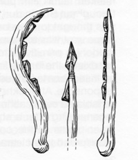
Composite use of microliths |
|
blankxx |
Sites in Suffolk thought to date from the Late Mesolithic include Wangford, Lakenheath and West Stow.
The red deer was hunted by arrows fitted with small flint barbs. Their flint technology now includes finer microliths, which are small worked flakes which seem useless as tools. These are believed to have been set in wooden or bone shafts to make a composite blade, or tool. Uses could include sickles, knives and as points for boring holes in other objects.
As sea levels rose, early man had to obandon traditional sites and move to higher ground. Much evidence of early man and the animals he hunted has been lost to the North Sea. This recession also took place along the major rivers like the Thames, and we may suggest, like the Fens and Broadland areas of East Anglia.
Mixed oak forest was now the dominant form of landscape in southern Britain.
Small leaved lime trees had arrived in Britain and the warmer Atlantic period lasted until 3,000 BC.
The lime is an insect-pollinated tree and so we know that the British climate could now support an insect population again.
|
|
6,000 BC
|
The so called "wildwood" was probably developed to its fullest extent by now, following the last glaciation. Man needed new tools and techniques to cope with the forests of Britain.
|
|
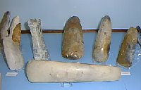
Neolithic polished flints |
|
4,600 BC
|
The Neolithic Period or New Stone Age
This time is known as the Neolithic period or New Stone Age, and the first farmers came on the scene. Some of them settled in the Lark Valley. Forest clearance was an essential skill before settlements could be established.
The tools from this time are characterised by polished stone axes, and leaf shaped arrowheads of flint. Not all the tools were polished, and included flint as well as stone axes.
Axes from the Lake District have been found in North West Suffolk, and from Cornwall in South East Suffolk.
This suggests two separate trade routes in operation and possibly two separate peoples in Suffolk. One was the Icknield Way along the Chalk ridge, connecting East Anglia with Wessex and beyond.
|
|
4,004 BC
|
At one time it was generally believed that interpretation of the Bible could show that the world was created on October 23rd, 4004 BC. This idea was put forward by the Archbishop of Armargh, James Ussher (1581-1656), in the 1650's. The calculation was included in the authorised bibles issued after 1701, and accepted as fact through the 18th century and much of the 19th century.
|
|
4,000 BC
|
Remnants of the Stone Age forest dating back 6,000 years to this period, can still be seen along our coasts. In the Thames Estuary low tides today will still reveal the stumps of oak, yew and hazel which grew at this time.
From 4,000 BC to 3,000 BC is a period when the elm tree had a great decline and remains of nettles and plantains show an increase. This is probably the first large scale impact of agriculture on the Wildwood and its decline continues to this day. Elms like to grow on the edge of woodlands and are likely to be the first to be felled in a clearance. Nettles and plantains tend to flourish where man has his home.
The treeless Breckland probably has its origins in Neolithic tree clearances from about 3,700 BC.
|
|
3,600 BC
|
Malta and Gozo were thought to have been colonised by early man from Sicily around 5,000 BC. By 3,500 BC the first stone temples of the Maltese archipelago were built, pre-dating the Egyptian pyramids by a thousand years. Although copper was used on the mainland, no metal tools have been found on Malta, and these elaborate temples were all the work of Neolithic stone tools. Some 23 temples were built and 4 remain recognisably intact today as the world's earliest free standing stone buildings. This civilisation flourished until about 2,300 BC, possibly because by then the resources of the island were exhausted.
|
|

Mildenhall Ware |
|
3,500 BC
|
A Neolithic farmstead of about 3,500 BC has been found at Hurst Fen, Mildenhall. As well as expertly worked leaf shaped arrowheads, the newly invented pottery has been found with round bases and decoration. This style of pottery is called Mildenhall Ware after this site. Saddle querns and rubbers to grind emmer-wheat and barley were also found.
|
|
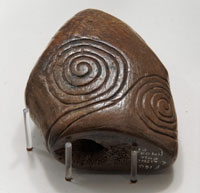
Garboldisham Macehead |
|
3,300 BC
|
During 2016 one of the exhibits at the West Stow gallery was radiocarbon dated by the University of Southampton as part of their project called "Making a Mark". The project examined decorated artefacts from Neolithic Britain. The Garboldisham Macehead was dateable because it was made of Red Deer antler and was found to be in the range of 3483 to 3104 BCE. This date indicates an earlier phase of decorative traditions in the British Neolithic than had been previously thought. The display card describes it as, "Carved macehead of red deer antler - Decorated with a triple spiral design which probably had a mystical significance in Neolithic times. Garboldisham. Found in the river. (ref) 977.844 " The third spiral is out of sight in this picture on the reverse side of the macehead.
|
|
3,200 BC
|
Studies centring on the mere at Diss suggest that in 3,200 BC a virulent strain of Dutch Elm disease wiped out thousands of elm trees. This mirrors the similar event in the late 20th century.
|
|
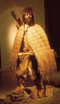
Otzi reconstruction |
|
3,100 BC
|
In 1991, a freeze-dried body dating from between 3,350 BC and 3,100 BC was discovered below a melting glacier in the Otztal Alps on the border between Italy and Austria at 3,210 metres above sea level. He became known as Otzi and is the oldest corpse to have survived in the world, pre-dating the Egyptian mummies. He seems to have died of exposure, but enough of his equipment survives to tell us that he wore clothes. He had a rainproof cloak of woven grass, goat hide leggings and jerkin, and a bearskin hat. He carried an axe, dagger and a bow. His axe was copper which had been moulded and then beaten. It was fixed to a yew tree haft with leather strips and birch bark resin. His bow was made of yew and he had a leather quiver of arrows. His dagger had a flint blade and an ash-wood handle. In total his equipment was made with 18 different types of wood, indicating a sophisticated woodworking tradition. In a leather pouch he had flints and the tinder fungus for making fire, but he also had containers in which to carry live embers wrapped in leaves. His body had simple tattoo markings which correspond to acupuncture points but were probably stimulated by pressure, not by needles. He died at the age of 46.
|
|
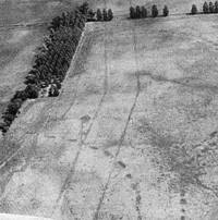
Fornham all Saints Cursus |
|
3,000 BC
|
New Stone Age man had, by now,settled quite densely around Mildenhall and one form of their pottery is called Mildenhall ware.
Causewayed enclosures from this period have been identified at Kedington and Fornham All Saints from aerial observation of crop marks. At Fornham a 'cursus', or processional way, has been identified, together with circular enclosures or henge-monuments.
The Fornham cursus is shown here in an aerial photograph from the Suffolk Archaeological Service. The village of Fornham All Saints is at the top of the picture, and the road from Hengrave to Fornham runs along the right hand edge of the view. Clicking on the thumbnail will reveal that Fornham church is visible within the village , almost in line with the cursus.
Several thousand implements were found in a single little valley at Icklingham, and perhaps these people arrived up the Icknield Way from Southern England and Northern France.
By contrast, East Suffolk is thought to have been colonised more from the Low Countries and Denmark and Germany up the coastal estuaries.
Meanwhile in the west country at Stanton Drew a massive wooden henge of concentric circles of wooden posts was erected, twice as big as Stonehenge was to be.
|
|
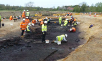
Seven Springs Woodbridge |
|
2,800 BC
|
In June, 2018 the Guardian reported that a neolithic site had been discovered in a field called Seven Springs near Woodbridge. The area was being developed as part of a land base and power lines for a £2.5bn Scottish Power Renewables offshore windfarm, East Anglia One. A Neolithic trackway, which had evidence of being repeatedly restored and renewed over decades and probably generations, seems to have led up to a level timber platform, with spring water deliberately channelled to surround it. From the platform, objects were dropped into the running water, including metal, pottery and the horned aurochs skull. The skull had been carefully shaped either to fix to a pole or use as part of a headdress. This was a major site of which not a trace remained in the historical record, despite evidence of Roman, Saxon and medieval occupation of the site.
The site was active for centuries. When the timber trackway was originally laid, the site had already been important for 500 years. A causewayed enclosure with a bank sheltering the slope and its springs is probably early Neolithic, built around 4,800 years ago. This was then reinforced by a later Neolithic ring ditch, which was then enclosed by a bronze age enclosure, which was then itself enclosed by an early iron age ditch.
|
|
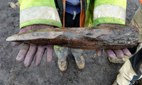
Stake 4300 years old |
|
blankx |
Because of the waterlogged nature of the site, organic remains were well preserved. Richard Newman of Wardell Armstrong, which oversaw the archaeology, said the site was undoubtedly of international significance: “It is exceptionally rare to find preserved organic materials from the Neolithic period, and we will learn a great deal from this discovery. Some of the wood is so well preserved we can clearly see markings made by an apprentice, before a more experienced tradesman has taken over to complete the job. Initially some of the wooden posts looked like they were maybe 100 years old, and it is incredible to think that they are over 4,000 years old.”
The archaeologists first thought the timbers must be medieval or even Victorian, and were puzzled to find them so deeply buried. But as 30 metres of timber track were exposed, alongside other unexpected objects too, such as the massive horns and skull of an aurochs, an extinct breed of giant cattle, they realised they were dealing with something far more ancient. The timbers were 4,300 years old, according to the first carbon-14 tests, and underlying ones may be much older.
|
|
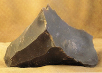
Worked flint core |
|
2,700 BC
|
The Copper Age in Britain?
There is some discussion as to whether copper tools arrived in Britain before bronze. There may have been a period on the continent when copper was in use before bronze was invented, but both metals may have been in use by the time the technology arrived in Britain. Bronze was made by adding tin to copper in the right proportions.
The first metal tools of copper had probably appeared by now in Britain, but we need to remember that flint was still the most important resource for another thousand years. Flint of a better and more consistent quality than that found on, or near, the surface was found by mining underground layers. In the Late Neolithic period there was a major industrial site at Grimes Graves which probably started in a small way at this time, building up in scale until about 2,000 BC. At first the flint may have been taken from shallow deposits, but by 2000 BC some 360 shafts of flint mines would have been dug, some up to 30 feet deep. These were dug with one of the other great resources available at the time, antler picks. A wide range of soft stone hammers and antler tools were developed to work the flint to an astonishing degree.
The Cambridge Museum of Archaeology holds two wooden bows dating to around 2,700 BC. These are the oldest bows found in England. One of them, called the Mere Heath Bow had a draw strength of around 100 lbs, making using it a substantial task.
Dating from the same time is the Ashcott Heath bow found in Somerset. This was made of yew, just as the medieval longbow was, but its construction was different. The older bow used yew heartwood exclusively, whereas medieval bows used a band of sapwood along the inner face to make the bow more flexible.
Arrows from this time were made using viburnum, a straight wood with inherent stiffness. Hazel was less good, but was more readily available in some places.
A round neolithic house has been found in Dorset which had its own henge adjacent, and is dated to this time.
|
|
2,670 BC
|
The first pyramid was built in Egypt at Saqqara. It was markedly stepped, built in a number of stages out of stone, and looked quite unlike the smooth sided Great Pyramid built about a hundred years later.
|
|
2,589 BC
|
The Great Pyramid at Gizeh was begun, and thought to have taken until 2,566 BC to build.
Around this time, Stonehenge was erected in Wiltshire apparently based upon the design of the wooden henges erected for the previous 500 years. It was probably started several hundred years earlier, and enlarged and developed over this period, and work probably continued as new ideas arose.
|
|
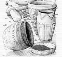
Late Neolithic pottery |
|
2,500 BC
|
Britain was cut off from the continent by about 6,500 or 6,400 BC, but the sea level did not immediately rise to the level that it is today. Forests continued to grow in areas now below the sea until about 2,500 BC.
Remnants of ancient forests drowned by sea level rises can still be seen today. At places like Titchwell and Sea Palling in Norfolk soft spongy remains of tree roots are often visible at low tide. Trees survived here above the water line perhaps up to 2,500 BC, as water levels gradually rose.
At least four types of pottery date from this time. Peterborough ware is found across southern England. Grooved Ware is also found, including a site at Honington. Bowls and beakers also occur at this time, and interpretation of these types is very uncertain.
These so-called beakers have given the culture containing them the name "Beaker People." Whether it indicates the movement of an entire people, or whether it represents a cultural 'fashion' which was adopted by local peoples, is still a matter for debate. However, Beakers arrived in Britain around 2500BC, declined in use around 2200-2100BC with the emergence of food vessels and cinerary urns and finally fell out of use around 1700BC (Needham 1996). A less colourful term for this period exists. It is also sometimes referred to as the LNEBA, Late Neolithic Early Bronze Age.
|
|
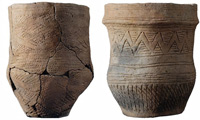
Fine beaker pottery - Trumpington Meadows |
|
blankxx |
In 2018, the Guardian and other newspapers quoted "Nature", and reported that, "The largest ever study on ancient DNA has shown that Britain was changed forever by the arrival of the Beaker folk, a wave of migrants about 4,500 years ago who brought with them new customs, new burial practices, and beautiful, distinctive bell-shaped pottery."
Geneticist Ian Barnes, from the Natural History Museum in London, said: “At least 90% of the ancestry of Britons was replaced by a group from the continent. Following the Beaker spread, there was a population in Britain that for the first time had ancestry and skin and eye pigmentation similar to the majority of Britons today.”
Ian Armit, an archaeologist from the University of Bradford, and a senior author of the study now published in Nature, said: “The pot versus people argument has been one of the most important and long-running questions in archaeology."
In Britain the puzzle remains of what happened to the pre-Beaker population: people who had no metal tools but were capable of stupendous communal projects such as the construction of Stonehenge and the giant artificial hill of Silbury.
“It’s not necessarily a story of violent conquest,” Armit said. “There is some evidence of a declining population and increased growth of forests, suggesting that agriculture was in decline. We could be looking at climate change, or even an epidemic of imported disease to which they had no resistance. But we certainly now have the evidence that they were replaced – and they never came back.”
Arminghall henge monument on the edge of Norwich also dates from this time. This was discovered by aerial photography in 1929, and excavated in 1935. It is thought that it was made of a circle of massive wooden posts, up to 7.5 metres high.
|
|
2,400 BC
|
Copper was first mined in Britain around 2,400 BC.
The Ross Island mine in south-west Ireland provided Britain with most of its earliest copper supply. Opening c. 2400 BC, the mine is associated with Beaker pottery, which suggests a link with the migration from continental Europe of people who spread the Beaker culture and introduced metallurgical knowledge (O'Brien 2004).
It would take another 200 years before copper mining began at Parys mountain in North Wales.
|
|
2,300 BC
|
In the period from 2,500 BC to 2,300 BC iron working began inside the Hittite Empire in the region which is now called Turkey. The iron ore or haematite was widely available, but hitherto it had been valued only for its use ground up to produce a red ochre for use as a paint. For centuries the ore would not be heated up enough to produce a liquid suitable for casting, but only a crude lump could be formed by the low temperatures available at the time. Nevertheless this lump could be beaten out to form an iron blade which could be sharpened to a good edge. It seems that the secret of iron working remained within the Hittite Empire for the next several hundred years.
|
|
Ring ditch at Lakenheath |
|
2,250 BC
|
For some years in the first decade of the 21st century, the American airbase at Lakenheath was extensively developed with new housing for base personnel. In late 2008, Suffolk County Council’s Archaeological Service discovered a ring ditch for an Early Bronze Age burial mound in advance of development at Liberty Village, RAF Lakenheath.
The archaeologists considered that the ring ditch was dated to the period from c.2500-2000 B.C., and was paired with a smaller example excavated in 2005 some 40m to the west. Both lay on an area of high ground overlooking the nearby fen edge and the areas of multi-period occupation and funerary activity previously excavated to the north. This prominent position means they would have been highly visible monuments within the landscape, possibly until relatively recently as both are respected by the adjacent crossroads which are derived from post-medieval routeways.
The ring ditch was a substantial feature, being 4.5m wide and 1.3m deep, and enclosed an area of about 29m in diameter. The ditch probably originally enclosed a central burial, with spoil from it being used to create an overlying mound. From the air the ring ditch was clearly visible as a circle of dark brown sand, set against the natural geology of white chalk and yellow/orange sands.
However no central or primary burial was found, in contrast to the adjacent ring ditch, indicating that the individual may have been laid onto the topsoil and covered by the mound rather than being placed into an excavated grave. Therefore when the mound was later eroded or ploughed away back to the original ground level, the burial would have been lost. One very shallow burial was found slightly off centre, the skeletons crouched position suggesting that it was an Early Bronze Age secondary burial, possibly of a child, inserted into the mound.
|
|
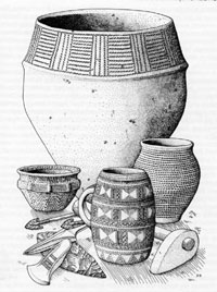
Early Bronze Age objects |
|
2,200 BC
|
The Bronze Age reaches Britain
Bronze technology seems to have reached Britain from Europe in about 2200 BC, having originated earlier in the Middle East. Bronze is commonly an alloy of 9 parts copper and 1 part tin.
Britain’s only unique export in this period is thought to be tin. It was probably gathered in streams in Cornwall and Devon as cassiterite pebbles and traded in this raw, unrefined state (Charles 1975). It was used to turn copper into bronze from around 2200BC and widely traded throughout Britain and into Ireland. Other possible European sources of tin are located in Brittany and Iberia, but it is not thought they were exploited so early as these areas did not have Bronze until after it was well established in Britain and Ireland (Bradley 2007, 146).
Gold working appeared in Britain at the same time. For a thousand years gold and bronze were the only two metals in use. Silver did not appear until the Iron Age.
The earliest bronze weapons were flat headed axes which copied the shape of polished stone axes. These occur as part of what is called the Beaker culture.
|
|
2,150 BC
|
Cornish/Devonian tin in south-west England was probably also discovered around 2200 BC, as Britain rapidly switched from copper to full tin-bronze (around 10 per cent tin) by about 2150 BC — much earlier than most of the rest of Europe (Pare 2000).
|
|
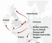
Origins and spread of Beaker People |
|
2,100 BC
|
Pots known as Beaker pottery dates from the early Bronze Age, as do many round barrows. For many years these people were referred to as the Beaker People. Some 825 round barrows are known in Suffolk by 1999, including How Hill at Icklingham. Settlements are still in river valleys and on the light soil areas.
By this time Salisbury Plain was a vast centre of burials and sacred sites, temples and henges. Stonehenge was at its centre. Bronze axes were used to clear woodland from the Plain to produce the open grassland landscape that we see today.
|
|
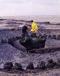
Sea Henge |
|
2,050 BC
|
In 1999 a startling excavation of a wooden henge monument of a "family" size was made on the sea-shore at Holme-next-the-Sea in Norfolk. A bronze axe head was found in 1998 and attracted the finder's attention to a circle of wood stumps newly visible above the sand as the tide receded. After considerable difficulties the timbers were excavated in 1999, and removed to Flag Fen for conservation and recording. The circle was six to seven paces across, surrounding an upturned tree stump of a 150 year old oak tree, with its roots pointing skyward. A supposed entrance faced the direction of the Mid-Winter sunset and the structure was thought to be a mortuary. It was dubbed sea-henge but was originally built not on the beach, but possibly in salt-marsh and the timbers were carbon dated to 2050 BC and 2049 BC, and had been worked by bronze axes and adzes.
A three dimensional laser scan of the 55 oak posts of the circle shows that at least 38 different bronze axes were used to cut and shape the timbers. Francis Pryor, the head of the Flag Fen archaeology centre has commented that "it is remarkable that this tiny community was able to lay hands on such a large number of tools only about 100 years after the knowledge of how to make bronze arrived in this country." This reveals an unexpected level of development and social organisation in these communities.
|
|
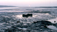
Holme II henge
|
|
blank |
On July 3rd, 2014, the Times carried the story that a second wooden henge had been discovered on Holme Beach in Norfolk. One hundred metres east of what now has to be called Holme I, another ring has been found, consisting of two concentric timber circles surrounding a hurdle lined pit containing two oak logs. Both wooden circles were, in fact, revealed in the sand near Hunstanton in the 1990s, according to BBC Norfolk, but only Holme I (called Sea Henge) was publicised.
This second ring, known as Holme II, was at first dated to the centuries before Holme I (c. 2400-2030 BCE) although the two sites were thought to have been in use together. Although also threatened with destruction by the sea, this site has been left in situ and exposed to the tidal actions of the sea. The two logs seen in the picture here have since been lost to the sea. Archaeologists have suggested that this non-intervention decision by English Heritage relates to the controversy over digging Holme I. Seahenge, (Holme I) was excavated in 1998-99, despite protests, and put on display at Lynn Museum, King's Lynn, in 2008.
Archaeologists have been testing wood from the second henge at Holme-next-the-Sea and now believe it was built, like Holme I, using trees felled in 2049BC. This seems to have been the point of the July 2014 announcement.
Experts now say that the study shows both structures were probably linked to the same burial.
|
|
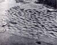 Grimes Graves
|
|
2000 BC
|
Grimes Graves was the site of a massive flint production industry at this time. It was probably yielding flints long before this date, but appears to have been at its busiest around 2000 BC. The mines covered an area of about 90 acres, and at least 500 shafts have now been found, many thirty feet deep. There were also at least 1,600 shallow pits from which we believe open cast methods extracted the shallower flint. The best flint was the what we now call the black floor flint, laid down in beds rather than the random nodules found throughout East Anglia.
|
|
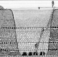
Shaft cross section |
|
blankxx |
Some shafts descended 30 or 40 feet, or about 12 metres, with galleries linking shafts or radiating from them. Over 50,000 antler picks were used over the life of the mines, and there must have been a whole industry here of miners, tool makers, basket makers and a community which traded their products far and wide.
As each pit was worked out, the waste from new pits was thrown down the old shafts.
|
|
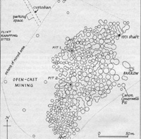
Plan of Grimes Graves today |
|
blankxx |
Grimes Graves was long known for the bumps and hollows in the ground, but not until 1868 were they shown to have originated as flint mines. Canon Greenwell spent three years digging out one shaft and demonstrated its true origin. The location of his shaft can be seen on the modern plan shown here by clicking to view an enlargement.
The deep mining ended here by about 1,800 BC, but shallow pits continued to be dug until 1,600 BC. There were other flint mines in Norfolk, in places like Lynford and Buckenham Tofts, but Grimes Graves is the best known.
With the growing availability of bronze the Stone Age era was now slowly drawing to its end, but it made up 98% of the time span that man has lived on Earth. Flint continued to be used where it was easily available, and bronze would have been too scarce to use for everyday tasks.
|
|
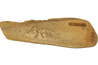
Engraved ox rib |
|
blankxx |
This Bronze Age Engraving can be seen in the Southwold Museum.
This small fragment of an ox rib, engraved with the outline of a deer, was found just north of Southwold. Recently featured in the BBC TV programme ‘Civilisations Stories - Treasures of the Bronze Age, with Ray Mears’, it dates from around 2000 BC and is one of the earliest examples of human art to survive in the UK.
|
|
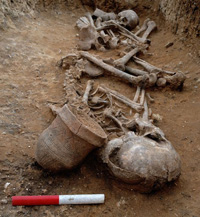
Trumpington Meadows Beaker burials |
|
1,975 BC
|
This twin grave of a 16-18 year old female and a 17-20 year old male, photographed by Dave Webb of the Cambridge Archaeological Unit, has been dated to c2000-c1950BC. Both were buried with a fineware beaker at Trumpington Meadows, Cambridgeshire.
A report in the Guardian of 22nd February, 2018, says, " The very existence of the Beaker folk – whose ancestry lay in central Europe and further east to the Steppes – and Beaker culture has been questioned in the past. The actual beakers, striking clay drinking vessels with an elegant flared lip, were clearly among the most treasured possessions of the people who were buried with them, and have been excavated from graves across Europe for centuries. However, archaeologists could not agree whether they represented a fashion spread by trade and imitation, or a culture diffused by migration.
Now a massive international project, involving hundreds of scientists and archaeologists and almost all the major laboratories in the field, has provided some of the answers. Using samples of more than 400 prehistoric skeletons from across Europe, researchers have uncovered new information about a period when a wave of migration rolled westward across Europe, almost totally displacing the earlier population in many places – including Britain."
|
|
1,950 BC
|
This extract from "Must Read", (Mark Knight - Cambridge Archaeological Unit - June 2012) describes how a period of dry land has been found beneath the wet layers of the Fens:-
"Our first encounter with deep dry spaces occurred in 2001 at Bradley Fen. There, we identified an old land surface just ten centimetres above modern sea level, with large quantities of Neolithic and Early Bronze Age worked flint. Further detailed exploration revealed a circle of postholes, with a porch arrangement and a central hearth. We found fragments of Beaker pottery and an impressive collection of finely retouched tools, and charred logs from the central hearth yielded a radiocarbon date of 2200–1950BC. Here was a Beaker house situated at the bottom of the Flag Fen basin, and nearly one metre below what had been considered to be the contemporary fen edge."
|
|
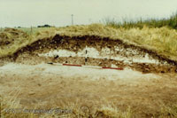
Bronze Age barrow at Risby |
|
1,900 BC
|
This picture shows a Bronze Age burial mound, excavated at Risby. It shows a section cut across the remains of this mound in 1975, displaying a buried soil and the white chalk rubble of the mound. The mound (also called a round barrow or tumulus) dates from about 1900 BC and covered the grave of a woman.
|
|
Great Orme copper mine |
|
1,700 BC
|
Copper had been mined in Britain since 2,200 BC at a number of relatively small scale sites. This view remained the state of our knowledge until after the discovery of a remarkable site near Llandudno in north Wales. Uncovered in 1987 during a scheme to landscape an area of the Great Orme, the copper mines discovered represent one of the most astounding archaeological discoveries of recent times.
This discovery showed that copper mining radically changed around 1,700BC, when prospectors made the original find of the exceptionally rich copper ores of the Great Orme mine on the north Wales coast. This was to become one of the largest Bronze Age copper mines in Europe. Probably in response to the sheer richness and easily-worked nature of the Great Orme ores, all the other copper mines in Britain would close by 1,600BC. The Great Orme mine met an increasing demand for metalwork of all types (axes, spearheads, rapiers).
Research published in Antiquity volume 93, issue 371 in October, 2019 revealed that the copper mined here could be identified by its chemical composition. The results revealed a distinctive metal rich in nickel and arsenic impurities and, combined with its isotopic “signature”, closely matched the metal type that dominated Britain’s copper supply for a 200-year period (c.1600-1400BC) in the Bronze Age.
|
|
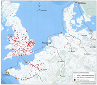
Great Orme distribution map |
|
blankxx |
Remarkably, this metal is also found in bronze artefacts across parts of Europe, stretching from Brittany to the Baltic. This map by Dr Alan Williams, who led the new study, shows the finds distribution of Group 1 shield pattern palstaves, based on continental data.
This very extensive distribution suggests a large-scale mining operation (in Bronze Age terms), with a full-time mining community possibly supported or controlled by farming communities in the adjacent agriculturally richer area of northeast Wales.
Nineteen radiocarbon dates suggest that the mine was probably worked for approximately eight centuries (c. 1700–900 BC), from the late Early Bronze Age to the Late Bronze Age (Williams 2018).
Beakers had arrived in Britain around 2500BC, but had declined in use around 2200-2100BC with the emergence of food vessels and cinerary urns and finally fell out of use around 1700BC (Needham 1996). The Beaker period had now definitely ended.
The so-called Wessex culture arose and produced bronze axes with decoration and flanged edges. Bronze daggers had rivetted handles and decorative pins were made. Elsewhere in Britain, change was less obvious.
|
|
Well at West Row Fen |
|
blankxx |
A settlement has been found at West Row, Mildenhall dated between 1,700 and 1,500 BC, and one bronze age house was circular, some 16½ feet in diameter. Its inhabitants used pottery, worked flint, grew cereals and processed flax. Excavations in 1985 revealed this water pit or shallow well with a wooden revetment across the middle. Alder logs, cut with a bronze axe, were held in place with vertical stakes. The well lay within the settlement that dated from around 1500 -1700 BC.
Elsewhere, several metalwork finds have come from Rymer Point. At Rymer Point there were a series of ponds, the only water in the area, and the ten parishes that joined here in medieval times possibly had origins in settlements and land claims as far back as this time. At Grimstone End, in Pakenham, near Ixworth a single round ditch was revealed by aerial photography. It was excavated in 1953 to reveal the base of an early Bronze Age barrow, containing an urn with cremated bones.
|
|
1,628 BC
|
Professor M Baillie is Professor of
Palaeoecology at Queen's University, Belfast. He has searched the ring patterns derived
from oak logs that had been preserved in the peat bogs of Ireland. He
found that many trees exhibited the worst growth of their lifetimes (ie - the narrowest rings) starting in 1628 B.C.
This is likely to indicate a period of poor growing conditions for all vegetation, and thus severe hardship for the animals and human beings that depended upon them. The cause of such conditions has been attributed to either the dust from a massive volcanic eruption, or the impact of a comet or large meteor. Such events in more recent times have been seen to affect global temperatures if sufficient debris is thrown into the atmosphere to reduce the penetration of sunlight.
It is not unlikely that major cultural shifts would result from such a calamitous period of shortages and hardship.
Only a few other such events
were seen in the tree rings, but two others were noted at 1159 B.C. and A.D. 540.
|
|
Middle Bronze Age objects |
|
1,600 BC
|
A phase of the Bronze Age known as the Arreton Down tradition developed widely outside Wessex. Arreton Down axeheads had pronounced flanges, daggers had ribs along the blade, and tanged spearheads appeared.
At Grimes Graves the intensive mining of flint from deep shafts had ended by about 1,800 BC. Digging flints from shallow pits at Grimes Graves seems to have continued for another two centuries, but had ended by 1,600 BC.
|
|
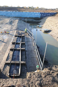
Must farm logboat excavations |
|
1,500 BC
|
An excavation at Must Farm brick quarries in the Fens near Whittlesey has proved to be one of the most important sites of the late Bronze Age. This was first shown by a spectacular find of eight waterlogged, but well preserved, hollowed out log boats.
A report on the BBC news website for 8th September, 2013, stated, "Eight Bronze Age boats discovered in a deep Cambridgeshire quarry are much older than it was first thought, carbon-dating research has revealed.
The vessels, found by archaeologists at Must Farm near Peterborough in 2011, have now been dated to about 1500 BC, 200 years older than was first thought.
Samples taken during the conservation process have revealed the boats to be made from oak, lime and field maple.
The vessels are undergoing a two-year preservation programme at Flag Fen.
This extract from "Must Read", (Mark Knight - Cambridge Archaeological Unit - June 2012) describes the subsequent preservation of these boats:-
"Hanson’s Must Farm quarry has unearthed a fleet of eight beautifully preserved prehistoric logboats. The boats survived deep within the waterlogged sediments of a later Bronze Age/earlier Iron Age watercourse (1300–400BC) that once meandered across the southern half of the Flag Fen basin. The same sediments preserved the hurdles and posts of a run of V-shaped weirs which divided up the channel into roughly uniform segments. Funnel-shaped baskets or fish traps occur with even greater regularity, as do metalwork finds such as swords and spears: when plotted alongside the boats and weirs these objects further strengthen the impression of a once bustling waterway."
The Acton Park phase of the Bronze Age is typified by a stopridge being added to the axeheads. Axes also had wings for better and more secure hafting and this type of axe is known as a palstave. Short swords with two rivet holes also typify this time.
It is thought that the Celtic language was first developing in Britain at around this time. It would be spoken in a developing form until Roman times, when it would be enriched by new words of latin derivation.
|
|
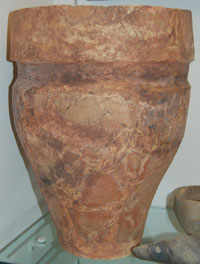
Early Bronze Age collared urn |
|
1,400 BC
|
This collared urn, as it is described, dates to the Early Bronze Age, around 1400 BC. It was found at Chamberlain's Farm, Eriswell, in the centre of a bowl barrow, in 1966. It was inverted over the cremated remains of a man aged 22. This urn is currently on display in the Archaeology gallery at West Stow Visitor Centre.
|
|
Great Orme mines today |
|
blankxx |
For about 200 years there had been a copper mining boom at the Great Orme mine in north Wales.
Geological estimates suggest that several hundred tons of copper metal were produced. This would have been enough to produce thousands of bronze tools or weapons every year, equivalent to at least half a million objects in the 200-year period.
When the mining boom turned to bust by around 1,400BC, the distinctive Great Orme metal gradually disappears. This major decline was probably due to the exhaustion of the richly mineralised central area of the mine.
The Great Orme mining bonanza was followed by a twilight period of many centuries, when all that remained were narrow ore veins that required a huge effort for a small output and probably only satisfied local needs.
Today the Great Orme copper mines can be visited and explored by the public. Further details are available at https://www.greatormemines.info/.
|
|
1,300 BC
|
Bronze objects were now being produced in greater diversity. Flanged palstaves continued but bronze sickles and even saw blades were being made. This period, now known as the Taunton Phase (in England, at least) included distinctive types of pin and coiled finger rings.
Just as man and his cultures were changing, so did the landscape. It is thought that the Bronze Age was a time of rising sea levels and wetter landscapes. Thanks to clay quarrying for bricks undertaken around Whittlesey, the deep diggings have revealed important Bronze Age discoveries. This extract from "Must Read", (Mark Knight - Cambridge Archaeological Unit - June 2012) an outline of the work done at Bradley Fen and Must Farm in the Fens describes this as follows:-
"Shortly after 1300BC the Flag Fen basin would have been discernible as a small fen embayment off the western Fen edge. Its formation fragmented the landscape, as easy passage became increasingly circumvented by the drowning of large areas of low-lying land. The fens were rapidly transforming a place once connected by a major river into a series of islands. The river itself had gone through many different manifestations, including periods of being estuarine and tidal. Now it returned to freshwater, only perched up high within the run of an old tidal creek or roddon.
Critically, routes that were once straightforward were broken. Mobility and access were becoming dependent on keeping both people and animals above the rising water. The earliest phases of the Flag Fen and Must Farm timber constructions overlapped with the waning of the field systems, but coincided very closely with the arrival of hundreds of bronze weapons."
"The ever rising sea had gradually transformed a low lying, dry terrain into a saturated embayment. Must Farm and Flag Fen were constructed right at the wet end of this spectrum."
|
|
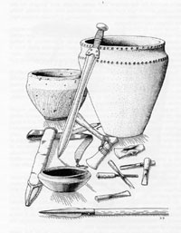
Later Bronze Age objects |
|
1,200 BC
|
Bronze metal work entered the Penard phase when European styles increasingly influenced those seen in Britain. Palstaves continued, but axe heads and spearheads were now produced with sockets, and more types of swordblades were made.
As the Hittite Empire fell, the secret of working iron began to spread to Greece from the area of Turkey. Iron working had originated in Turkey perhaps only in a very small way, a thousand years earlier.
A site of many burials was first excavated at Hallstat in Austria in 1846, and continuing for 17 years. These burials covered the period from the Late Bronze Age into the Early Iron Age, and the finds were so many and various that the cultural changes which they represent have become named after the site. Thus the late Bronze Age is also known as Hallstat A and B, covering the period from 1200 BC to 800 BC. Hallstat C and D represents the culture of the early Iron Age, from 800 BC to 500 BC.
|
|
1,159 BC
|
It has been suggested by Michael Baillie, Professor of
Palaeoecology at Queen's University, Belfast, that in 1159 BC a passing comet smothered the earth with a veil of dust, having a significant effect upon the global climate for the next 20 years. This is best seen in tree rings, which show very poor growth for 18 years at this date. Some very significant events have been linked to this time of crop failure and starvation. For example, the Mycenaean era of
mainland Greece collapsed around this time.
Such cold and wet conditions might have caused a great change in the European Bronze Age cultures as well. It may be that the cult of water began at this time, exemplified by the constructions at Flag Fen, where massive causeways are associated with the deposition of swords and daggers into the water.
|
|

Must Farm reconstruction?
|
|
1,100 BC
|
With an increase in water levels society lost much farmland, and had to adapt to the loss of living space as well. Nevertheless, if they could adapt to a watery existence, they gained in the possibility of fishing resources, reedbed production, and water transport. Excavations at Must Farm, near Whittlesey, are demonstrating some of these adaptations.
Here is an artist's impression of how people made a living space on a platform above a river at Must Farm.
At present Must Farm is dated to between 1,100 BC and 800 BC.
|
|
Isleham Founder's Hoard
|
|
1,000 BC
|
The Wilburton phase of the Bronze Age produced more changes in style and metal alloys with many pieces of equestrian equipment and weaponry suggesting a developing warrior society. Short swords became more narrow bladed. Clearly they fought from horseback, as well as on foot.
By now the secret of working iron was beginning to enter Europe from Greece. Iron is widely found, so it would be easy to adopt its use once the knowledge was available.
The collection illustrated here is a major Late Bronze Age hoard, which was ploughed up at Isleham, Cambridgeshire, in 1959. At this time Isleham was on the edge of the great wet fenland bog, interspersed with navigable waterways. Nearby the old River Snail gave a good flowing water supply. There was probably a farming village here, and in the next field a scatter of burnt flints could indicate the location of a smelting workshop.
The Isleham Hoard has been assigned a date of about 1,000 BC, and may have belonged to one or more itinerant bronze smiths. It is made up of old weapons, tools, ornaments, and sheet metal, broken up into over 6,500 pieces ready to be melted down.
This bronze hoard is the largest of the period yet found in Britain. Its total weight is about 90 kg, or 200 lb. Mr William Houghton's plough located it buried in a large pot at the end of a ditch. Ploughing had spread the contents over some distance. Another excavation took place in 2000, and a further 300 small pieces were recovered.
Because the collection included casting waste and sweepingss, it suggests that the bronze was of considerable value. The weaponry and ornaments suggest a culture with a wealthy, flamboyant and warlike culture.
Perhaps it was too heavy for easy transport and was buried in a pot for concealment, but was never recovered. It was displayed in Moyse's Hall Museum until 2006, but is now on display at West Stow Visitor Centre. The display board at West Stow suggests that, "The hoard was buried for safe keeping in an easily remembered place. It is probably the metal stock from the main workshop of a group of bronze smiths. They would have toured East Anglia selling their wares in part exchange for damaged and worn out goods. Perhaps they left Isleham to work at another site, or perhaps the workshop closed through adverse circumstances. Whatever the reason, they never returned."
|
|
Must Farm roundhouse
|
|
920 BC
|
This extract is from "Must Read", (Mark Knight - Cambridge Archaeological Unit - June 2012), and describes the finding of a remarkably well preserved Bronze Age settlement in the Fens, near Whittlesey:-
"It was in the summer of 1999 that decaying timbers were discovered protruding out of the southern face of the old quarry pit at Must Farm. Subsequent investigations in 2004 and 2006 revealed the site to be later Bronze Age (1300-800BC) and to comprise a succession of large timber structures spanning an ancient watercourse. In its earliest form the channel was crossed by a series of massive, square cut oak piles (25cm by 25cm) made from trees that had been felled at the same time as the first two rows of the nearby Flag Fen post alignment (around 1300–1250BC). The size and orientation of the piles seemed to be completely out of proportion to the stream, as if they also related to something much larger in the landscape. A thin accumulation of silts had formed around the base of the uprights when the structure partially collapsed, crushing a fish trap beneath it. Water — indicated by freshwater snail shells — inundated the buckled structure before brand new sets of posts were inserted.
These posts included a large encircling palisade made up of tightly spaced, 7–15cm diameter ash poles that appeared to choke the flow of the stream.
It was not too long before catastrophe struck again, when a major fire, dating to sometime between 920 and 800BC, seems to have brought a sudden and unanticipated end to the site, plunging its smouldering superstructure along with most of its contents into the depths. Fire, water and yielding silts guaranteed the preservation of all manner of things including finely woven textiles made of plant fibres, glass beads, bronze tools and implements, and whole pots replete with ‘vitrified’ food, and on one occasion, a wooden spatula still stirring its contents."
The excavations known as Flag Fen are only 2 kilometres distant from this site.
|
|
Must Farm wheel
|
|
900 BC
|
On 20th February, 2016, the archaeologists at Must Farm revealed that a Bronze Age wheel had been discovered. "We've found the largest complete example of a Later Bronze Age wheel! The wheel is sitting in sediments close to the first round house and raises a whole host of questions: mainly why is there a wheel in the remains of a river channel? "
This find continues in the Must Farm trend of remarkable preservation. The wooden wheel found by archaeologists near one of the largest of the roundhouse dwellings at Must Farm dates to anywhere between 1,100 BCE to 800 BCE, is around three feet in diameter, and still contains its hub. Cambridge Archaeological Unit’s David Gibson, the leader of the dig, said to the BBC that the discovery of the wheel shows how the river settlement was linked closely to the dry land beyond.
A skeleton of what may be a horse was found nearby.
Chris Wakefield, "In the Bronze Age horses are quite uncommon. It's not until the later period of the Middle Iron Age that they become more widespread, so aside from this very exciting discovery of the wheel, we've also got potentially other related aspects that are giving us even more questions."
The next period of the Bronze Age is known as the Ewart Park phase and is the commonest type of material found today, frequently appearing in "founders' hoards" of broken tools and casting scrap.
|
|
800 BC
|
The continental Iron Age was in its earliest stage at this time, and is typified by the site at Hallstat in Austria. From 800 BC to 600 BC is known as Halstatt C, a period when iron swords were first being interred at the Hallstat site.
|
|
700 BC
|
The final British Bronze Age phase is known as Llyn Fawr from a find spot in Wales. It overlaps the first periods of the British Iron Age. Many bronze objects with a high lead content from this period are thought to have been produced for votive or religious purposes, to be deposited in the earth or often in water.
Throughout the Bronze Age flint continued to be used, and in particular arrowheads were routinely made of flint.
By this time people had developed sophisticated weapons such as bronze swords.
In this era a man might die of old age at 34 and women at 37, based on the average remains found in Suffolk Bronze Age barrows and graves.
|
|
|
Quick links on this page
Top of Page 7 million BP
Happisburgh man 850,000 BP
Pakefield man 750,000 BP
Bytham & Boxgrove 500,000 BP
Anglian Ice Age 478,000 BP
Swanscombe/Elveden 400000BP
Hoxne man 360,000 BP
Neanderthals 250000 BP
Toba eruption 74000 BP
Homo sapiens-Europe 40000BP
End of Neanderthals 30000 BP
Modern Warm period 8300 BC
Britain now an island 6500 BC
New Stone Age 4600 BC
British Copper Age 2700 BC
British Bronze Age 2200 BC
|
|
700 BC on
|
Please click here to follow our history into the Iron Age.
|
Prepared for the St Edmundsbury Local History Project
by David Addy, June 1998 - December 2004
Books consulted:
An Historical Atlas of Suffolk: Suffolk County Council, David Dymond and Edward Martin
The Archaeology of Roman Suffolk: Suffolk County Council
The History of Suffolk: D Dymond and P Northeast
An Historical Atlas of Norfolk: Peter Wade-Martins
Secrets of the Stone Age: Richard Rudgley
Ape Man: Robin McKie
Hunters to First Farmers, Norfolk Origins, by Bruce Robinson 1981.
'Homo Britannicus' by Chris Stringer, 2006
'London The Illustrated History', by C Ross and J Clark for the Museum of London, 2008
The Suffolk Geology Website : http://www.geosuffolk.co.uk
Some museum objects photographed by Graham Portlock
The Shotton project of University of Birmingham- The Ice Age in the Midlands
and the Ancient Human Occupation of Britain
'Boom and bust in Bronze Age Britain: major copper production from the Great Orme mine and European trade, c. 1600–1400 BC':- Antiquity, Volume 93, Issue 371, October 2019 , pp. 1178-1196, by R. Alan Williams, and Cécile Le Carlier de Veslud
|


